MyTopo
Classic USGS Collettsville North Carolina 7.5'x7.5' Topo Map
Couldn't load pickup availability
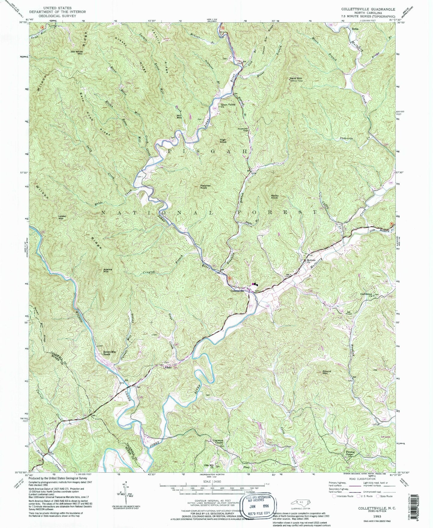
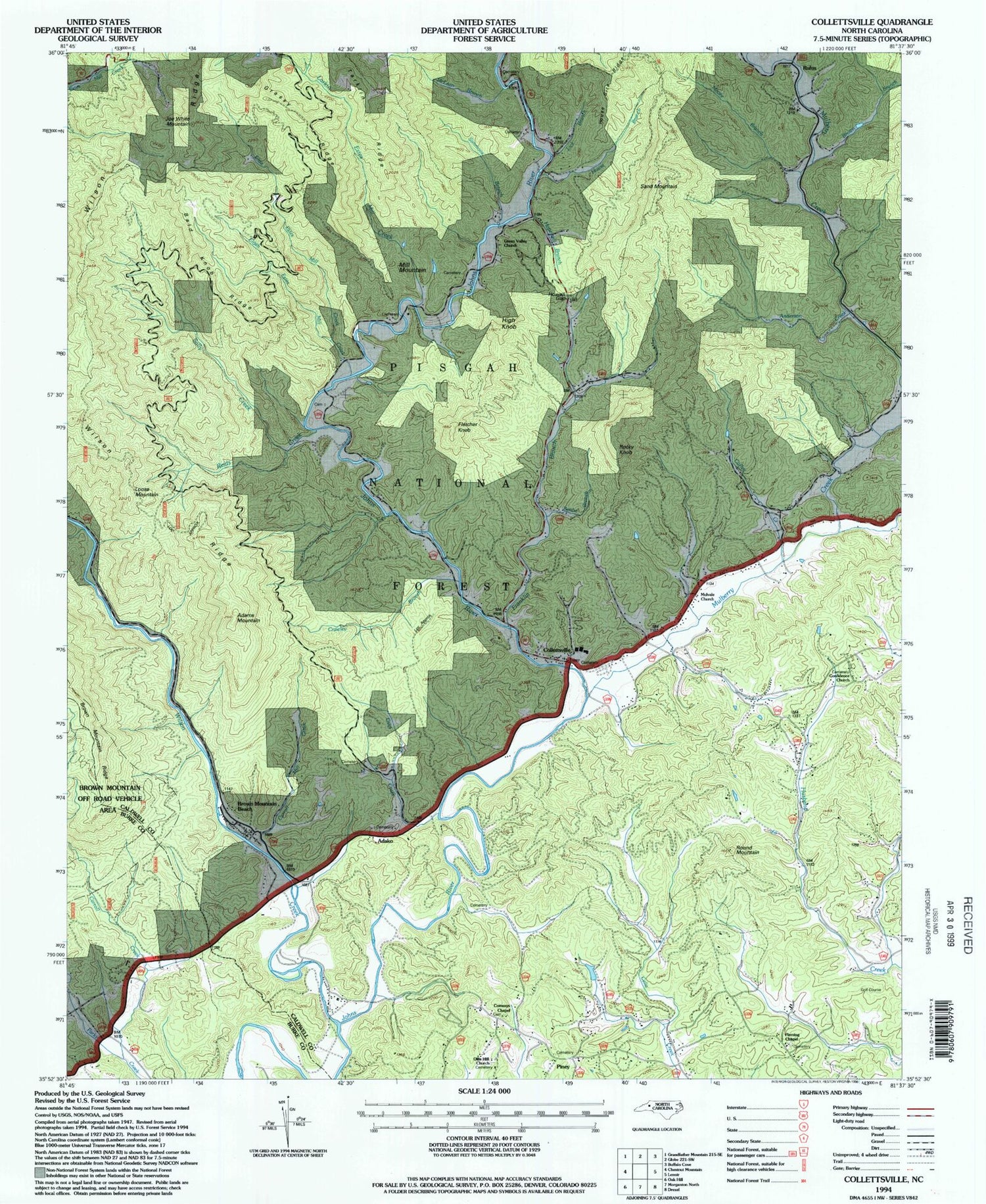
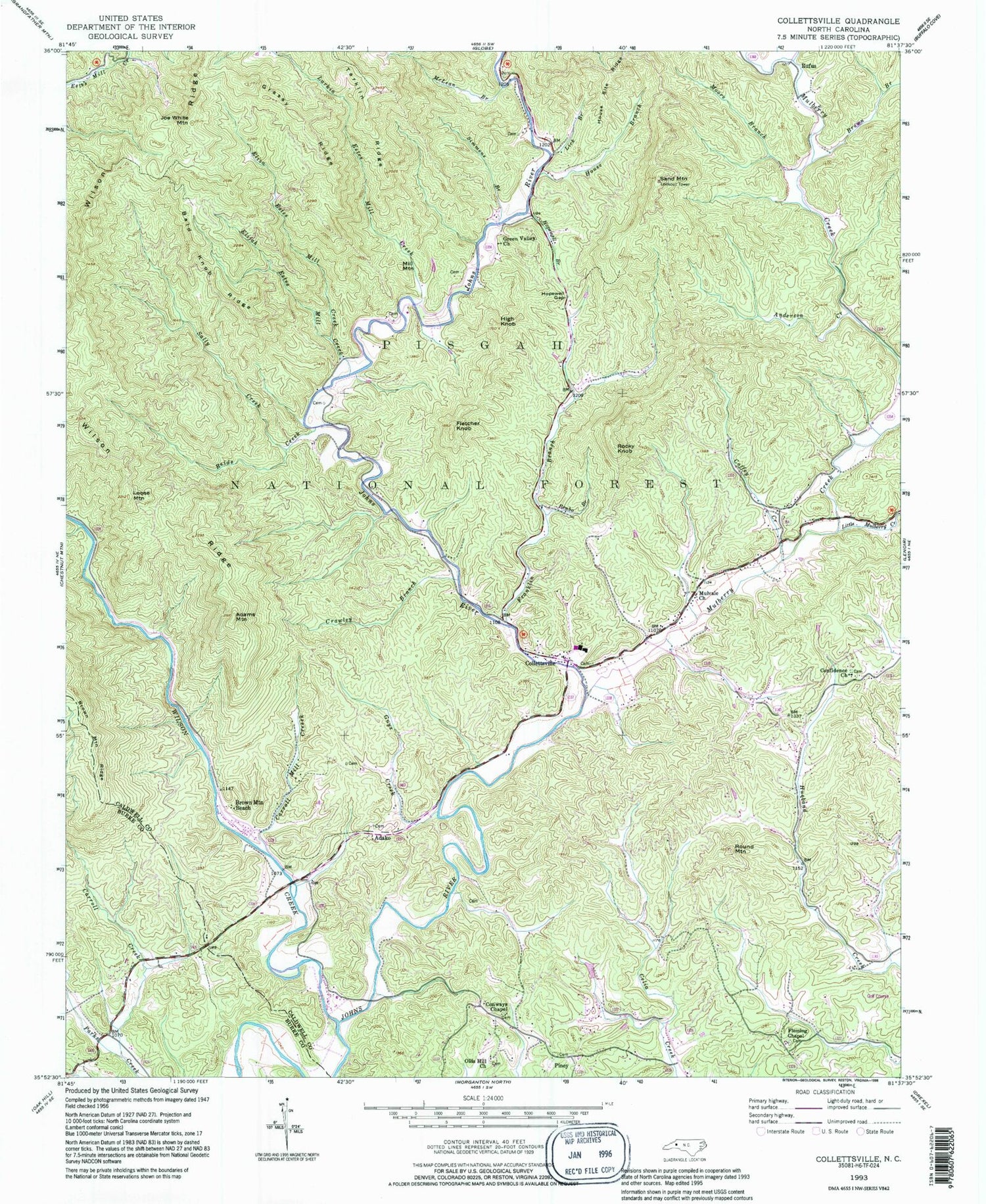
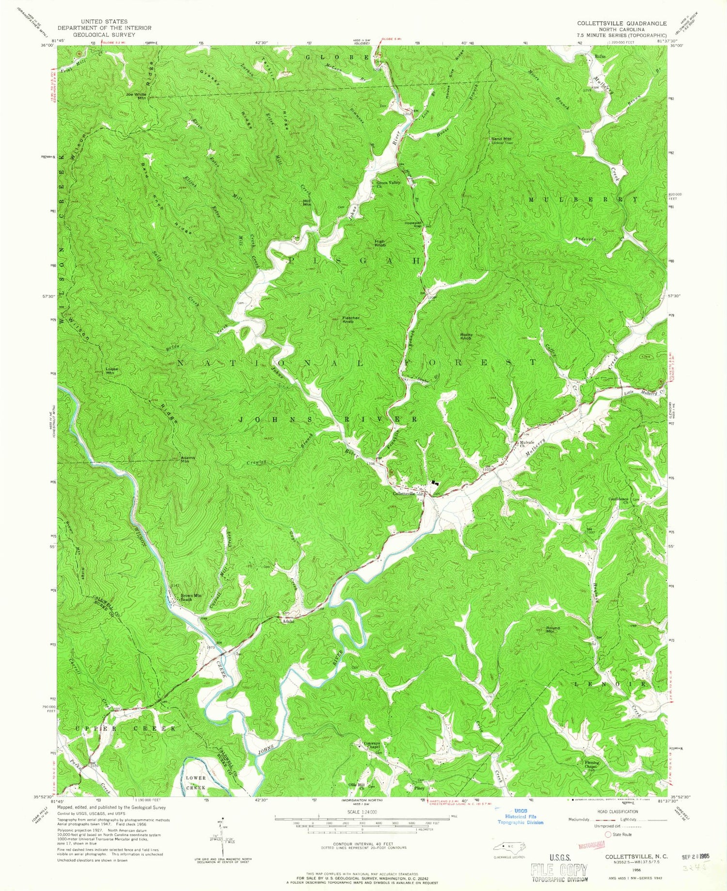
Historical USGS topographic quad map of Collettsville in the state of North Carolina. Typical map scale is 1:24,000, but may vary for certain years, if available. Print size: 24" x 27"
This quadrangle is in the following counties: Burke, Caldwell.
The map contains contour lines, roads, rivers, towns, and lakes. Printed on high-quality waterproof paper with UV fade-resistant inks, and shipped rolled.
Contains the following named places: Wilson Ridge, Muttenz (historical), Anderson Creek, Bald Knob Ridge, Benbo Branch, Boone Fork, Brown Branch, Brown Mountain Ridge, Carroll Creek, Carroll Mill Creek, Coffey Creek, Collettsville, Confidence Church, Conways Chapel, Crawley Branch, Elijah Estes Mill Creek, Eliza Estes Mill Creek, Fletcher Knob, Franklin Branch, Grassy Ridge, Green Valley Church, Guys Creek, High Knob, Hopewell Branch, Hopewell Gap, House Branch, House Site Ridge, Joe White Mountain, Lick Branch, Loose Mountain, McLean Branch, Moore Branch, Mulberry Creek, Mulvale Church, Ollis Hill Church, Reids Creek, Round Mountain, Rufus, Sally Creek, Sand Mountain, Simmons Branch, Tarklin Ridge, Wilson Creek, O P Fox Dam, Coffeys, Collettsville School, Globe Set (historical), Rocky Springs Baptist Church, Rufus Baptist Church, Adako, Adams Mountain, Brown Mountain Beach, Mill Mountain, Piney, Rocky Knob, Larkins Estes Mill Creek, Fleming Chapel, Township of Johns River, Collettsville Volunteer Fire and Rescue Department, Collettsville Post Office, Wilson Ridge, Muttenz (historical), Anderson Creek, Bald Knob Ridge, Benbo Branch, Boone Fork, Brown Branch, Brown Mountain Ridge, Carroll Creek, Carroll Mill Creek, Coffey Creek, Collettsville, Confidence Church, Conways Chapel, Crawley Branch, Elijah Estes Mill Creek, Eliza Estes Mill Creek, Fletcher Knob, Franklin Branch, Grassy Ridge, Green Valley Church, Guys Creek, High Knob, Hopewell Branch, Hopewell Gap, House Branch, House Site Ridge, Joe White Mountain, Lick Branch, Loose Mountain, McLean Branch, Moore Branch, Mulberry Creek, Mulvale Church, Ollis Hill Church, Reids Creek, Round Mountain, Rufus, Sally Creek, Sand Mountain, Simmons Branch, Tarklin Ridge, Wilson Creek, O P Fox Dam, Coffeys, Collettsville School, Globe Set (historical), Rocky Springs Baptist Church, Rufus Baptist Church, Adako, Adams Mountain, Brown Mountain Beach, Mill Mountain, Piney, Rocky Knob, Larkins Estes Mill Creek, Fleming Chapel, Township of Johns River, Collettsville Volunteer Fire and Rescue Department, Collettsville Post Office