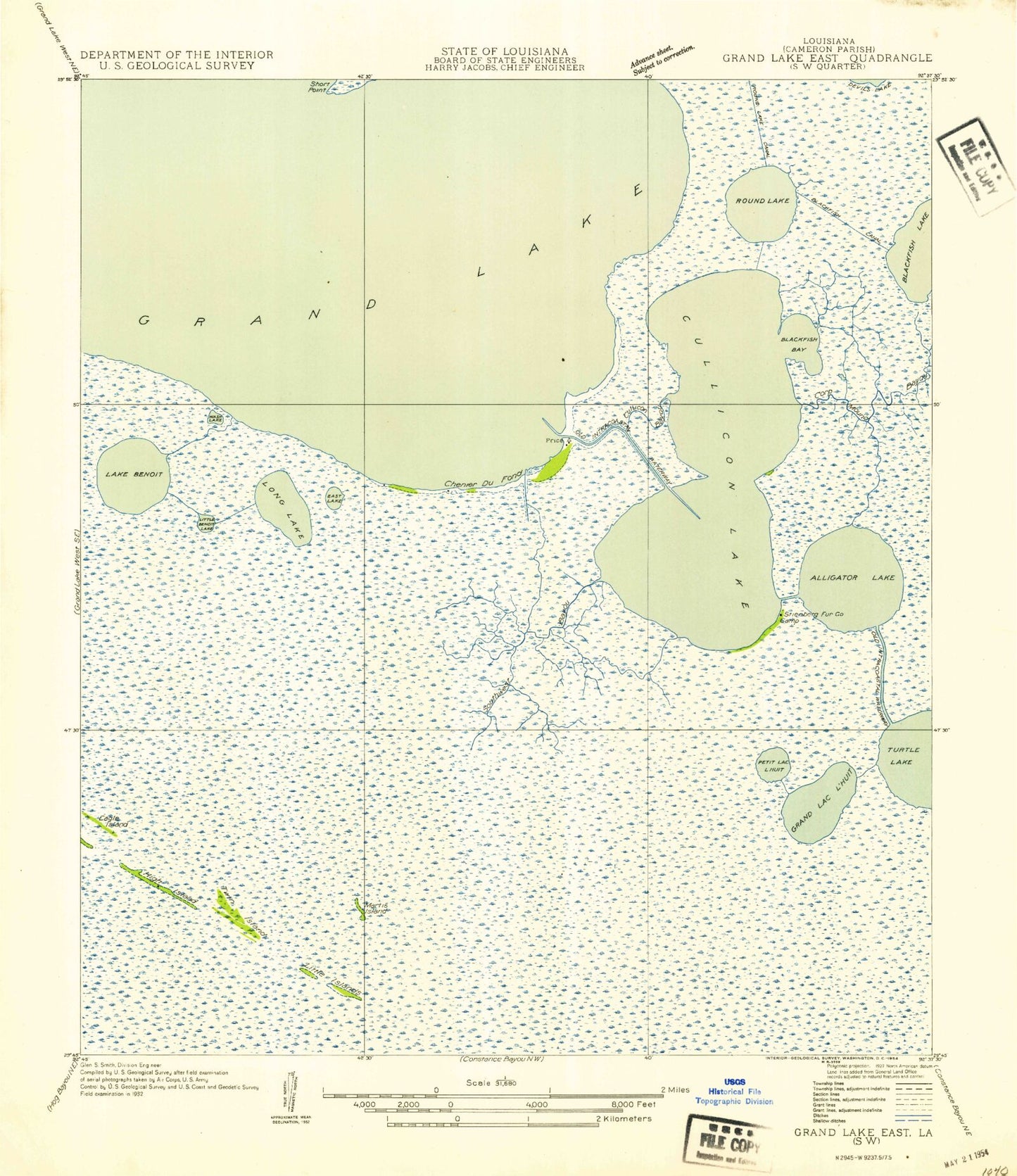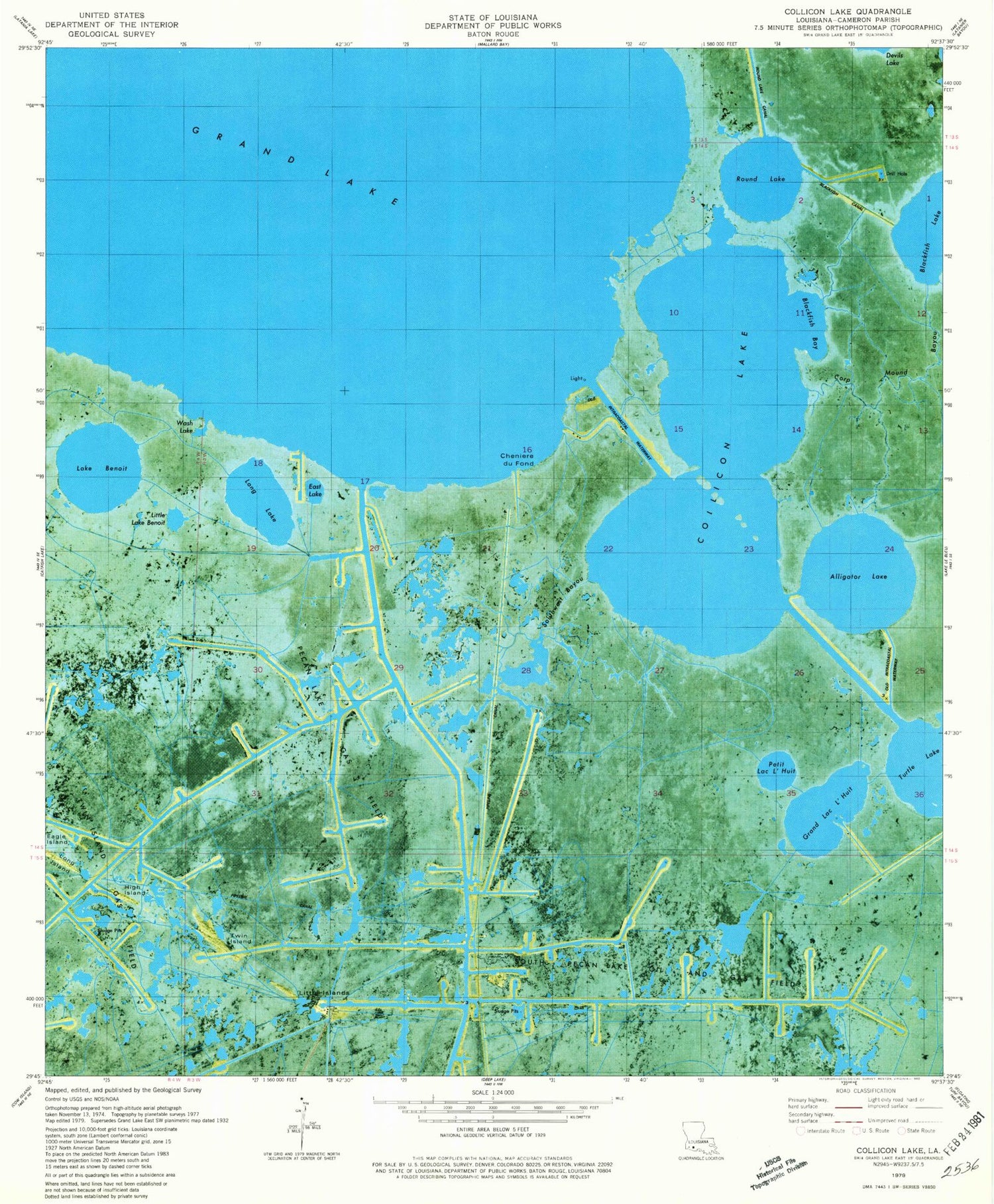
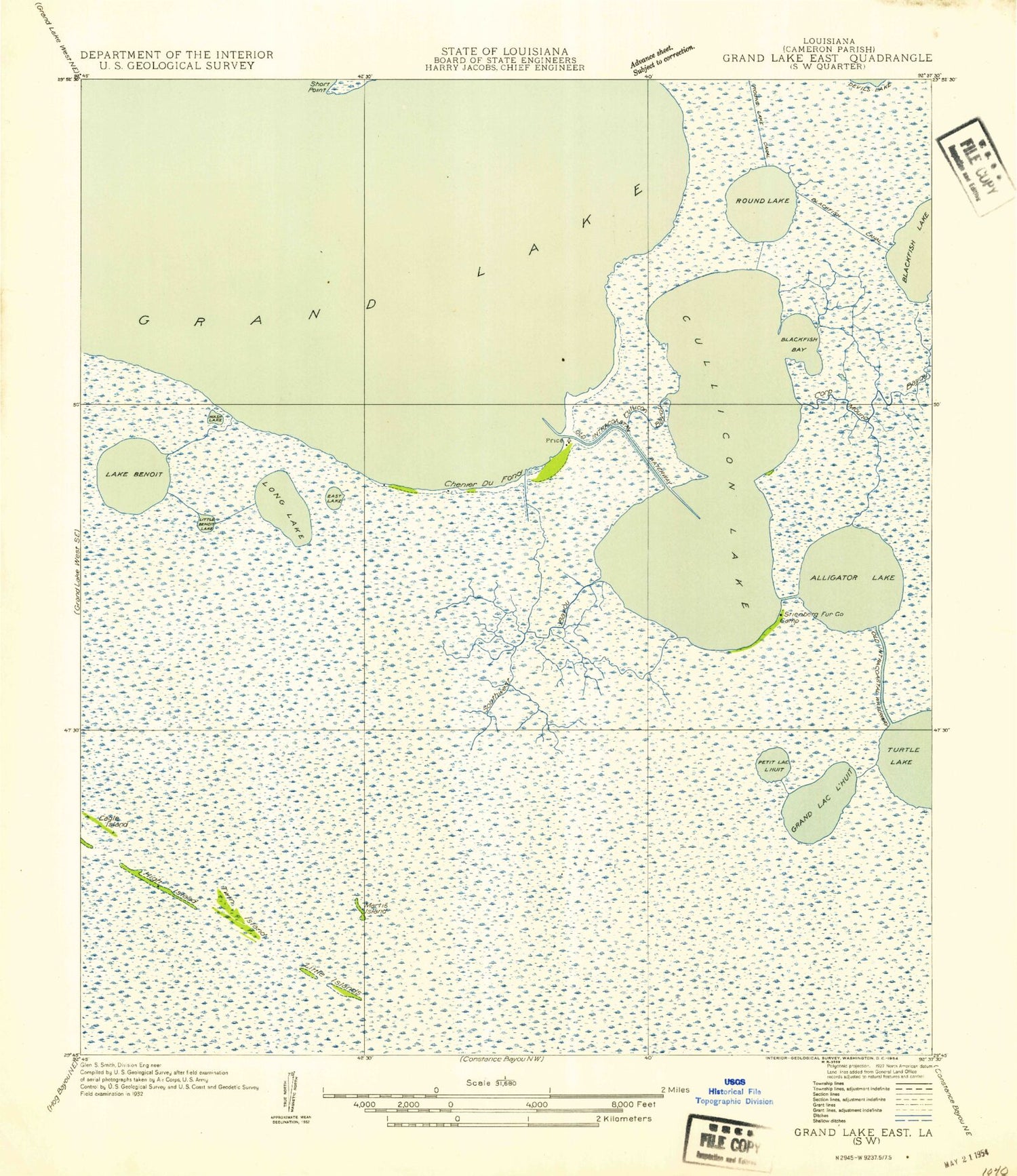
MyTopo
Classic USGS Collicon Lake Louisiana 7.5'x7.5' Topo Map
Couldn't load pickup availability
Historical USGS topographic quad map of Collicon Lake in the state of Louisiana. Map scale may vary for some years, but is generally around 1:24,000. Print size is approximately 24" x 27"
This quadrangle is in the following counties: Cameron.
The map contains contour lines, roads, rivers, towns, and lakes. Printed on high-quality waterproof paper with UV fade-resistant inks, and shipped rolled.
Contains the following named places: Alligator Lake, Blackfish Bay, Blackfish Canal, Cheniere du Fond, Collicon Lake, Corp Mound Bayou, Cow Island Ward One, Eagle Island, East Lake, Grand Lac L'Huit, High Island, Lake Benoit, Little Islands, Little Lake Benoit, Long Lake, Pecan Lake Gas Field, Petit Lac L'Huit, Round Lake, Round Lake Canal, South Pecan Lake Oil and Gas Field, Southwest Bayou, Turtle Lake, Twin Island, Twin Island Oil Field, Wash Lake