MyTopo
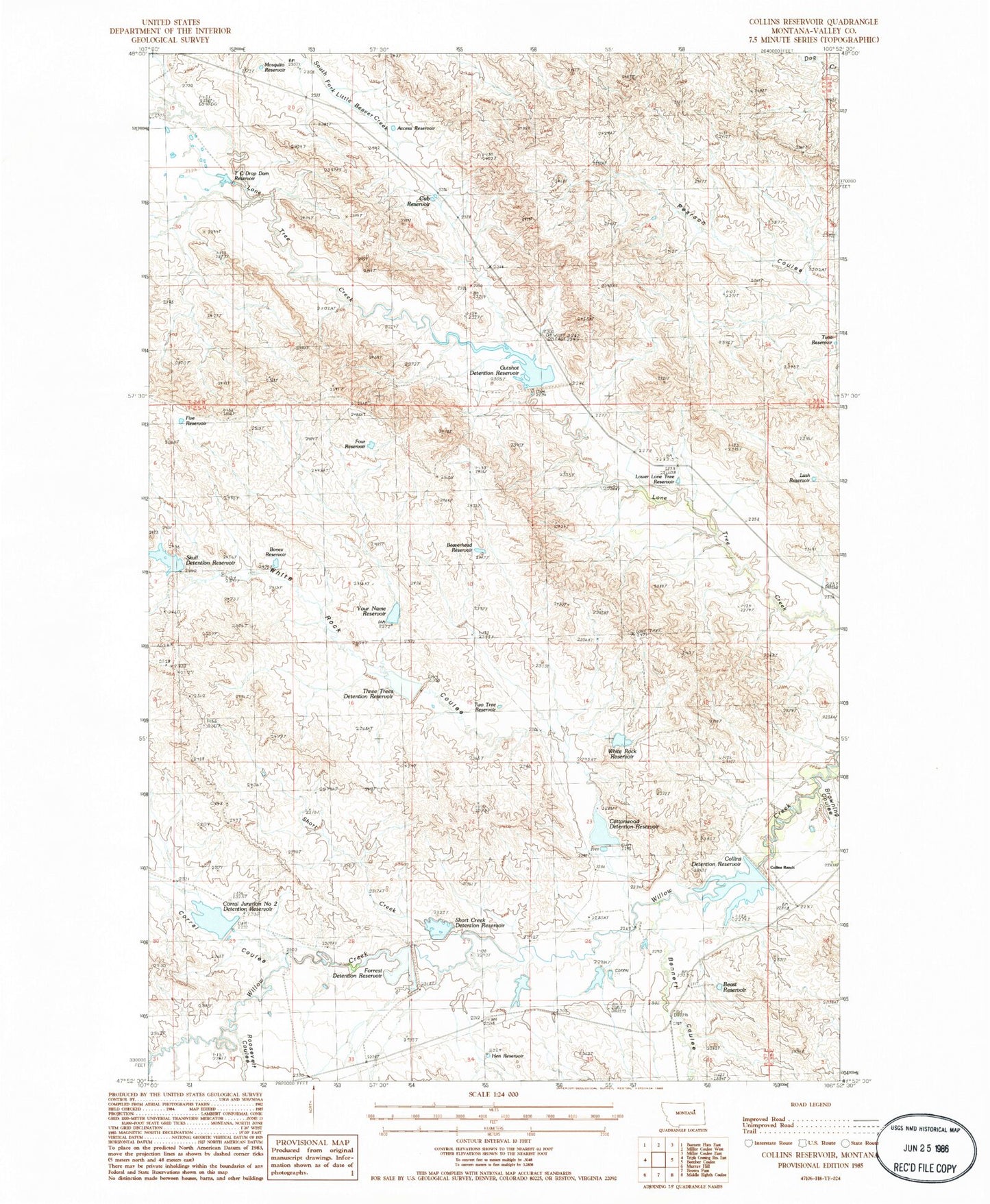
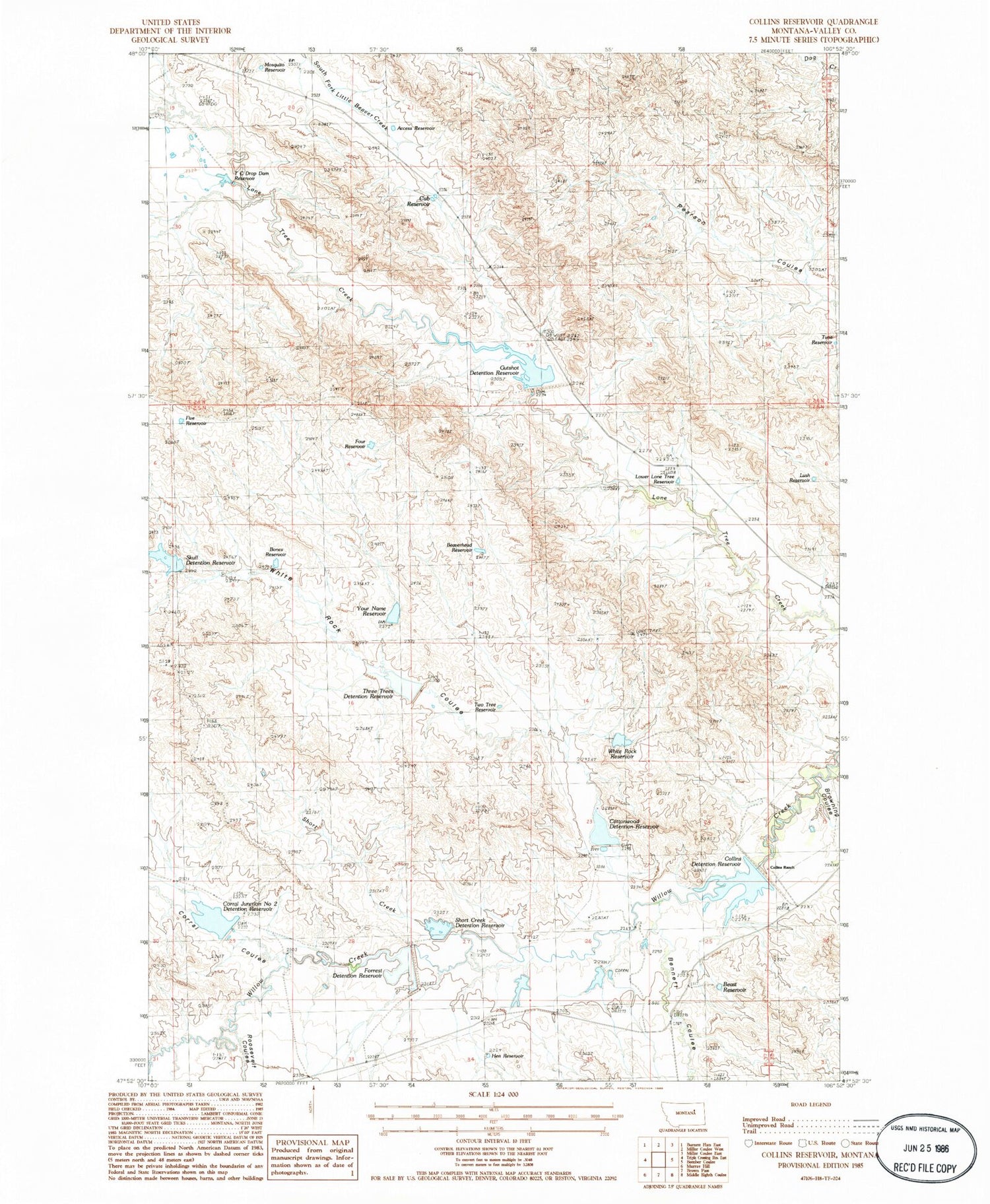
Classic USGS Collins Reservoir Montana 7.5'x7.5' Topo Map
Couldn't load pickup availability
Historical USGS topographic quad map of Collins Reservoir in the state of Montana. Map scale may vary for some years, but is generally around 1:24,000. Print size is approximately 24" x 27"
This quadrangle is in the following counties: Valley.
The map contains contour lines, roads, rivers, towns, and lakes. Printed on high-quality waterproof paper with UV fade-resistant inks, and shipped rolled.
Contains the following named places: Access Reservoir, Beast Reservoir, Beaverhead Reservoir, Bennett Coulee, Bones Reservoir, Collins Headcut Dam, Collins Ranch, Collins Reservoir, Corral Coulee, Corral Junction Number Two Detention Reservoir, Corral Junction Two Dam, Cottonwood Dam, Cottonwood Reservoir, Cub Reservoir, Divide Number Two Reservoir, Divide Reservoir, Five Reservoir, Forrest Reservoir, Forrest Reservoir Dam, Four Reservoir, Gutshot Dam, Gutshot Detention Reservoir, Hen Reservoir, Lower Lone Tree Reservoir, Lush Reservoir, Mosquito Reservoir, North Fork Lone Tree Creek, Roosevelt Coulee, Short Creek, Short Creek Dam, Short Creek Reservoir, Skull Dam, Skull Reservoir, South Valley Division, T C Drop Dam Reservoir, Thingamajig Dam, Three Trees Reservoir, Tuna Reservoir, Two Tree Reservoir, Whatchamacallit Dam, White Rock Coulee, White Rock Dam, White Rock Reservoir, Your Name Dam, Your Name Reservoir