MyTopo
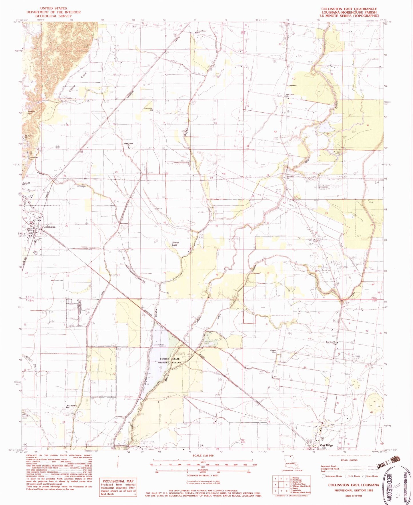
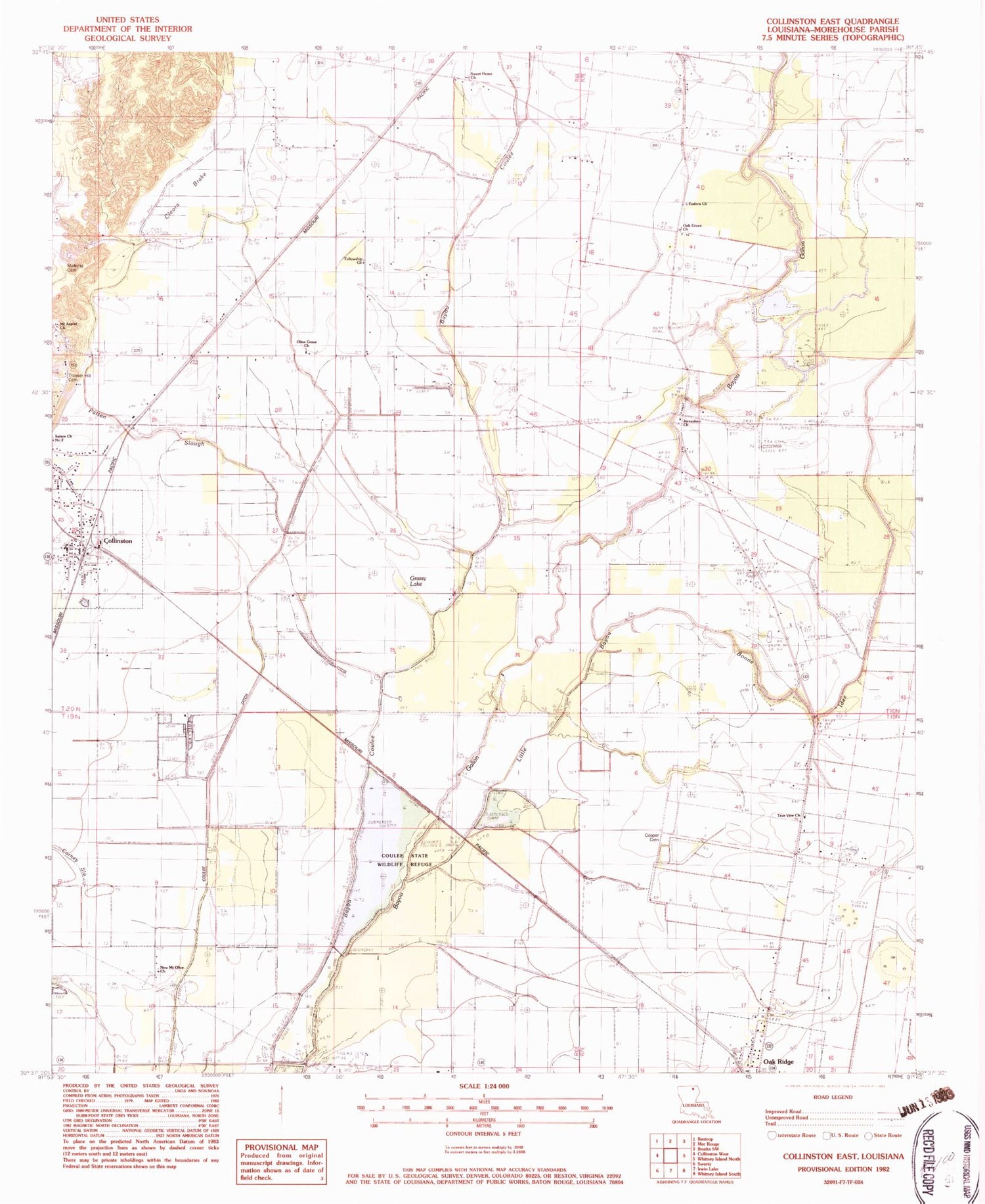
Classic USGS Collinston East Louisiana 7.5'x7.5' Topo Map
Couldn't load pickup availability
Historical USGS topographic quad map of Collinston East in the state of Louisiana. Map scale may vary for some years, but is generally around 1:24,000. Print size is approximately 24" x 27"
This quadrangle is in the following counties: Morehouse.
The map contains contour lines, roads, rivers, towns, and lakes. Printed on high-quality waterproof paper with UV fade-resistant inks, and shipped rolled.
Contains the following named places: Barham Airport, Carney Slough, Cleora, Cleora Brake, Collinston, Collinston Elementary School, Collinston Police Department, Cooper Cemetery, Cooper School, Coulee State Wildlife Refuge, Courney Cemetery, Eudora Church, Fellowship Church, Grassy Lake, Gum Ridge, Jerusalem Church, Little Bayou Bonne Idee, New Mount Olive Church, Oak Grove Church, Olive Grove Church, Patten Slough, Sweet Home Church, True Vine Church, Village of Collinston, Ward Eight, White Oak Bayou