
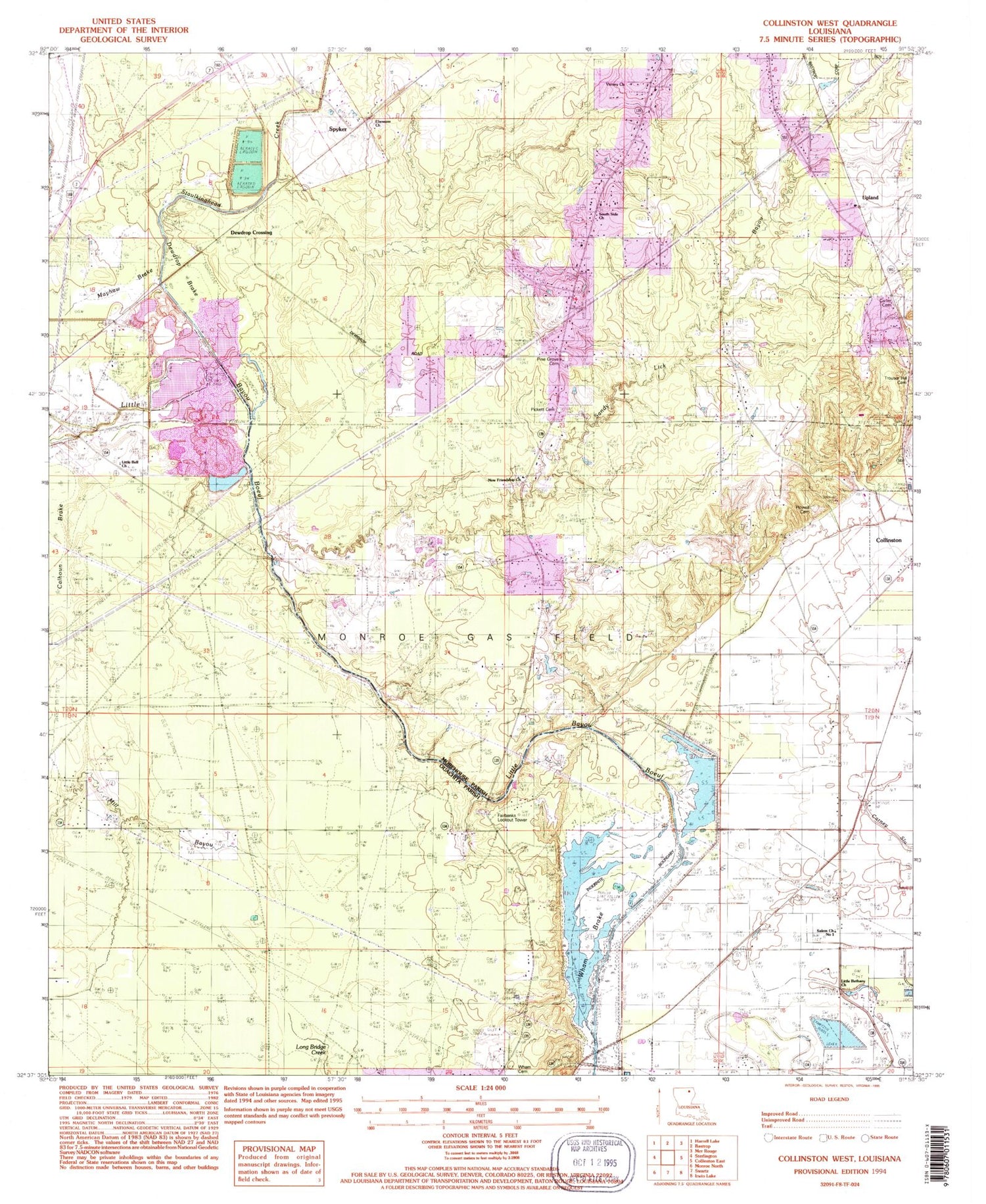
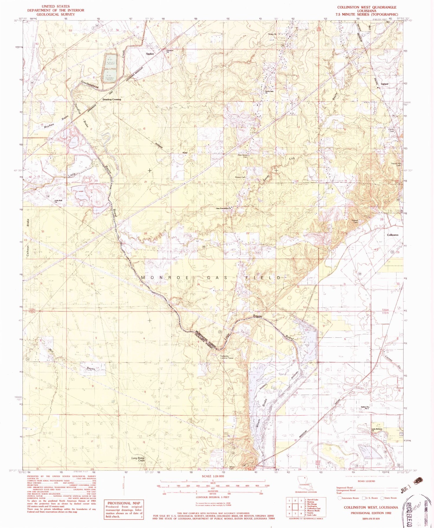
MyTopo
Classic USGS Collinston West Louisiana 7.5'x7.5' Topo Map
Couldn't load pickup availability
Historical USGS topographic quad map of Collinston West in the state of Louisiana. Map scale may vary for some years, but is generally around 1:24,000. Print size is approximately 24" x 27"
This quadrangle is in the following counties: Morehouse, Ouachita.
The map contains contour lines, roads, rivers, towns, and lakes. Printed on high-quality waterproof paper with UV fade-resistant inks, and shipped rolled.
Contains the following named places: Bastrop Fire Department Station 5, Carter Cemetery, Cities Service Wildlife Management Area, Collinston Church, Collinston Volunteer Fire Department, Doss, Ebenezer Church, Fairbanks Lookout Tower, Howell Cemetery, Jordan Creek, KMYQ-FM (Bastrop), KNLU-FM (Monroe), KYEA-FM (West Monroe), Little Bell Church, Little Bethany Church, Marcarco, Mayhaw Brake, Mount Arrat Church, New Friendship Church, Pickett Family Cemetery, Pine Grove Cemetery, Salem Church Number 1, Salem Church Number 2, Sandy Lick Bayou, South Side Church, Spyker, Staulkinghead Creek, Upland, Victory Church, Ward Three, Wham, Wham Brake Cemetery, William Chapel, Windsor, Woodlawn Church, ZIP Code: 71229


