MyTopo
Classic USGS Collinsville NE Oklahoma 7.5'x7.5' Topo Map
Regular price
$16.95
Regular price
Sale price
$16.95
Unit price
per
Couldn't load pickup availability
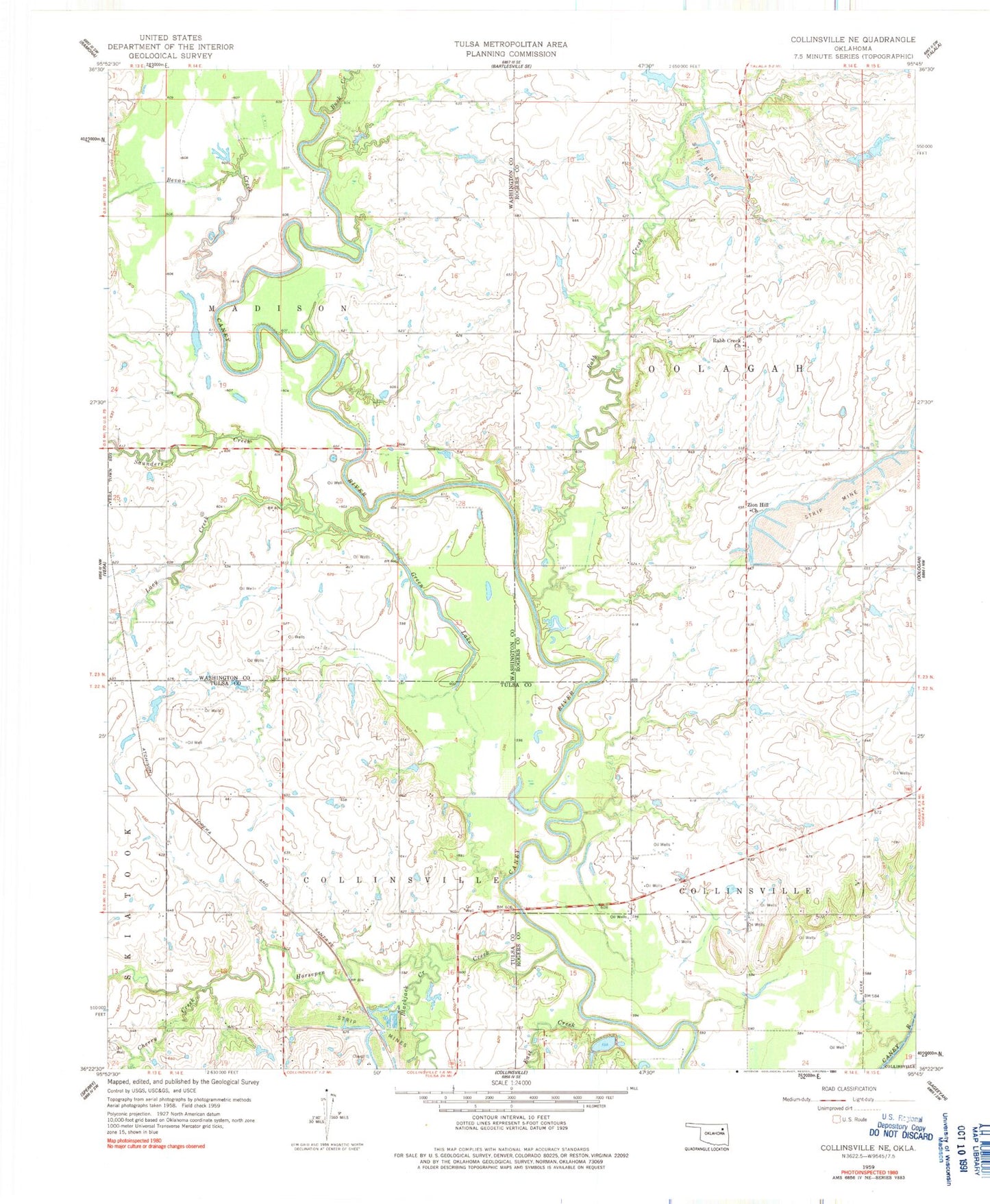
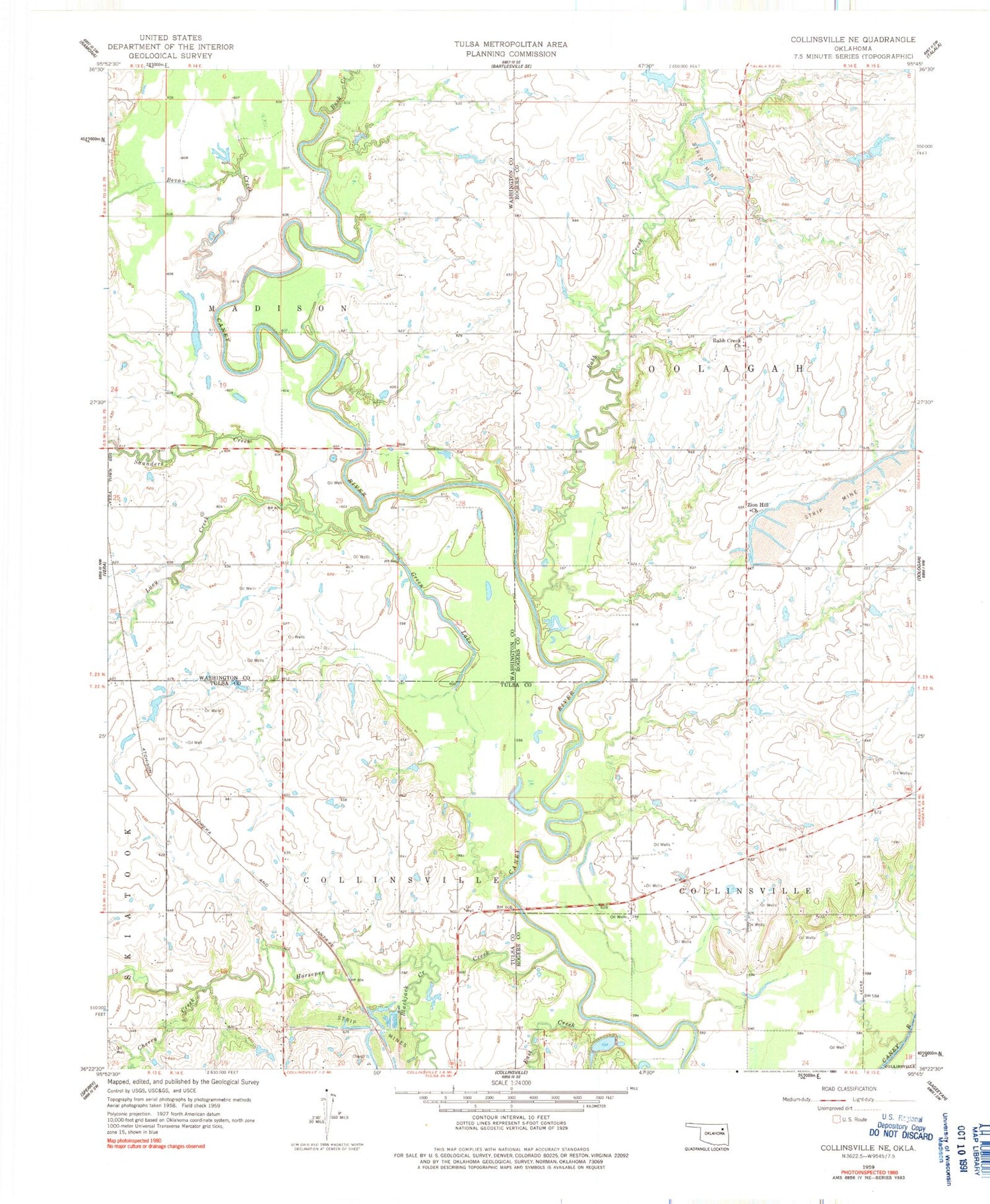
Historical USGS topographic quad map of Collinsville NE in the state of Oklahoma. Map scale may vary for some years, but is generally around 1:24,000. Print size is approximately 24" x 27"
This quadrangle is in the following counties: Rogers, Tulsa, Washington.
The map contains contour lines, roads, rivers, towns, and lakes. Printed on high-quality waterproof paper with UV fade-resistant inks, and shipped rolled.
Contains the following named places: Bevan Creek, Blackjack Creek, Buck Creek, Cherry Creek, Collinsville Lake, Collinsville Lake Dam, East Creek, Green Lake, Horsepen Creek, Lacy Creek, Rabb Creek, Rabb Creek Church, Saunders Creek, Township of Collinsville, Zion Hill Church, ZIP Code: 74021