MyTopo
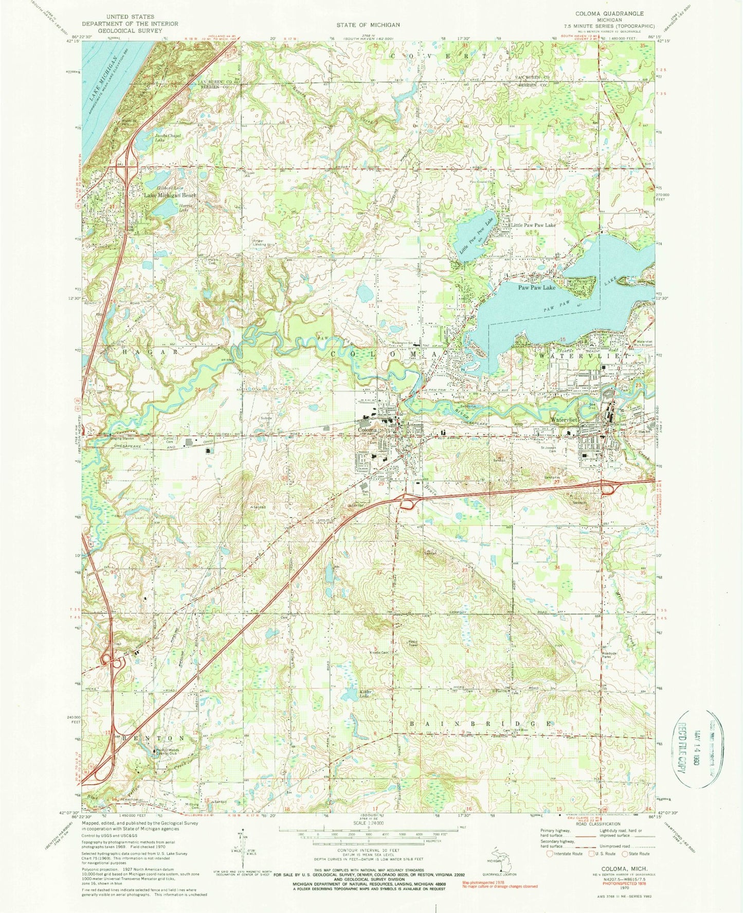
Classic USGS Coloma Michigan 7.5'x7.5' Topo Map
Couldn't load pickup availability
Historical USGS topographic quad map of Coloma in the state of Michigan. Typical map scale is 1:24,000, but may vary for certain years, if available. Print size: 24" x 27"
This quadrangle is in the following counties: Berrien, Van Buren.
The map contains contour lines, roads, rivers, towns, and lakes. Printed on high-quality waterproof paper with UV fade-resistant inks, and shipped rolled.
Contains the following named places: Clymer School, Coloma, Curtis Cemetery, Faith Church, First General Church, Free Church, Harris Cemetery, Harris Lake, Hibbard Lake, Jacobs Chapel Lake, Kibler Lake, Kniebes Cemetery, Lake Michigan Beach, Little Paw Paw Lake, Little Paw Paw Lake, Midway Church, Mill Creek, Millburg Cemetery, New Hope Church, Paw Paw Lake, Paw Paw Lake, Ryno Drain, Saint Joseph Catholic Cemetery, Saint Paul Church, Washington School, Watervliet, Yellow Creek, Ringer Landing Strip (historical), Point O'Woods Country Club, Watervliet Municipal Airport, City of Coloma, Charter Township of Coloma, City of Watervliet, Pawpaw Lake Post Office (historical), Lake Michigan Hills Golf Club, Watervliet Cemetery, Coloma Cemetery, Zion Evangelical United Brethren Cemetery, Saint Pauls United Church of Christ Cemetery, Saint Mary's Catholic Cemetery, Boyer Cemetery, Lake Point Station (historical), Lake Point Post Office (historical), Hagar Shores Post Office (historical), Seventh-Day Adventist Church, Coloma United Methodist Church, First Congregational Church, Apostolic Church of Coloma, Kingdom Hall of Jehovah's Witnesses, Lakeshore Bible Church, Red Arrow Family Practice, Coloma Medical Center, Tri City Medical Clinic, North Berrien Fire Rescue Station 1, Coloma City Hall, Coloma Public Library, Coloma Township Police Department, Coloma Post Office, Coloma Station, Deer Forest Park, North Berrien Historical Museum, Pleasant View Mobile Home Park, Hillview Mobile Estates, Ravine View Estates Mobile Home Park, North Middle School, Coloma High School, Coloma Middle School-South, Coloma Elementary School, Randall Park, Lions Club Park, FOP Sports Park, Paw Paw Lake Golf Club, Faith Lutheran School, Living Word Church of God, Central Assembly of God Church, Coloma Bible Church, Salem Lutheran Church, First Missionary Baptist Church, Watervliet Clinicare, Watervliet Post Office, Watervliet City Fire Department, Watervliet Library, Watervliet City Hall, Watervliet Police Department, Watervliet High School, North Elementary School, Saint Joseph Catholic Church, Saint Joseph Catholic School, South Elementary School, Flaherty Park, Hayes Park, Forest Beach Park, Word of Life Church, Church of Jesus Christ of Latter-Day Saints, New Harvest Church of Watervliet, Plymouth Congregational Church, Salvation House of Prayer, Watervliet First Methodist Church, Watervliet Baptist Church, Watervliet Station, Benton Harbor/Saint Joseph KOA Campground, Paw Paw Lake Census Designated Place, Coloma Emergency Ambulance Service, Medic 1 Emergency Medical Services North, White Pit