MyTopo
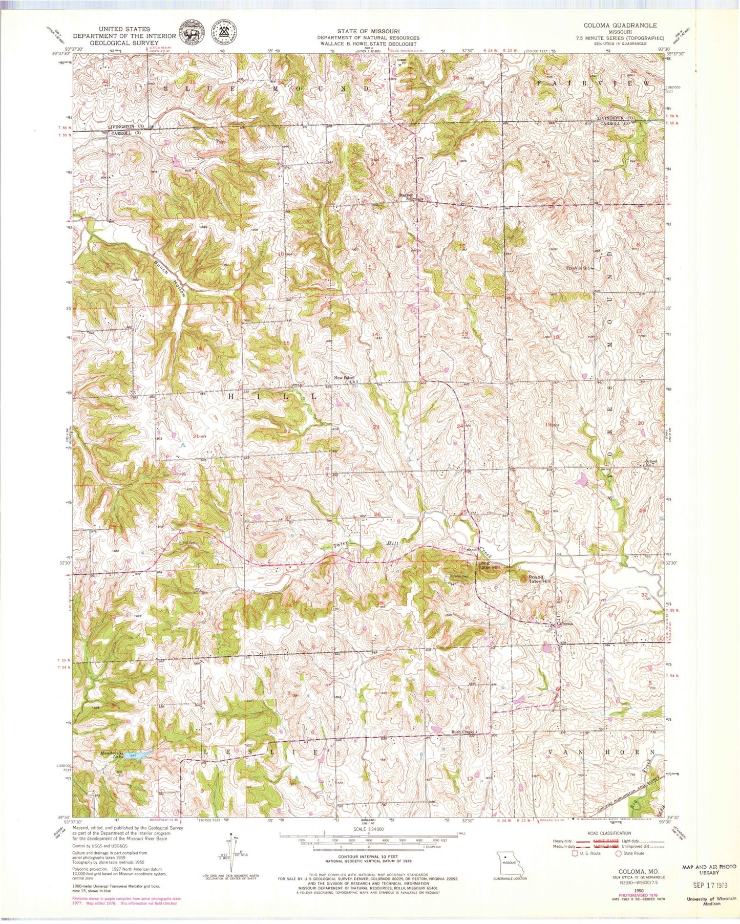
Classic USGS Coloma Missouri 7.5'x7.5' Topo Map
Couldn't load pickup availability
Historical USGS topographic quad map of Coloma in the state of Missouri. Map scale may vary for some years, but is generally around 1:24,000. Print size is approximately 24" x 27"
This quadrangle is in the following counties: Carroll, Livingston.
The map contains contour lines, roads, rivers, towns, and lakes. Printed on high-quality waterproof paper with UV fade-resistant inks, and shipped rolled.
Contains the following named places: Braden Cemetery, Braden School, Bunch Hollow, Coloma, Coloma School, Cream Ridge School, Fisher, Fisher Post Office, Franklin School, Greenwood School, Harts Lake, Harts Lake Dam, Henry Lake, Henry Lake Dam, Hill Cemetery, Isom School, Locust School, Long Tater Hill, Maberry Lake, Maberry Lake Dam, Mandeville Lake, Mandeville Lake Dam, Maple Grove School, New Salem Church, Oak Hill School, Round Tater Hill, Rush Chapel, Salem Cemetery, School Number 7, Stagner School, Susewine Lake, Susewine Lake Dam, Sykes Lake, Sykes Lake Dam, Township of Hill, Waitman Lake Section 30, Waitman Lake Section 30 Dam, Wooden School, ZIP Code: 64638