MyTopo
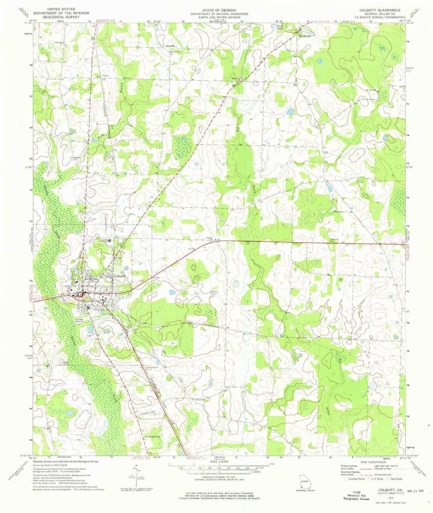
Classic USGS Colquitt Georgia 7.5'x7.5' Topo Map
Couldn't load pickup availability
Historical USGS topographic quad map of Colquitt in the state of Georgia. Map scale may vary for some years, but is generally around 1:24,000. Print size is approximately 24" x 27"
This quadrangle is in the following counties: Miller.
The map contains contour lines, roads, rivers, towns, and lakes. Printed on high-quality waterproof paper with UV fade-resistant inks, and shipped rolled.
Contains the following named places: Cecil Lake, City of Colquitt, Colquitt, Colquitt - Miller County Volunteer Fire Department, Colquitt Church, Colquitt City Cemetery, Colquitt Division, Colquitt Police Department, Colquitt Post Office, Colquitt Town Square Historic District, Colquitt United Methodist Church, Corea, Cow Pen Pond, Ebenezer Church, First Baptist Church, Georgia State Patrol Troop G Post 14 Colquitt, Grimes School, Hardy School, Harmony Cemetery, Harmony Church, Harmony School, Jeterville, Jeterville School, Long Branch, Macedonia, McLendon School, Miller County, Miller County Elementary School, Miller County Emergency Medical Services, Miller County High School, Miller County Hospital, Miller County Jail, Miller County Junior High School, Miller County Sheriff's Office, Mount Olive Church, Nicholasville, Pine Hill School, Rawls Cemetery, Saint Marys Church, Shepard African American Cemetery, Shepard Cemetery, Swingington Cemetery, Thompson Church, ZIP Code: 39837