


MyTopo
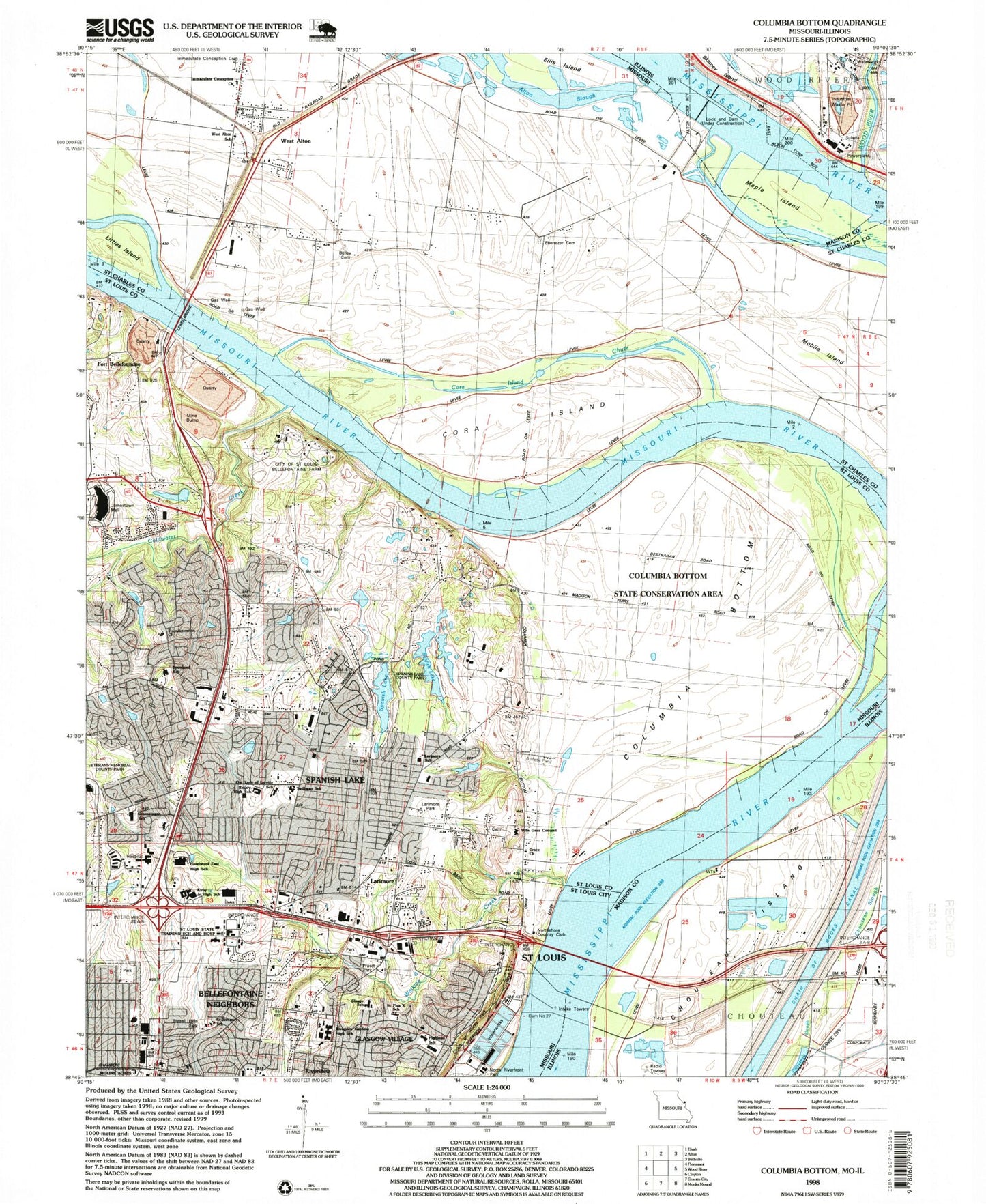
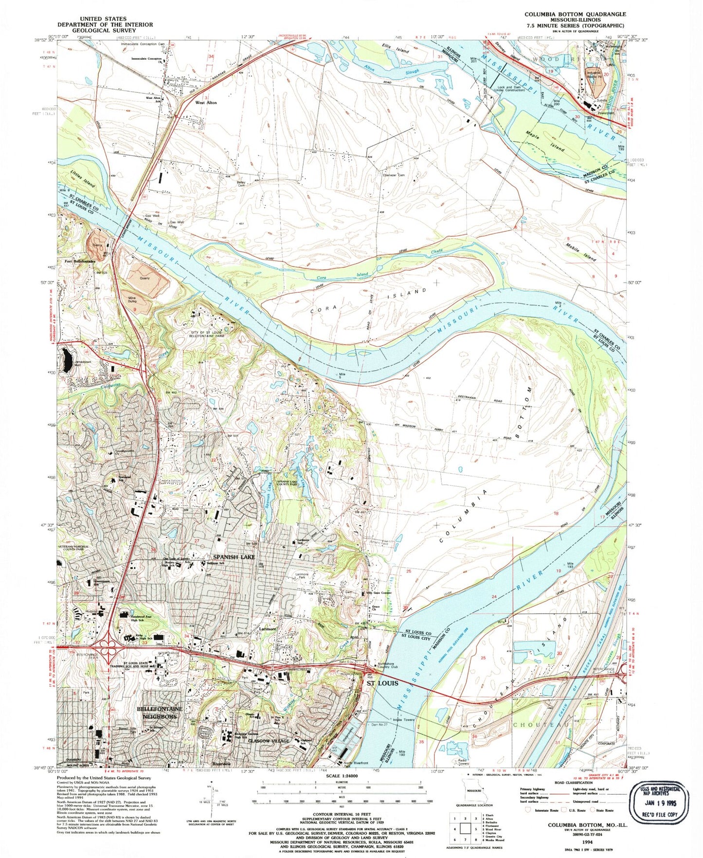
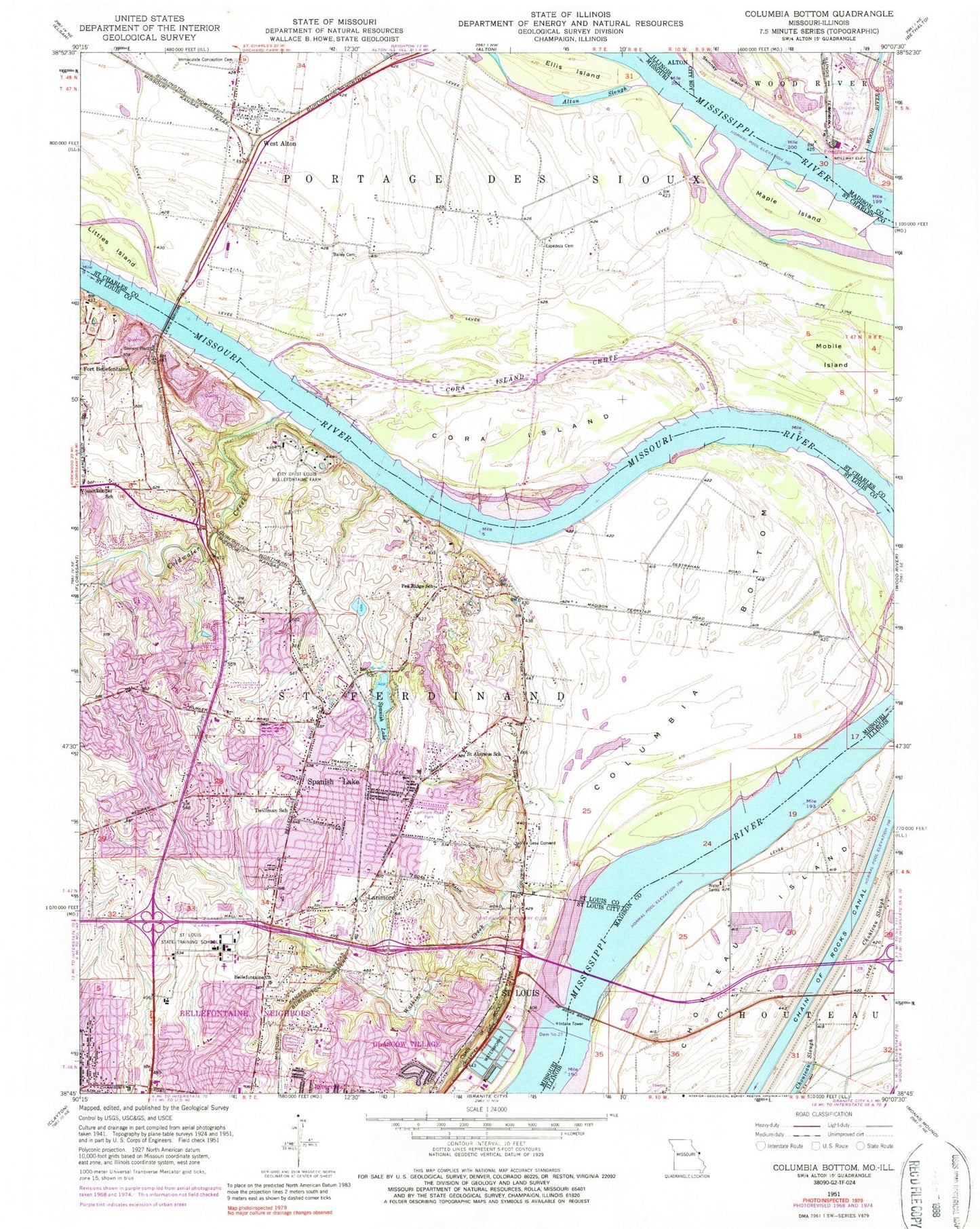
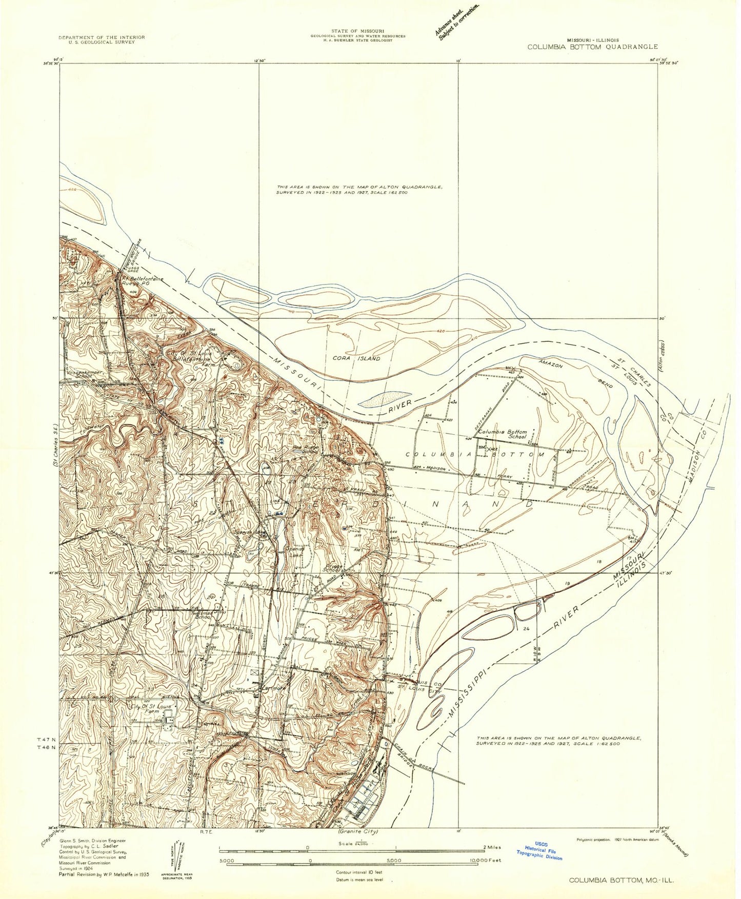
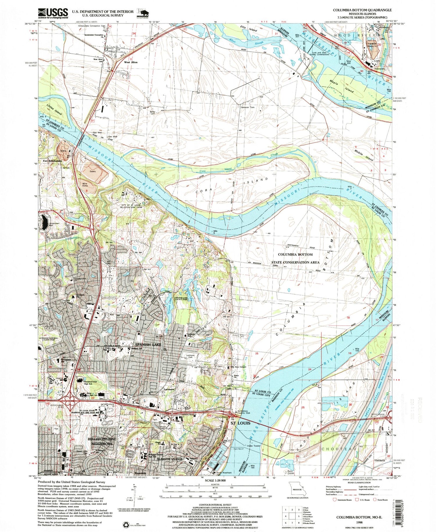
Classic USGS Columbia Bottom Missouri 7.5'x7.5' Topo Map
Couldn't load pickup availability
Historical USGS topographic quad map of Columbia Bottom in the states of Missouri, Illinois. Map scale may vary for some years, but is generally around 1:24,000. Print size is approximately 24" x 27"
This quadrangle is in the following counties: Madison, St. Charles, St. Louis, St. Louis (city).
The map contains contour lines, roads, rivers, towns, and lakes. Printed on high-quality waterproof paper with UV fade-resistant inks, and shipped rolled.
Contains the following named places: Alton Slough, Arrowpoint Elementary School, Atkins School, Bailey Cemetery, Bellefontaine Bridge, Bellefontaine Church, Bellefontaine Neighbors Baptist Church, Belle-Parke Plaza, Bethany-Peace United Church of Christ, Blessed Hope Bible Church, Bradshaw Island, Castle Point, Castle Point Census Designated Place, Chain of Rocks, Chain of Rocks Bridge, Chain of Rocks Canal, Chain of Rocks Park, Chapel of the Cross, Chouteau Island, Chouteau Slough, Christian Hospital, Church of the Nazarene North County, City of Bellefontaine Neighbors, City of Saint Louis Bellefontaine Farm, City of West Alton, Coldwater Creek, Columbia Bottom, Cora Island, Cora Island Chute, Dam 27, Duck Island, Dundee Park, Ellis Island, Espedeza Cemetery, First Church of God, Fort Bellefontaine, Friendship Missionary Baptist Church, Glasgow Elementary School, Glasgow Village, Glasgow Village Census Designated Place, God First Church, Gods Grace Church, Goose Island, Grace Baptist Church, Greater Saint Mark Missionary Baptist Church, Green Island, Hazelwood East High School, Hazelwood East Middle School, Highland Elementary School, Hog Island, Hope Church, Immaculate Conception Cemetery, Jamestown Mall, KGLD-AM (St Louis), Kic-ka-poo Village, Larimore, Larimore Road Park, Lewis and Clark Center, Lewis and Clark Center Shopping Center, Lewis Bridge, Liberty Missionary Baptist Church, Littles Island, Lock and Dam Number 26 Heliport, Locks 27, Maple Island, Maple Island Conservation Area, Melvin Price Locks and Dam, Mobile Island, Moline Acres Police Department, Mount Moriah Church of Christ, New Jamestown Road Baptist Church, North County Post Office, Northshore Country Club, Northside Family Worship Center, Oasis of Love Fellowship Church, One Way Missionary Baptist Church, Our Lady of Loretto Church, Paddock Forest Shopping Center, Pea Ridge School, Red School, Rivers Pointe Fire and Rescue Station 1, Roseview Church of God in Christ, Ruegg, Saint Aloysius Church, Saint Aloysius School, Saint Andrews Missionary Baptist Church, Saint Jeromes Catholic Church, Saint Louis Assembly Hall of the Kingdom Hall of Jehovahs Witnesses, Saint Louis Christian Center, Saint Louis Church of Christ, Saint Louis State Training School, Saint Peters Lutheran Church, Sierra Vista Plaza Shopping Center, Skinney Island, Spanish Lake, Spanish Lake Census Designated Place, Spanish Lake Fire Protection District Station 1, Spanish Lake Fire Protection District Station 2, The Temple Non-Denominational Church, Townsend Elementary School, Township of Saint Ferdinand, Township of Spanish Lake, Trinity Catholic High School, True Gospel Church of God, Twillman School, Villa Gesu Convent, Vossenkemper School, Watkins Creek, West Alton, West Alton Post Office, Wilson Island, Wilson Point, Wood River, Wood River Power Station, ZIP Codes: 63137, 63138, 63386