MyTopo
Classic USGS Columbia Falls North Montana 7.5'x7.5' Topo Map
Couldn't load pickup availability
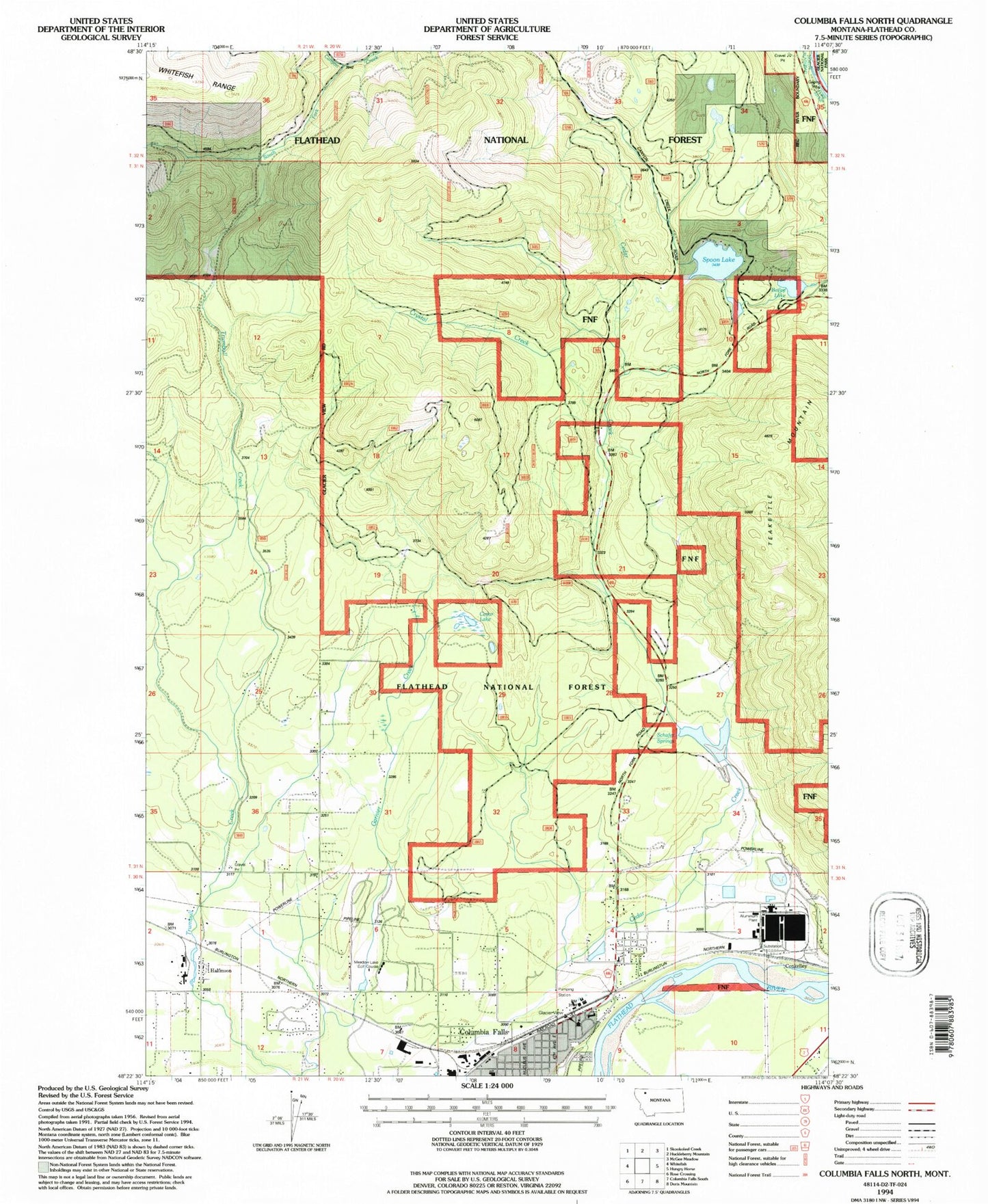
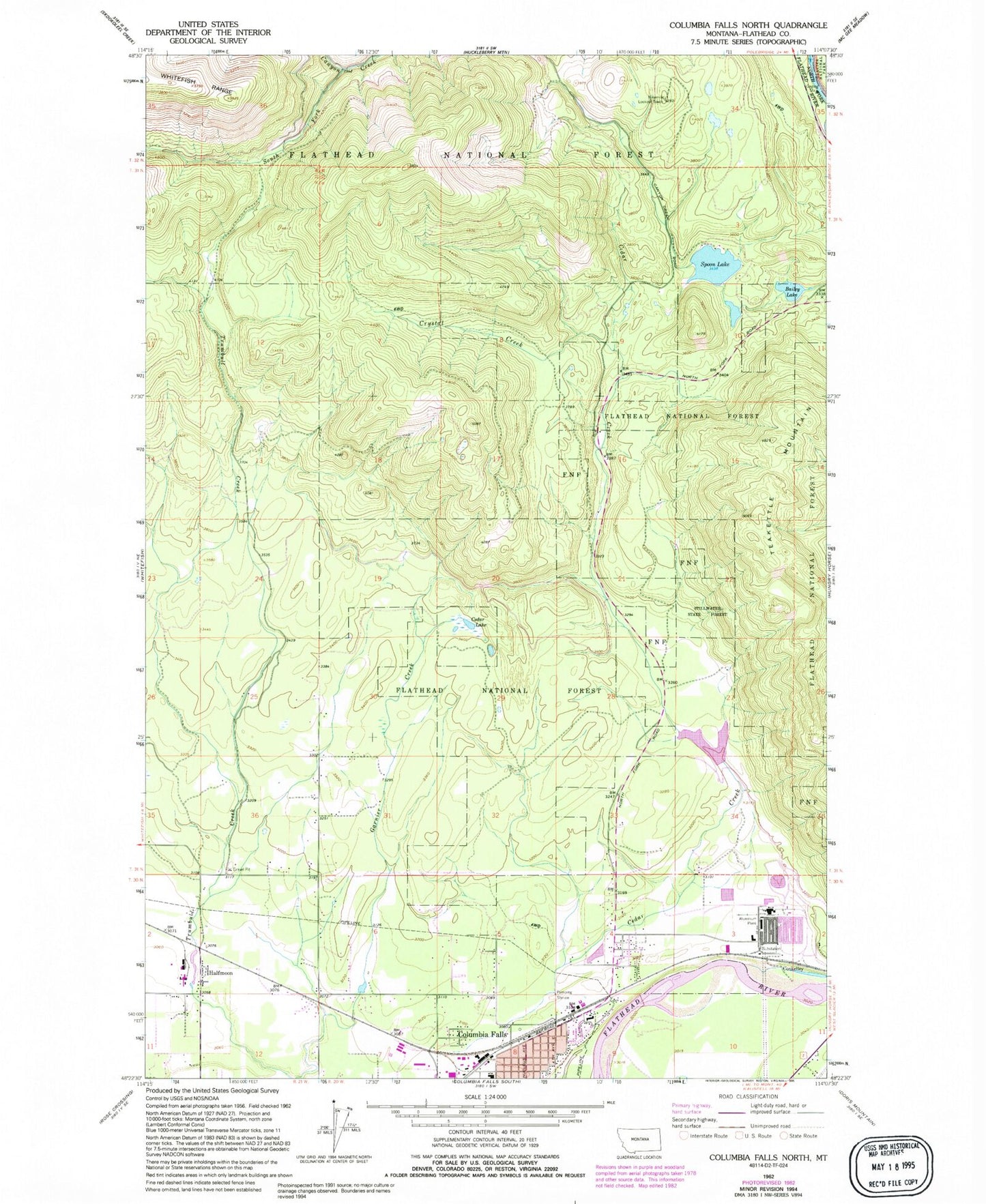
Historical USGS topographic quad map of Columbia Falls North in the state of Montana. Typical map scale is 1:24,000, but may vary for certain years, if available. Print size: 24" x 27"
This quadrangle is in the following counties: Flathead.
The map contains contour lines, roads, rivers, towns, and lakes. Printed on high-quality waterproof paper with UV fade-resistant inks, and shipped rolled.
Contains the following named places: Bailey Lake, Cedar Creek, Cedar Lake, Crystal Creek, South Fork Canyon Creek, Spoon Lake, Glacier View Ranger District Ranger Office, Schafer Springs, Cedar Creek Dam, Ninemile Lookout Tower, Conkelley, Halfmoon, 30N20W09CBCB01 Well, 30N20W08DAD_01 Well, 30N20W08CA__01 Well, 30N20W07DA__01 Well, 30N21W11AA__01 Well, 30N20W03DDDA01 Well, 30N20W03DDDA02 Well, 30N20W05CD__01 Well, 30N20W02CB__01 Well, 30N20W03DA__01 Well, 30N20W06CB__01 Well, 31N20W31CCBA01 Well, 31N21W25AD__01 Well, Seventh Day Adventist Church, Columbia Falls United Methodist Church, Half Moon Mobile Home Park, Country Estates Mobile Home Park, Meadow Lake Golf Course, Half Moon, Columbia Falls Post Office, Columbia Falls, Conkelley, Glacier Christian School