
MyTopo
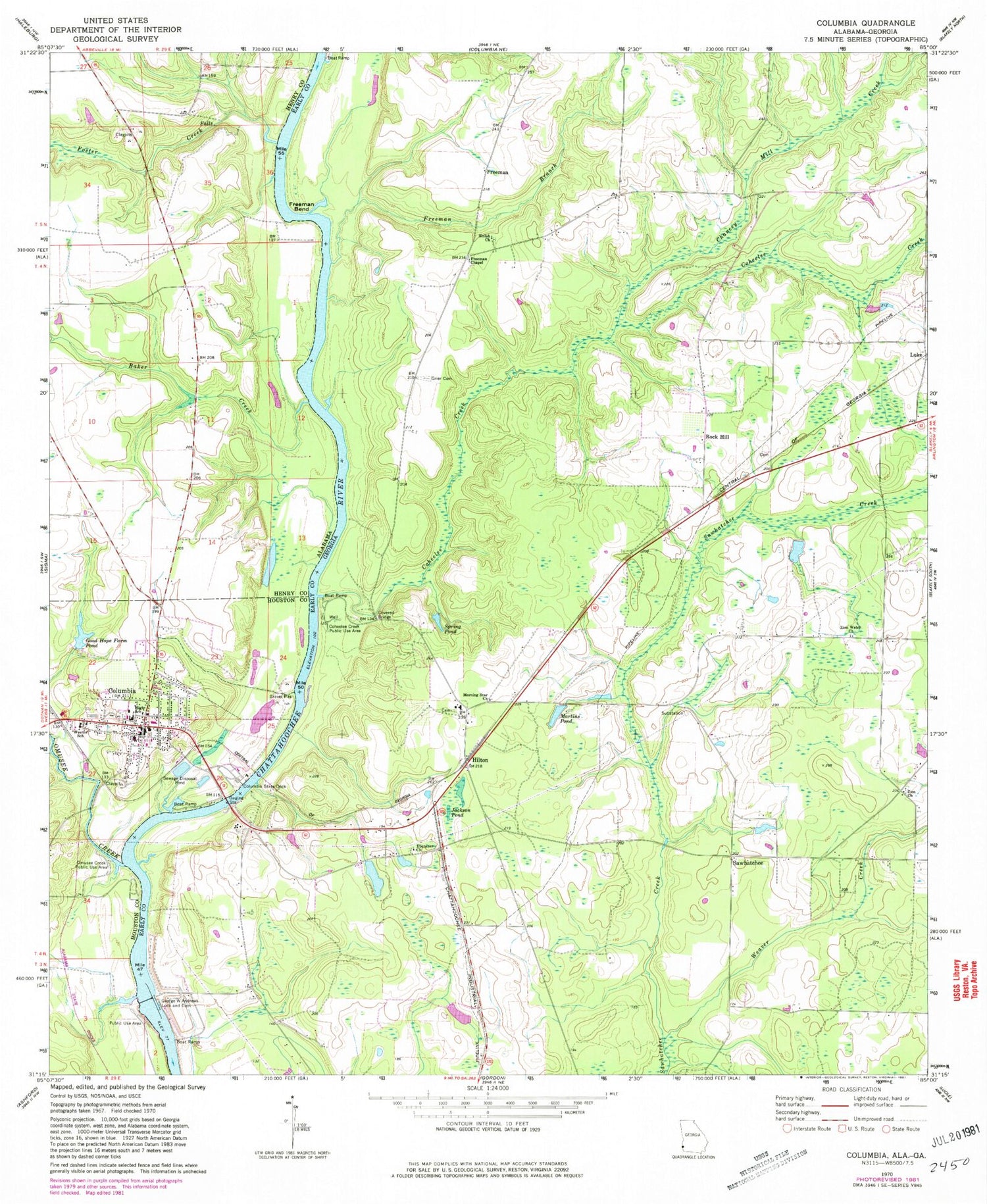
Classic USGS Columbia Alabama 7.5'x7.5' Topo Map
Couldn't load pickup availability
Historical USGS topographic quad map of Columbia in the states of Alabama, Georgia. Map scale may vary for some years, but is generally around 1:24,000. Print size is approximately 24" x 27"
This quadrangle is in the following counties: Early, Henry, Houston.
The map contains contour lines, roads, rivers, towns, and lakes. Printed on high-quality waterproof paper with UV fade-resistant inks, and shipped rolled.
Contains the following named places: Baker Creek, Chancey Mill Creek, Chancy Mill, Coheelee Creek, Coheelee Creek Covered Bridge, Coheelee Creek Public Use Area, Columbia, Columbia Baptist Church, Columbia Bridge, Columbia Fire Department, Columbia Methodist Church, Columbia Police Department, Columbia Post Office, Columbia Sewage Lagoon, Columbia State Dock, Early County Fire Department Rock Hill Station, Ebenezer Church, Emussa, Fannie Askew Williams Park, First Baptist Church, Foster Creek, Freeman, Freeman Bend, Freeman Branch, Freeman Chapel, Freeman Landing, Freeman School, George W Andrews Lock and Dam, Good Hope Farm Pond, Good Shephard Catholic Church, Green's Mobile Home Park, Grier Cemetery, Hilton, Houston County High School, Houston County Port Authority Industrial Park, Jackson Pond, Lake George W. Andrews, Luke, Martins Pond, Morning Star Church, Odom Creek, Odom Creek Public Use Area, Old Cabin Jail Museum, Omusee Creek, Omusee Creek Public Use Area, Rock Hill, Rock Hill Cemetery, Rossie Purcell Library, Saint Luke Methodist Church, Sawhatchee, Second Baptist Church, Shiloh Church, Shiloh Missionary Church Cemetery, Spring Pond, Town of Columbia, Weaver Creek, Weems School, Wellborn, Wellborn Post Office, Zion Church, Zion Freewill Baptist Cemetery, Zion Watch Church


