MyTopo
Classic USGS Columbiaville Michigan 7.5'x7.5' Topo Map
Couldn't load pickup availability
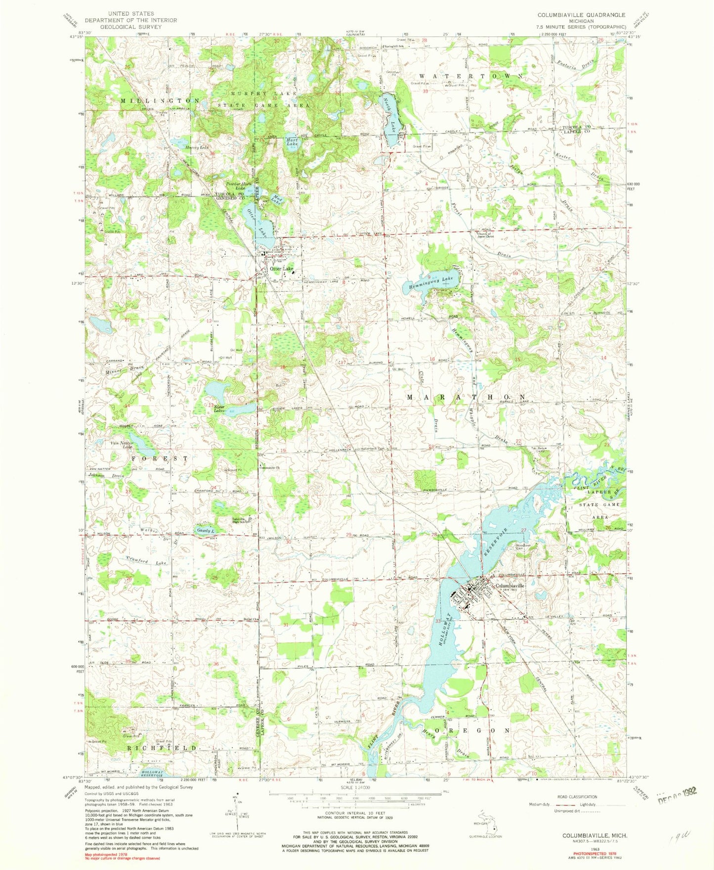
Historical USGS topographic quad map of Columbiaville in the state of Michigan. Map scale may vary for some years, but is generally around 1:24,000. Print size is approximately 24" x 27"
This quadrangle is in the following counties: Genesee, Lapeer, Tuscola.
The map contains contour lines, roads, rivers, towns, and lakes. Printed on high-quality waterproof paper with UV fade-resistant inks, and shipped rolled.
Contains the following named places: Bethel Church, Church of Jesus Christ, Clute Drain, Columbiaville, Columbiaville Assembly of God Church, Columbiaville Baptist Church, Columbiaville Branch Library, Columbiaville Depot Historical Marker, Columbiaville Elementary School, Columbiaville Fire Department, Columbiaville Post Office, Columbiaville Station, Columbiaville United Methodist Church, Crawford Lake Drain, Davison Hills Mobile Home Park, Gawdy Lake, Genesee-Otter Lake Campground, Hart Lake, Harvey Lake, Hemmingway and Whipple Drain, Hemmingway Lake, Henry Drain, Hollenbeck Cemetery, Johnson Drain, Joslyn Drain, Lake Henson, Lakeville Community Free Methodist Church, Lakeville High School, Marathon Medical Clinic, Marathon Post Office, Mud Lake, North Branch Flint River, North Lake, Otter Lake, Otter Lake Branch Library, Otter Lake Cemetery, Otter Lake Church of the Nazarene, Otter Lake Elementary School, Otter Lake Fire and Rescue, Otter Lake Park, Otter Lake Post Office, Otter Lake Seventh Day Church, Otter Lake Station, Otter Lake United Methodist Church, Otter Lake Village Campground, Powder Horn Lake, Saint John's Episcopal Church, Sister Lakes, South Branch Flint River, Springhill School, Tau Beta Camp, Township of Marathon, United Methodist Church Historical Marker, Van Natter Lake, Village of Columbiaville, Village of Otter Lake, Village of Otter Lake Museum, Walker Drain, William Peter Mansion Historical Marker, Wolverine Campground, Woodlawn Cemetery, ZIP Codes: 48421, 48464


