

MyTopo
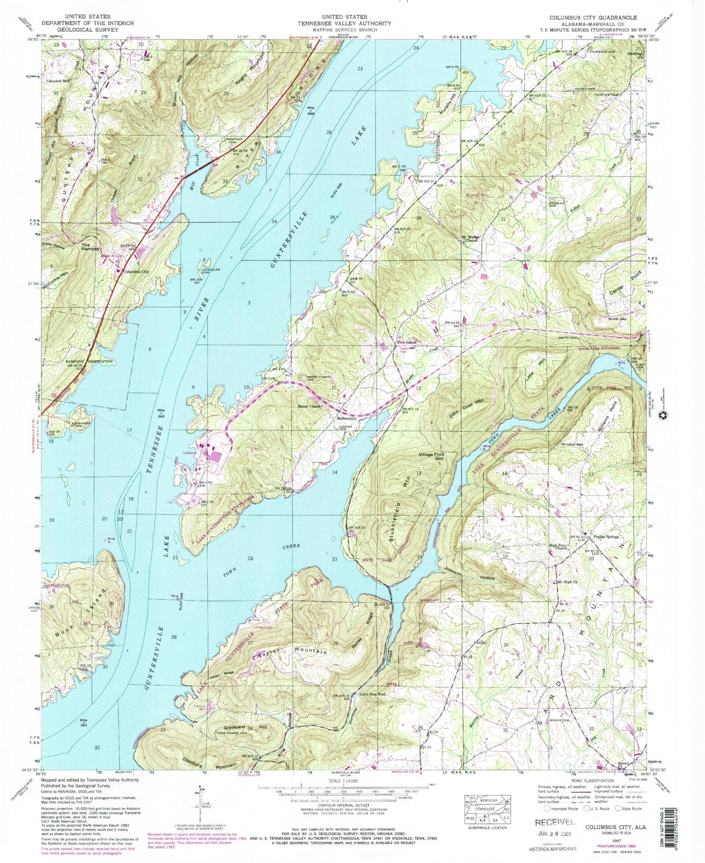
Classic USGS Columbus City Alabama 7.5'x7.5' Topo Map
Couldn't load pickup availability
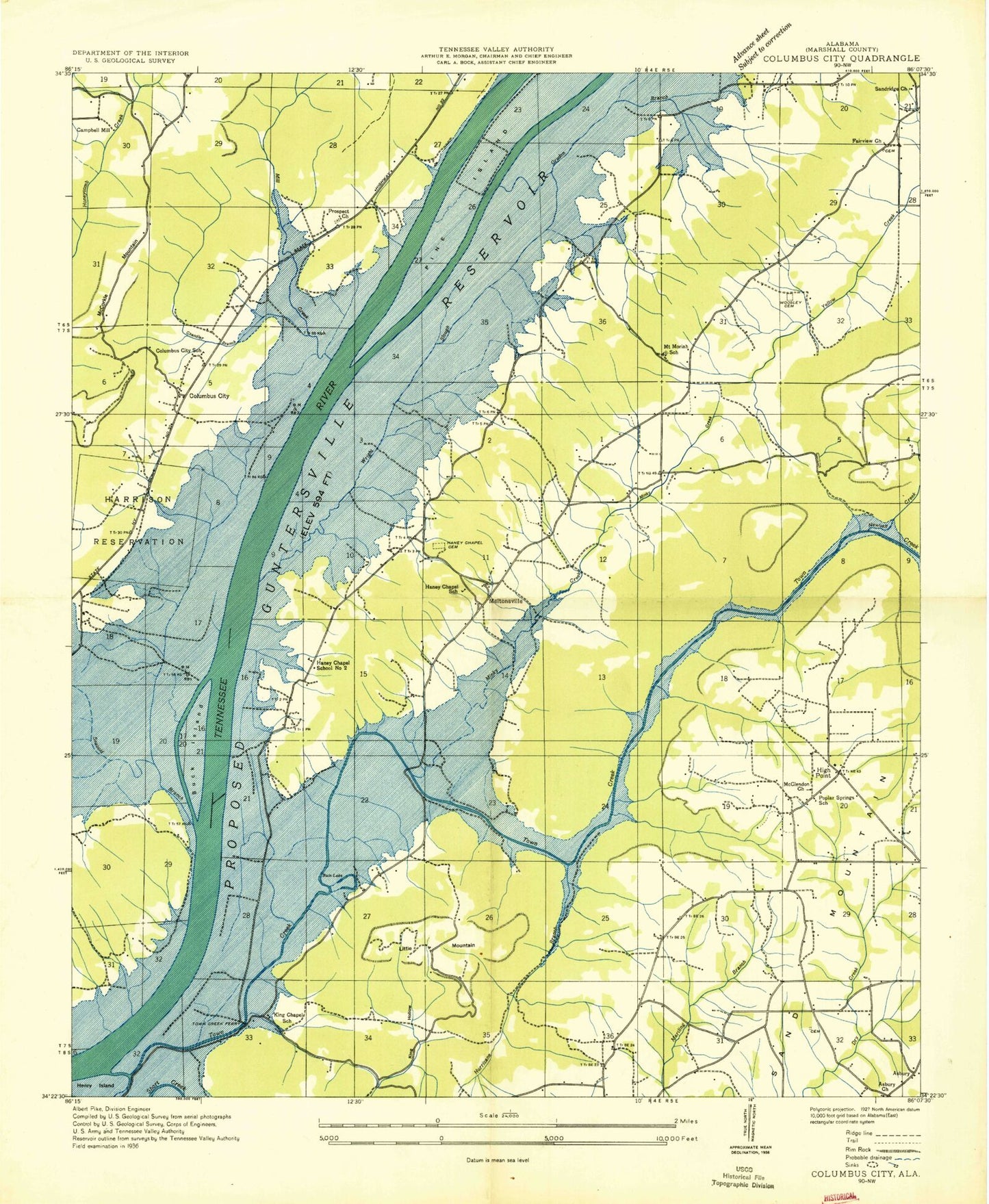
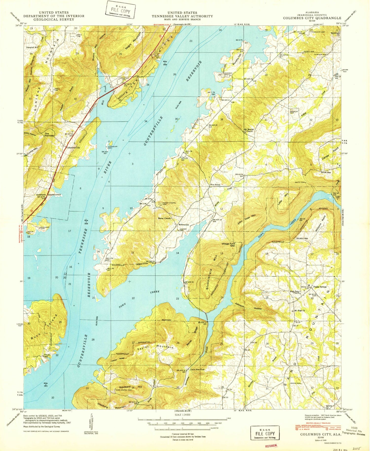
Historical USGS topographic quad map of Columbus City in the state of Alabama. Map scale may vary for some years, but is generally around 1:24,000. Print size is approximately 24" x 27"
This quadrangle is in the following counties: Marshall.
The map contains contour lines, roads, rivers, towns, and lakes. Printed on high-quality waterproof paper with UV fade-resistant inks, and shipped rolled.
Contains the following named places: Alabama Christian Youth Camp, Asbury, Asbury Methodist Church, Bailey Ridge, Bryant Mill Hollow, Buck Island, Buck Island Bar, Camp Ney A Ti, Camp Trico, Campbell Mill, Cedar Ridge, Center Point, Center Star Church, Chandler Branch, Chandler Cemetery, Columbus Bar, Columbus City, Columbus City Ferry, Columbus City Landing, Columbus City School, Cooper Cemetery, Duvall Branch, Ellenburg Mountain, Fairview Cemetery, Fairview Church, Five Points, Five Points School, Glen Haven, Graveyard Hill, Gunters Bar, Haney Chapel, Haney Chapel Cemetery, Haney Chapel School, Haney Chapel School Number 2, Harrison Reservation, Henrys Bar, High Point Church, Hurricane Branch, John Doss Mountain, Johnson Cemetery, Johnson Hollow, Johnsons Store, Kennamer Cemetery, King Chapel, King Chapel Cemetery, Kirby Cemetery, Lake Guntersville State Park, Law Landing, Little Mountain, Little Mountain Marina, Little New York, Lovelace Landing, Lower Bar, McCorkle Mountain, McDonald Spring, Meltonsville, Mid, Mill Creek, Minky Creek, Mount High Primitive Baptist Church, Mount Moriah Church Cemetery, Mount Moriah Methodist Church, Mount Moriah School, Murphy Hill, Negro Mountain, Old Union Branch, Pine Island, Pine Island Church, Pine Island Landing, Poplar Springs, Poplar Springs Church, Poplar Springs School, Prospect Cemetery, Prospect Church, Rainey Cemetery, Rooks Cemetery, Sandridge Church, Smith Cemetery, Smith Gap, Stubblefield Mountain, Sycamore Landing, Tanglewood, Taylor Mountain, The Narrows, Thomason Cemetery, Town Creek, Town Creek Division, Town Creek Ferry, Turner Marina, Village Ford Gap, Wakefield Community Center, Wakefield Volunteer Fire Department, Waterfront Fire Department, Williams Point, Winston Gap, Woosley Cemetery, ZIP Code: 35755