MyTopo
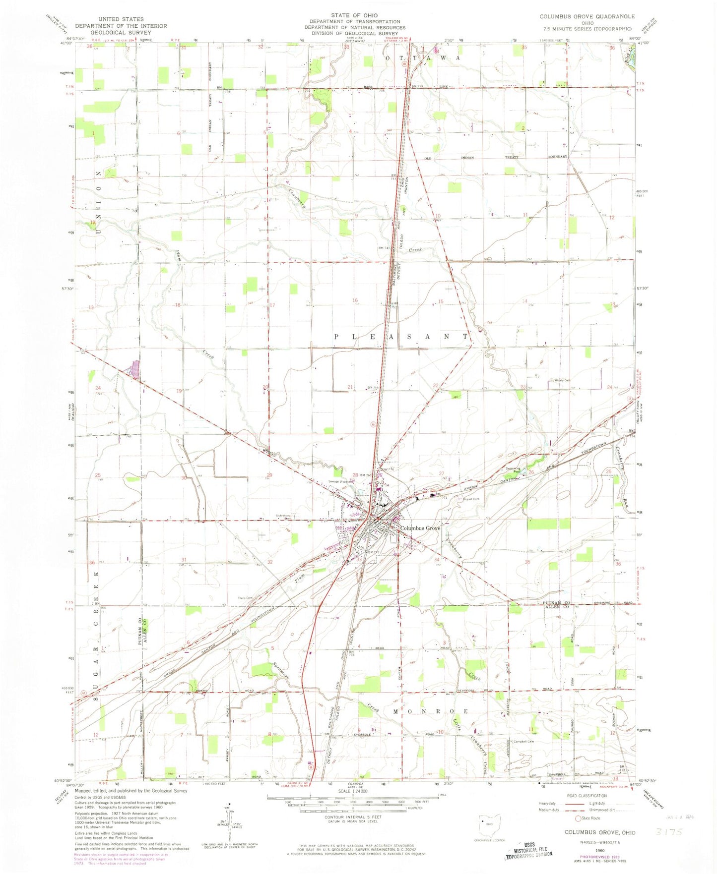
Classic USGS Columbus Grove Ohio 7.5'x7.5' Topo Map
Couldn't load pickup availability
Historical USGS topographic quad map of Columbus Grove in the state of Ohio. Map scale may vary for some years, but is generally around 1:24,000. Print size is approximately 24" x 27"
This quadrangle is in the following counties: Allen, Putnam.
The map contains contour lines, roads, rivers, towns, and lakes. Printed on high-quality waterproof paper with UV fade-resistant inks, and shipped rolled.
Contains the following named places: Bogart Cemetery, Bowers Mobile Home Park, Campbell Cemetery, Columbus Grove, Columbus Grove Elementary School, Columbus Grove Emergency Medical Services, Columbus Grove Fire Department Station 2, Columbus Grove High School, Columbus Grove Middle School, Columbus Grove Police Department, Columbus Grove Post Office, Columbus Grove Volunteer Fire Department Station 20, Do Well Mobile Village, Gettman Trailer Park, Little Cranberry Creek, Lugibill's Greenhouse, Macks Heliport, Ridge Farms, Ridge Road Trailer Park, Saint Anthony Catholic Church, Saint Anthony Cemetery, Saint Anthony of Padua School, Saint John United Methodist Church, Sycamore Creek, Township of Pleasant, Truro Cemetery, Village of Columbus Grove, Windmill Swine Farm, Wisely Cemetery, ZIP Code: 45830