MyTopo
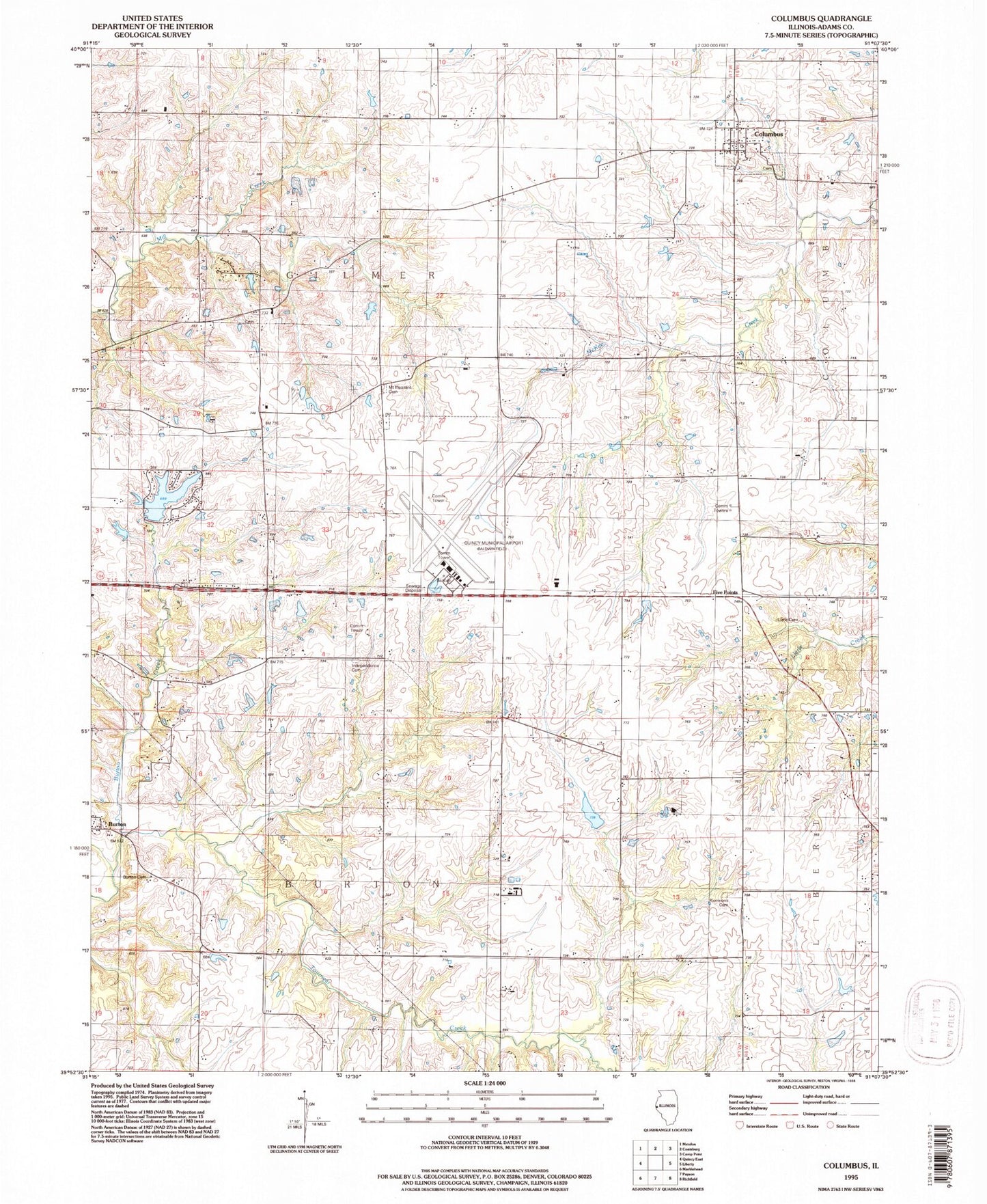
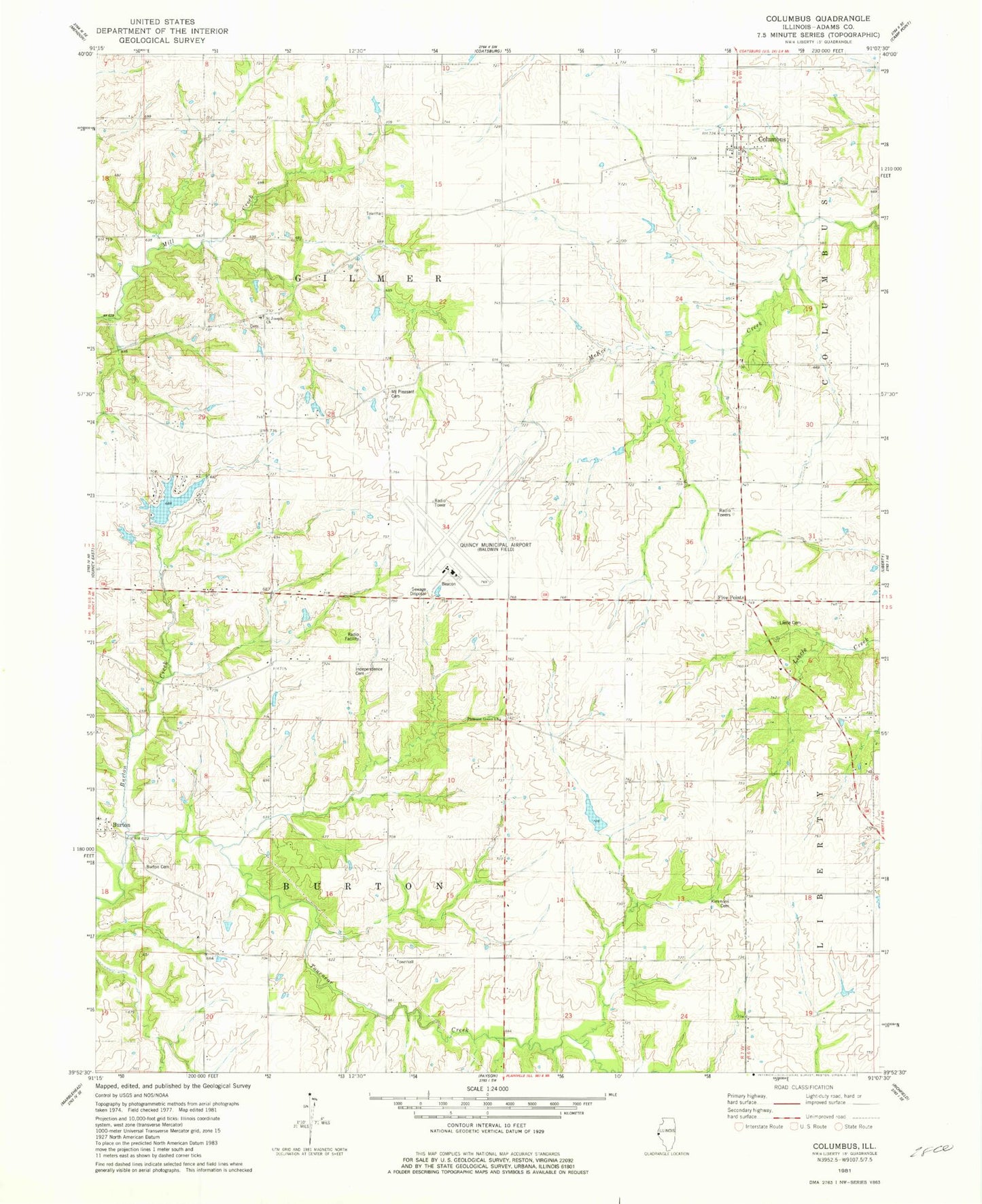
Classic USGS Columbus Illinois 7.5'x7.5' Topo Map
Couldn't load pickup availability
Historical USGS topographic quad map of Columbus in the state of Illinois. Map scale may vary for some years, but is generally around 1:24,000. Print size is approximately 24" x 27"
This quadrangle is in the following counties: Adams.
The map contains contour lines, roads, rivers, towns, and lakes. Printed on high-quality waterproof paper with UV fade-resistant inks, and shipped rolled.
Contains the following named places: Adams County, Burton, Burton Cave Nature Preserve, Burton Cemetery, Burton Census Designated Place, Burton Townhall, Columbus, Columbus Cemetery, Douglas School, Franklin School, Gilmer Townhall, Independence Cemetery, Independent School, Kimmons Cemetery, Lakeshore Hills Lake, Lakeshore Hills Lake Dam, Lierle Cemetery, Livingston School, Maple Grove School, Mount Pleasant Cemetery, Mount Pleasant Church, Mount Pleasant School, Pleasant Grove Church, Prairie School, Quincy Regional Airport-Baldwin Field, Saint Joseph Cemetery, Saint Joseph School, Seigel School, Tournear Creek, Township of Burton, Township of Gilmer, Village of Columbus, West Union School, ZIP Code: 62338