MyTopo
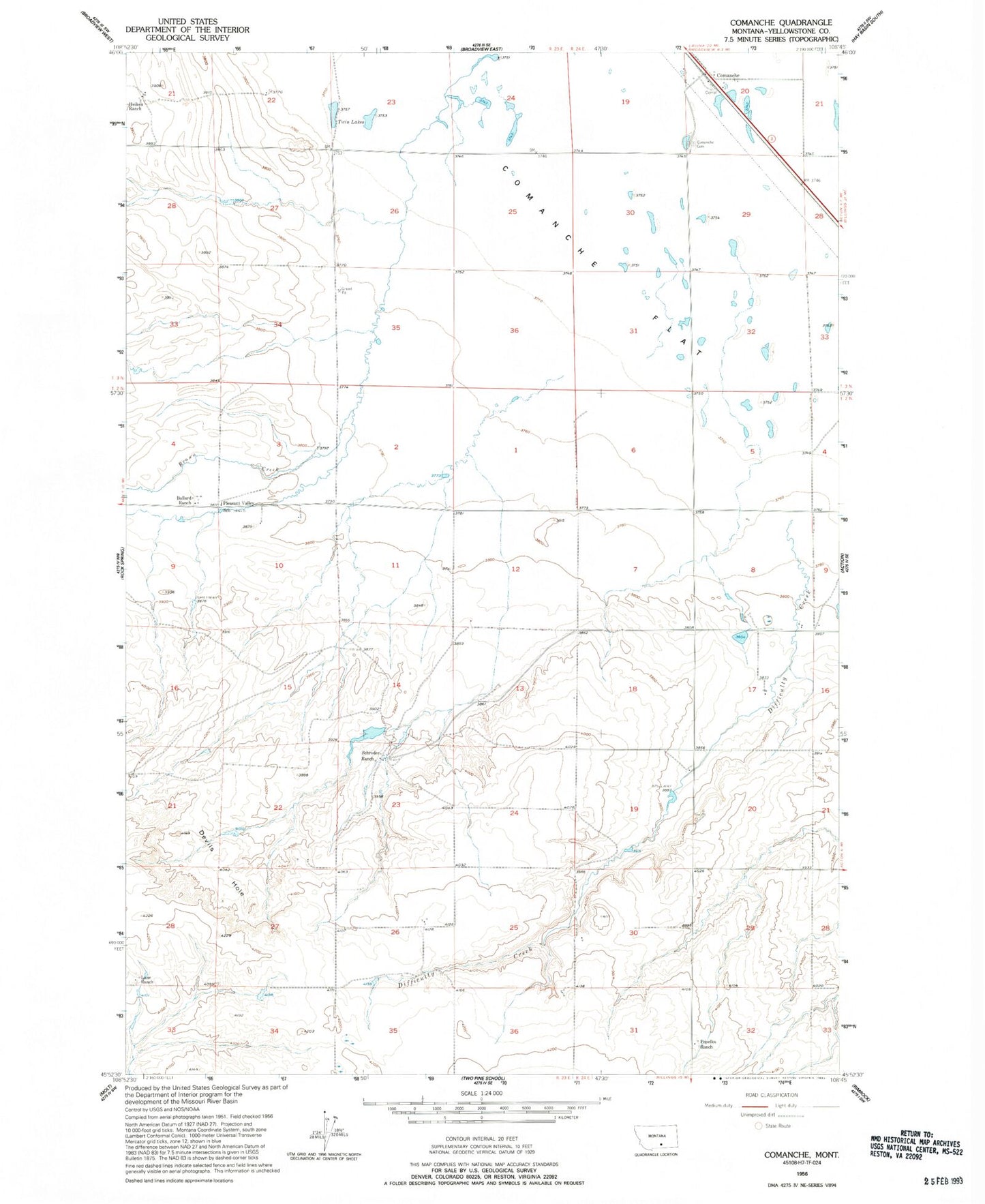
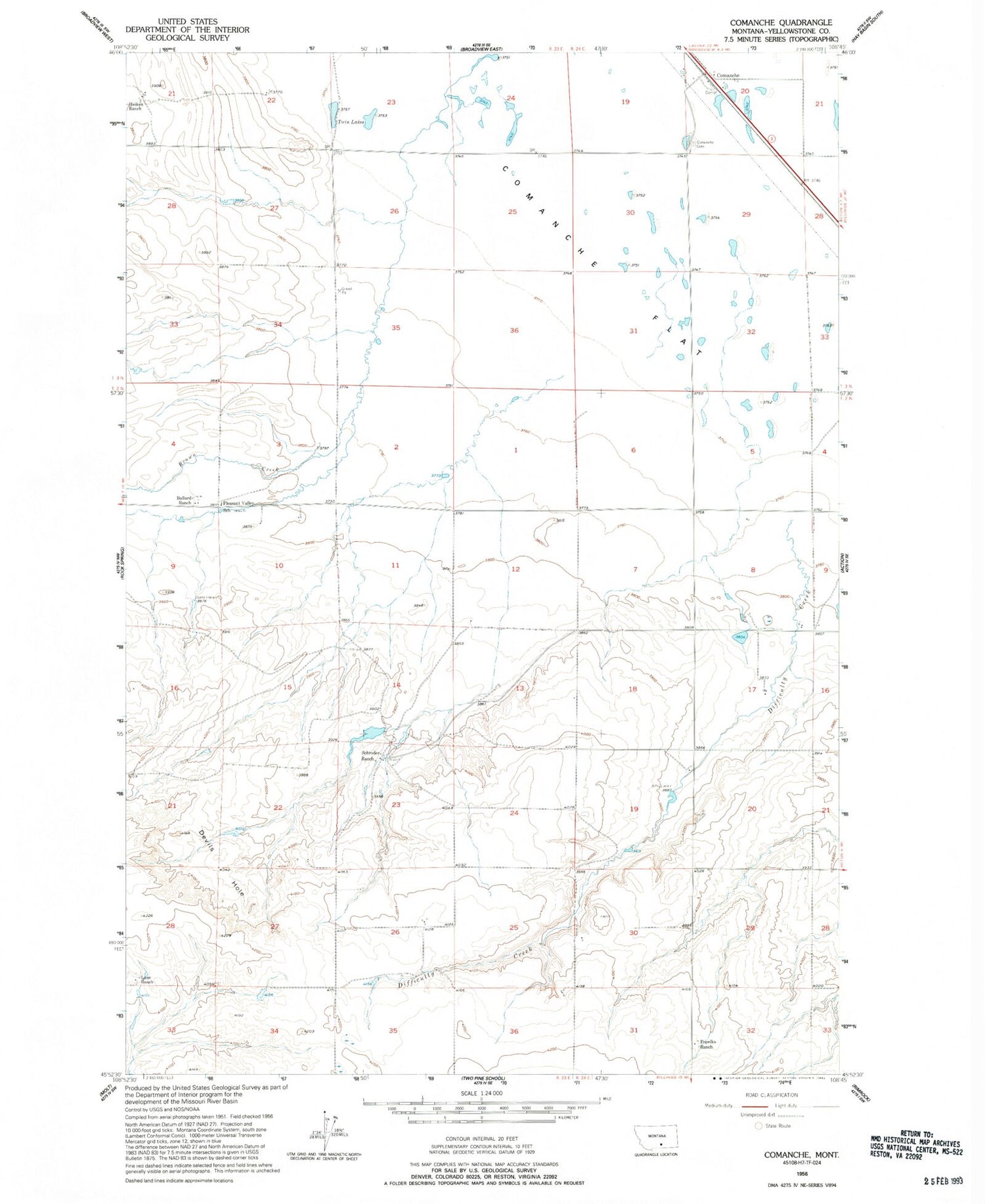
Classic USGS Comanche Montana 7.5'x7.5' Topo Map
Couldn't load pickup availability
Historical USGS topographic quad map of Comanche in the state of Montana. Map scale may vary for some years, but is generally around 1:24,000. Print size is approximately 24" x 27"
This quadrangle is in the following counties: Yellowstone.
The map contains contour lines, roads, rivers, towns, and lakes. Printed on high-quality waterproof paper with UV fade-resistant inks, and shipped rolled.
Contains the following named places: 02N23E02D___01 Well, 02N23E24A___01 Well, 02N23E28C___01 Well, 02N24E32B___01 Well, 03N24E20B___01 Well, 03N24E32ADDC01 Well, Ballard Ranch, Brown Creek, Comanche, Comanche Cemetery, Devils Hole, Difficulty Creek, Heiken Ranch, K L Clark Number 1 Dam, Lane Ranch, Pleasant Valley School, Popelka Ranch, Schroder Ranch, Twin Lakes