MyTopo
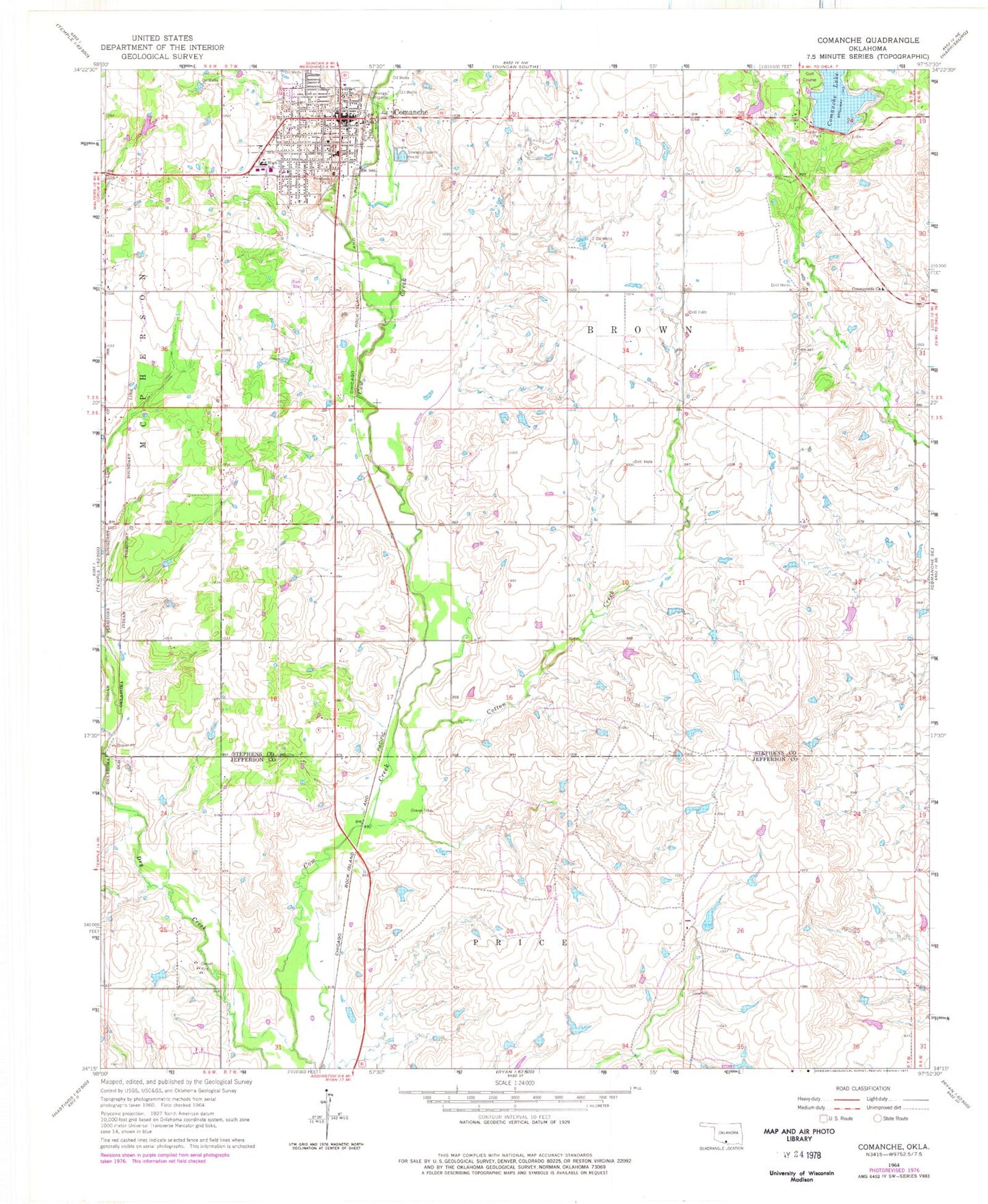
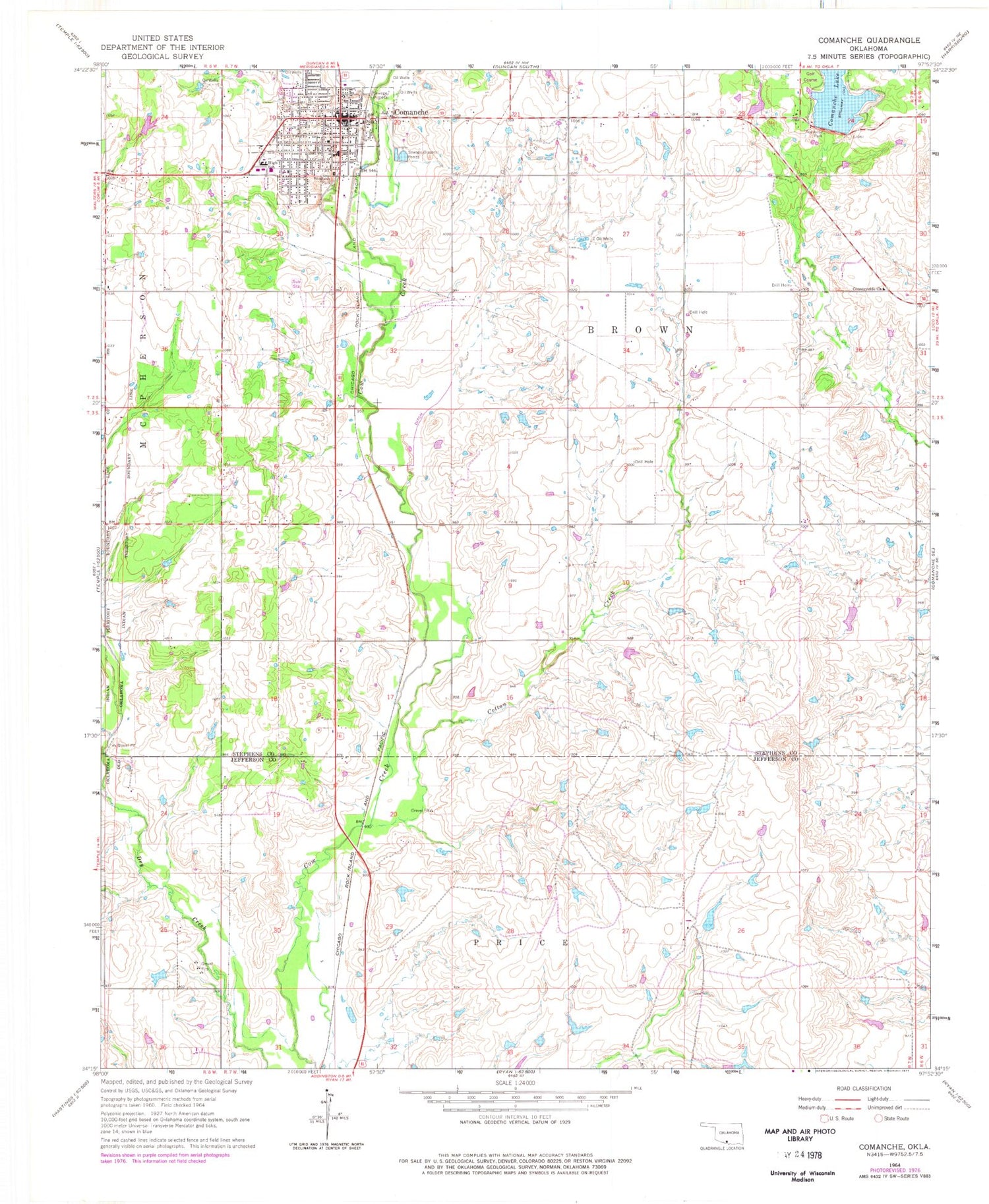
Classic USGS Comanche Oklahoma 7.5'x7.5' Topo Map
Couldn't load pickup availability
Historical USGS topographic quad map of Comanche in the state of Oklahoma. Map scale may vary for some years, but is generally around 1:24,000. Print size is approximately 24" x 27"
This quadrangle is in the following counties: Jefferson, Stephens.
The map contains contour lines, roads, rivers, towns, and lakes. Printed on high-quality waterproof paper with UV fade-resistant inks, and shipped rolled.
Contains the following named places: Christian Helping Hands, Church of Christ, City of Comanche, Comanche, Comanche Church of God, Comanche Division, Comanche Elementary School, Comanche Fire Department, Comanche High School, Comanche Lake, Comanche Lake Dam, Comanche Middle School, Comanche Police Department, Comanche Post Office, Comanche Reservoir, Cotton Creek, Countryside Church, Cow Creek Site 28 Dam, Cow Creek Site 28 Reservoir, Cow Creek Site 29 Dam, Cow Creek Site 29 Reservoir, Cow Creek Site 8 Dam, Cow Creek Site 8 Reservoir, First Baptist Church, Oknoname 067004 Dam, Oknoname 067004 Reservoir, Oknoname 137071 Dam, Oknoname 137071 Reservoir, Oknoname 137072 Dam, Oknoname 137072 Reservoir, Oknoname 137084 Dam, Oknoname 137084 Reservoir, Patterson Avenue Baptist Church, Ray of Hope Church, Township of Brown, Wildlife Ranch Airport, ZIP Codes: 73520, 73529