
MyTopo
Classic USGS Comer Alabama 7.5'x7.5' Topo Map
Couldn't load pickup availability
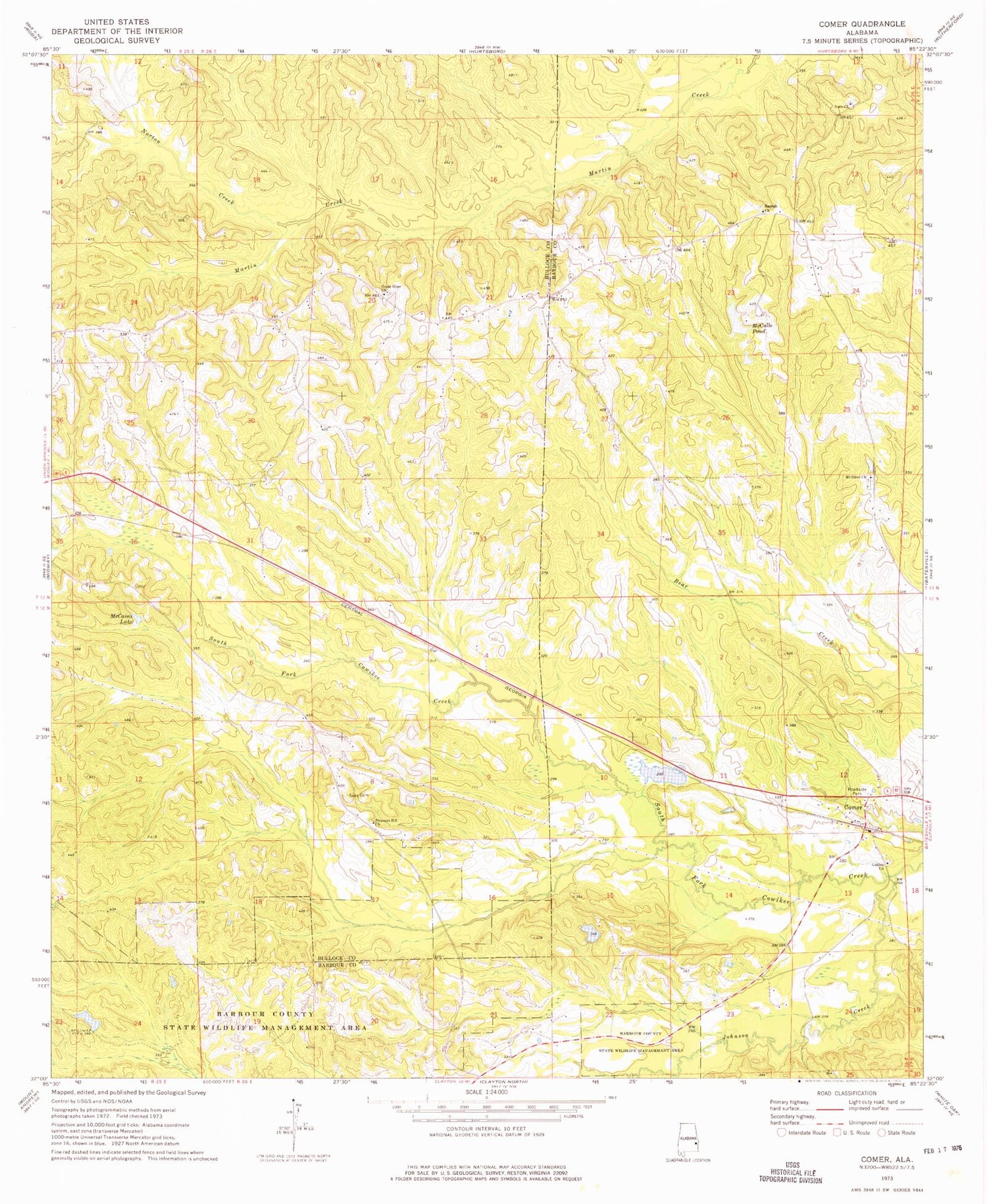
Historical USGS topographic quad map of Comer in the state of Alabama. Map scale may vary for some years, but is generally around 1:24,000. Print size is approximately 24" x 27"
This quadrangle is in the following counties: Barbour, Bullock.
The map contains contour lines, roads, rivers, towns, and lakes. Printed on high-quality waterproof paper with UV fade-resistant inks, and shipped rolled.
Contains the following named places: Barbour County State Wildlife Management Area, Comer, Comer United Methodist Church, Galilee Church, Galilee Comer Elementary School, Grants Duck Pond, Grants Duck Pond Dam, Great Hope African Methodist Epsicopal Church, Great Hope Junior High School, Johnson Creek, Mc Calls Lake Dam, McCains Lake, McCalls Pond, Mount Olive Church, Nero Church, Norton Creek, Pleasant Hill Church, Ramah Cemetery, Ramah Church, Seay Cemetery, Taylors Store, Wehle Lake, Wehle Lake Dam, ZIP Code: 36053


