
MyTopo
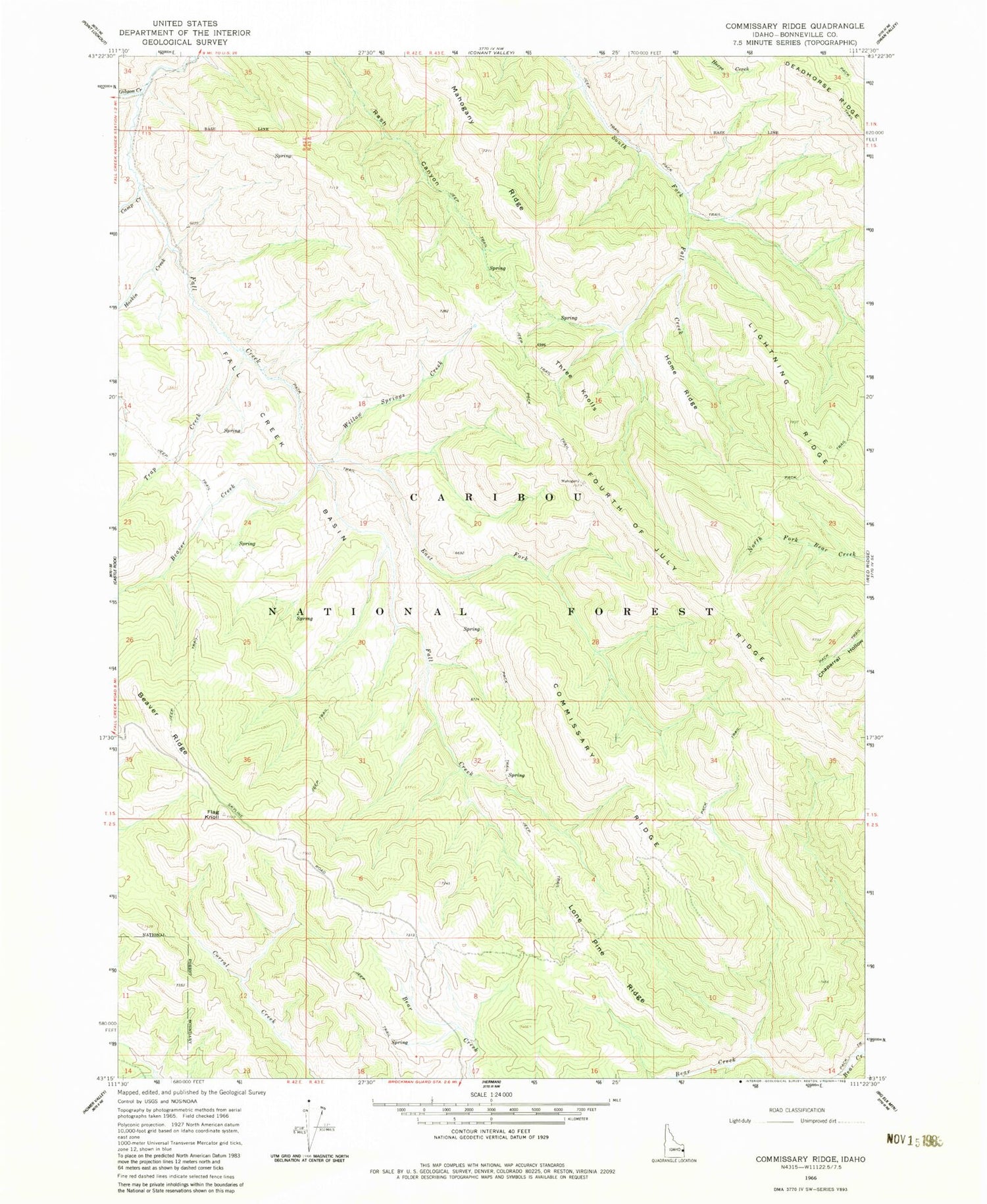
Classic USGS Commissary Ridge Idaho 7.5'x7.5' Topo Map
Couldn't load pickup availability
Historical USGS topographic quad map of Commissary Ridge in the state of Idaho. Map scale may vary for some years, but is generally around 1:24,000. Print size is approximately 24" x 27"
This quadrangle is in the following counties: Bonneville.
The map contains contour lines, roads, rivers, towns, and lakes. Printed on high-quality waterproof paper with UV fade-resistant inks, and shipped rolled.
Contains the following named places: Beaver Creek, Beaver Ridge, Camp Creek, Commissary Ridge, East Fork Fall Creek, Fall Creek Basin, Flag Knoll, Fourth of July Ridge, Gibson Creek, Haskin Creek, Home Ridge, Lightning Ridge, Lone Pine Ridge, Mahogany Ridge, Swan Valley Division, Three Knolls, Trap Creek, Willow Springs Creek, ZIP Code: 83449


