MyTopo
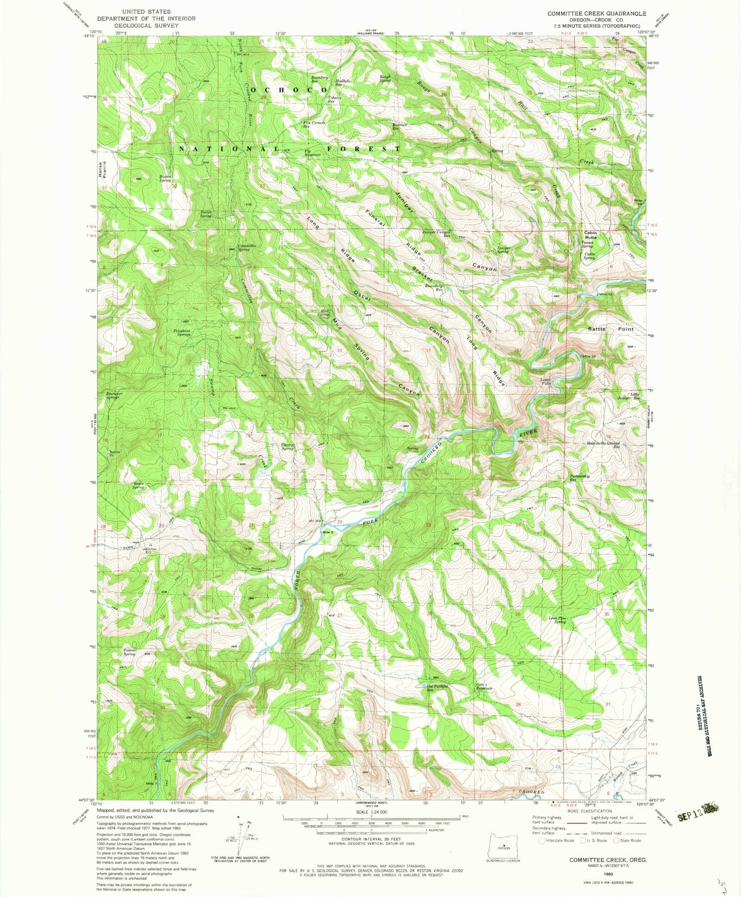
Classic USGS Committee Creek Oregon 7.5'x7.5' Topo Map
Couldn't load pickup availability
Historical USGS topographic quad map of Committee Creek in the state of Oregon. Map scale may vary for some years, but is generally around 1:24,000. Print size is approximately 24" x 27"
This quadrangle is in the following counties: Crook.
The map contains contour lines, roads, rivers, towns, and lakes. Printed on high-quality waterproof paper with UV fade-resistant inks, and shipped rolled.
Contains the following named places: Basin Spring, Battle Point, Booton Spring, Boundary Reservoir, Bracket Canyon, Cabin Butte, Cabin Spring, Cherry Spring, Committee Creek, Committee Spring, Federal Spring, Fly Reservoir, Funeral Ridge, Gate One Reservoir, Hail Creek, Hole-in-the-Ground Reservoir, Juniper Canyon, Juniper Canyon Reservoir, Juniper Spring, Little Juniper Reservoir, Lone Pine Spring, Long Ridge, Lower Falls, Lutsey Reservoir, Mud Spring, Mud Spring Canyon, Mudhole Reservoir, North Fork Crooked Wild and Scenic River, Old Faithful Reservoir, Oscar Canyon, Partnership Reservoir, Rimrock Reservoir, Rough Canyon, Rough Canyon Creek, Rough Spring, Swamp Creek, Teater Spring, Teaters Ranch, Telephone Springs, Tohatin Reservoir, Veason Spring, Watson Creek