MyTopo
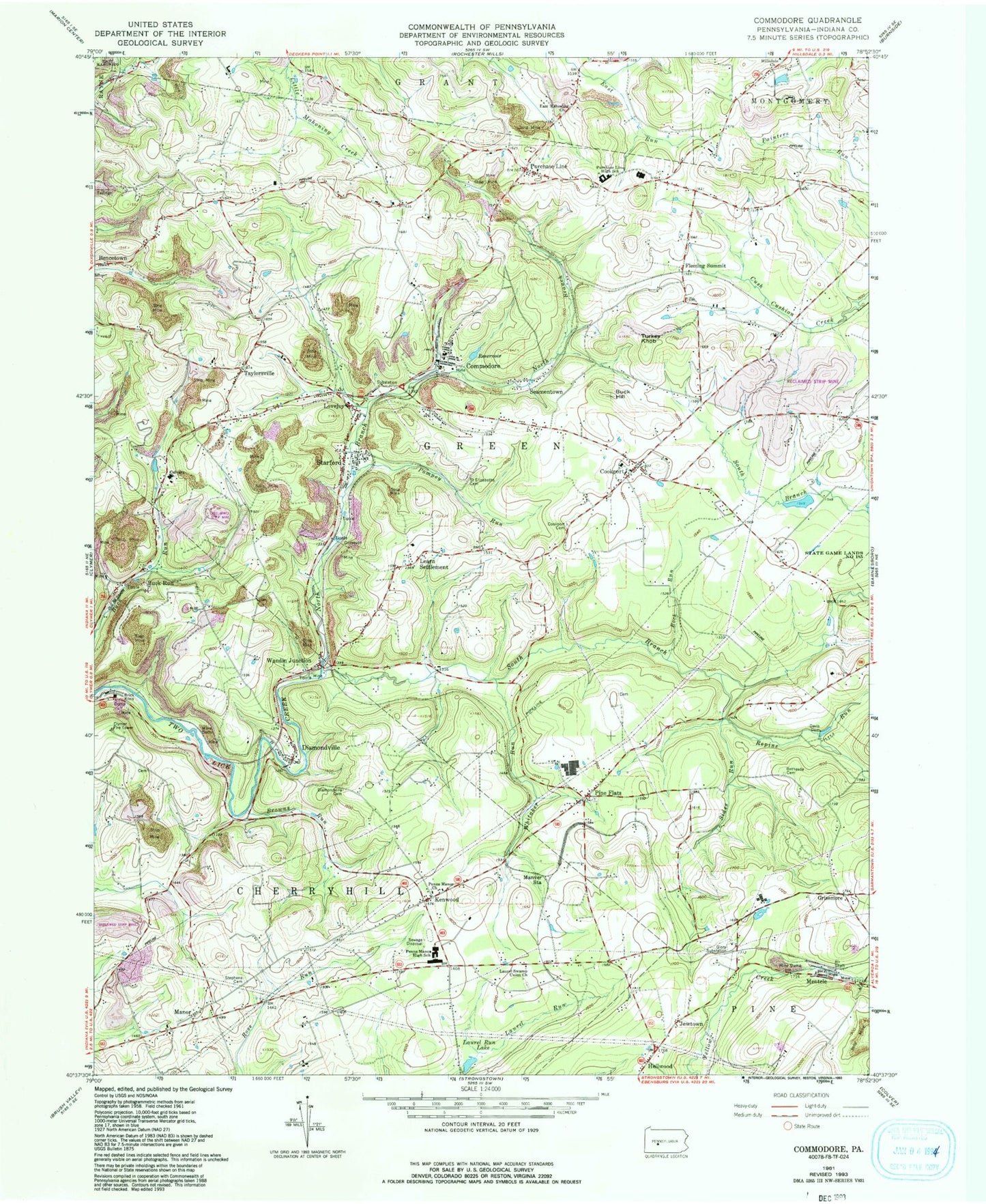
Classic USGS Commodore Pennsylvania 7.5'x7.5' Topo Map
Couldn't load pickup availability
Historical USGS topographic quad map of Commodore in the state of Pennsylvania. Map scale may vary for some years, but is generally around 1:24,000. Print size is approximately 24" x 27"
This quadrangle is in the following counties: Indiana.
The map contains contour lines, roads, rivers, towns, and lakes. Printed on high-quality waterproof paper with UV fade-resistant inks, and shipped rolled.
Contains the following named places: Bakers Run, Bencetown, Bethesda Cemetery, Browns Run, Buck Hill, Buck Run, Calvary Church, Church of the Resurrection Cemetery, Citizens Ambulance Service Hillsdale Station 40, Clymer Fire Tower, Commodore, Commodore Census Designated Place, Commodore Post Office, Commodore Volunteer Fire Department Station 540, Cookport, Cookport Cemetery, Cookport Lutheran Cemetery, Davis Dam, Diamondville, Diamondville Cemetery, Downes Airport, East Mahoning Cemetery, East Mahoning Church, East Union Presbyterian Cemetery, Fleming Summit, Glenside Mine Station, Grisemore, Jewtown, Kenwood, Laurel Run Lake, Laurel Swamp Cemetery, Laurel Swamp Union Church, Leard, Learn Settlement, Lovejoy, Manor, Manor Cemetery, Manver, Manver Station, Mentcle, Mitchell Mills, North Branch Two Lick Creek, Penns Manor Church, Penns Manor High School, Pine Flats, Pine Flats Cemetery, Pompey Run, Prosperity Hill, Purchace Line South Elementary School, Purchase Line, Purchase Line High School, Repine Run, Rock Run, Saint Elizabeths Cemetery, Seamentown, Sharkstown, Sides Run, South Branch Two Lick Creek, Standford Post Office, Starford, Starford Post Office, Stephens Cemetery, Taylorsville, Township of Green, Turkey Knob, Utah, Wandin, Wandin Junction, Whitaker Run, ZIP Codes: 15728, 15729, 15761, 15777