MyTopo
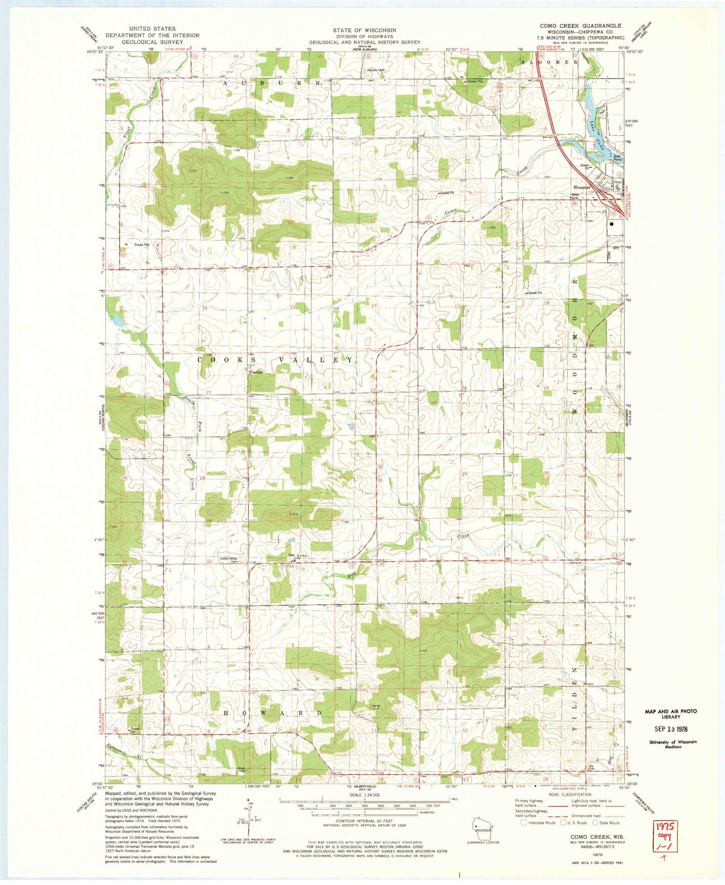
Classic USGS Como Creek Wisconsin 7.5'x7.5' Topo Map
Couldn't load pickup availability
Historical USGS topographic quad map of Como Creek in the state of Wisconsin. Map scale may vary for some years, but is generally around 1:24,000. Print size is approximately 24" x 27"
This quadrangle is in the following counties: Chippewa.
The map contains contour lines, roads, rivers, towns, and lakes. Printed on high-quality waterproof paper with UV fade-resistant inks, and shipped rolled.
Contains the following named places: Auburn Cemetery, Auburn Center School, Auburn Dale School, Auburn School, Chippewa Fire District Station 6, Como Creek, Cooks Valley Cemetery, Cooks Valley Church, Cooks Valley Dairy Farm, Cooks Valley Townhall, D D Farms, Good Shepherd Lutheran Church, Hay Creek Nursery, Kelm Farm, Lake Como, Loew School, Mayo Clinic Health System - Chippewa Valley Hospital, Needy Acres, Prill Dairy Farm, Rooney Farm, Saint Johns Church, Saint Johns School, Sunny Side School, Town of Cooks Valley, Trout Brook Farm, Zion Church