MyTopo
Classic USGS Como East Wyoming 7.5'x7.5' Topo Map
Regular price
$16.95
Regular price
Sale price
$16.95
Unit price
per
Couldn't load pickup availability
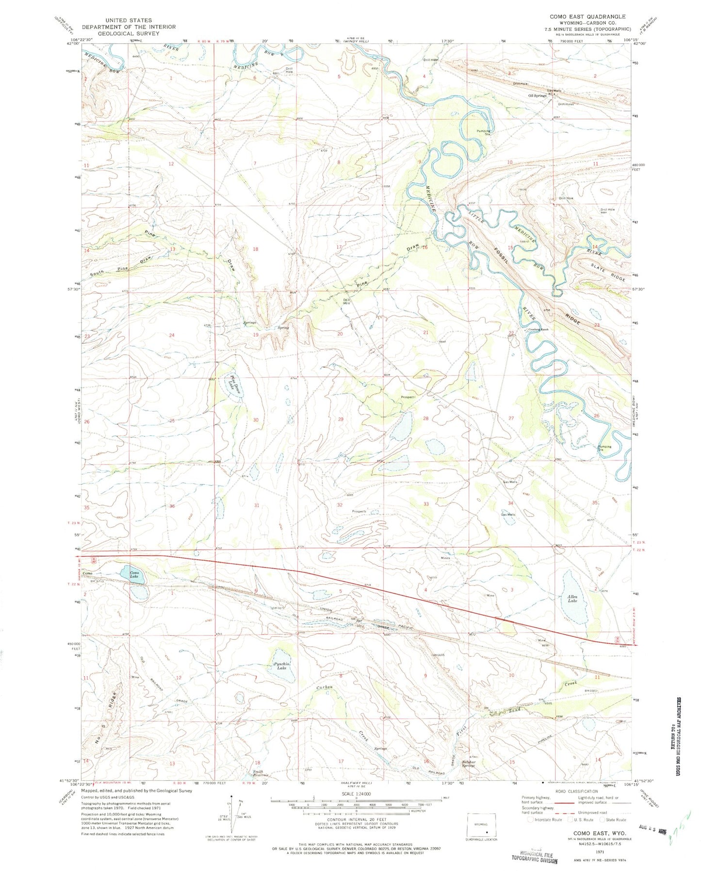
Historical USGS topographic quad map of Como East in the state of Wyoming. Map scale may vary for some years, but is generally around 1:24,000. Print size is approximately 24" x 27"
This quadrangle is in the following counties: Carbon.
The map contains contour lines, roads, rivers, towns, and lakes. Printed on high-quality waterproof paper with UV fade-resistant inks, and shipped rolled.
Contains the following named places: Allen Lake, Calvin Bend, Carbon Creek, Chace Number 1 Reservoir, Como Lake, First Sand Creek, Fossil Ridge, Little Medicine Bow River, Oil Springs, Pine Draw, Pine Draw Lake, Pynchin Lake, South Pine Draw, Sulphur Springs