MyTopo
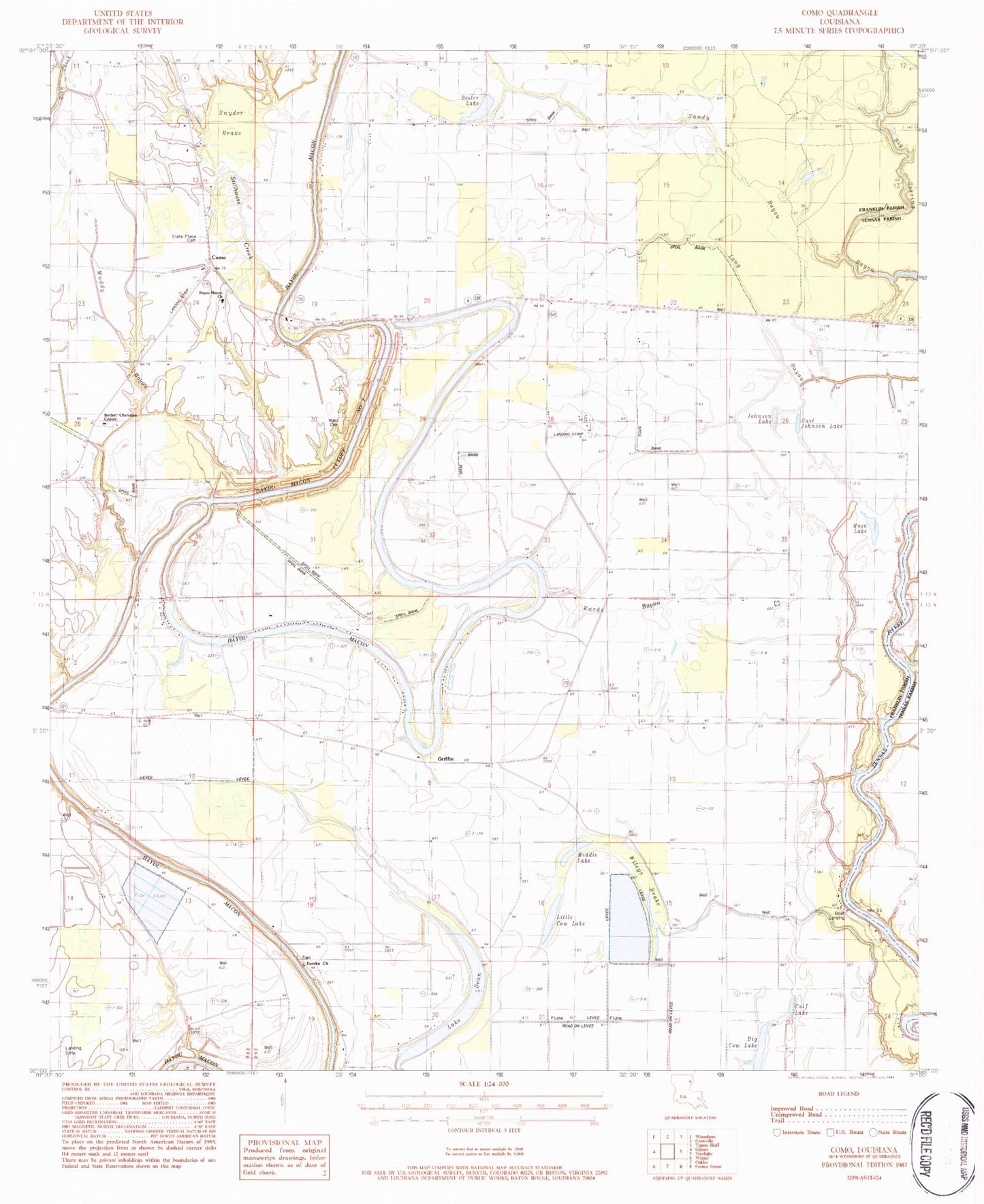
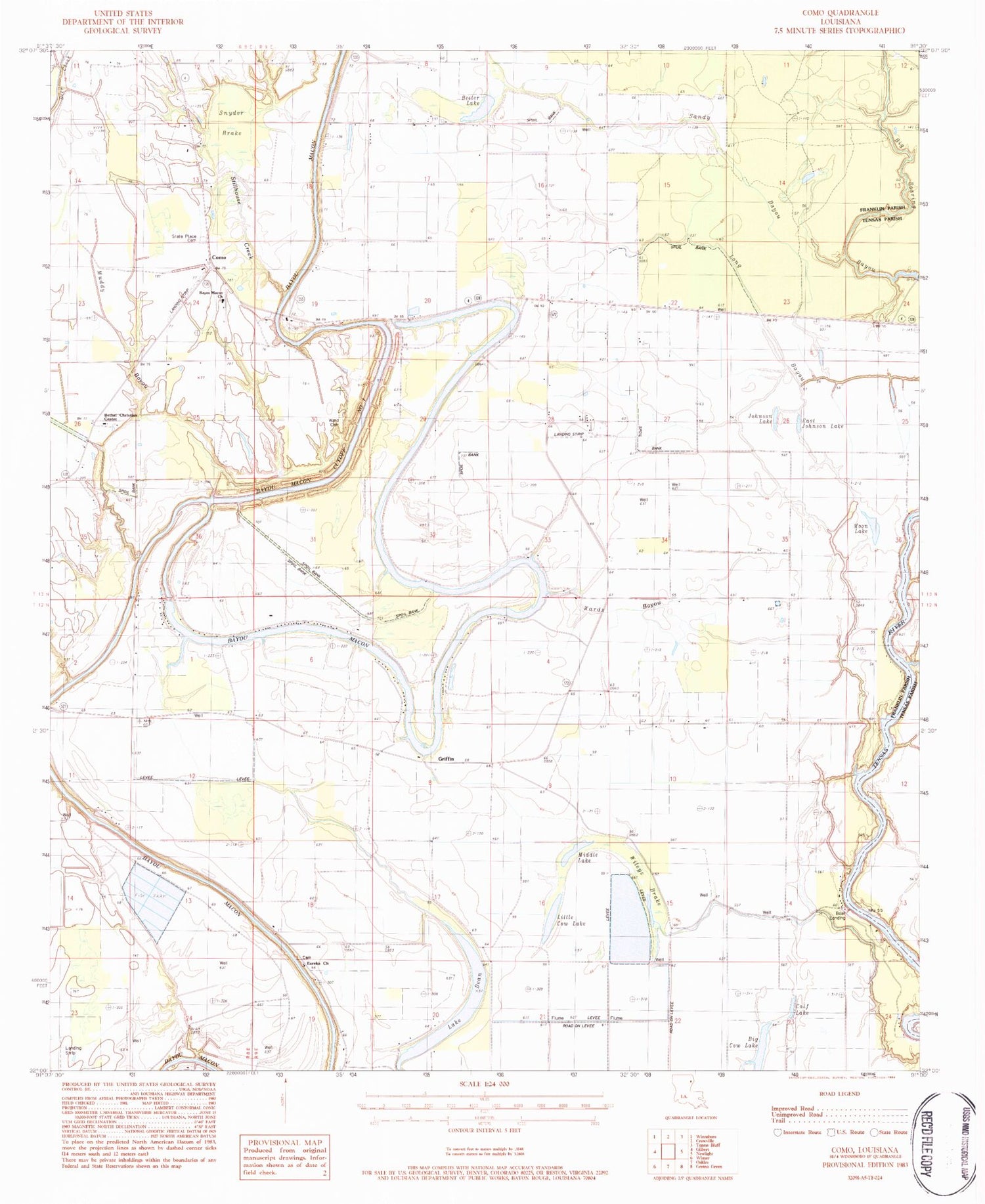
Classic USGS Como Louisiana 7.5'x7.5' Topo Map
Couldn't load pickup availability
Historical USGS topographic quad map of Como in the state of Louisiana. Map scale may vary for some years, but is generally around 1:24,000. Print size is approximately 24" x 27"
This quadrangle is in the following counties: Franklin, Tensas.
The map contains contour lines, roads, rivers, towns, and lakes. Printed on high-quality waterproof paper with UV fade-resistant inks, and shipped rolled.
Contains the following named places: Bayou Macon Baptist Church, Bayou Macon Cutoff Number One, Beeler Lake, Bethel Christian Center, Bethel School, Big Cow Lake, Board Tree Lake, Calf Lake, Church of God, Como, Cordill School, Cuba Baptist Church, Cuba School, Dickey Landing, Dixie Landing, East Johnson Lake, Eureka Baptist Church, Eureka Cemetery, Griffin, Harris Landing, Johnson Lake, Lake Dean, Little Cow Lake, Long Bayou, Lorelein, Middle Lake, Moon Lake, Muddy Bayou, Oakley Landing, Oakwood Landing, Parish Governing Authority District 3, Sandy Bayou, Snyder Brake, State Place Cemetery, Stillhouse Creek, Stones Landing, Talbot Landing, Ward Cemetery, Wards Bayou, Wileys Brake, ZIP Code: 71336