MyTopo
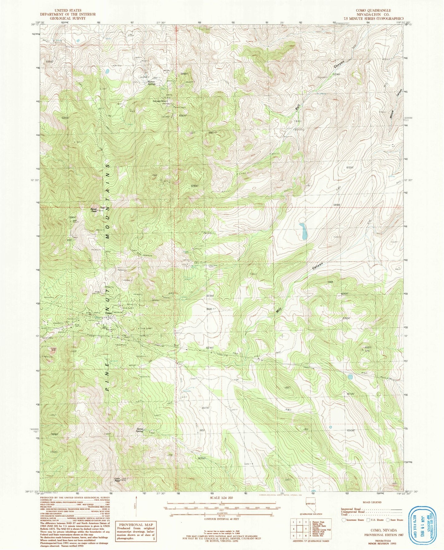
Classic USGS Como Nevada 7.5'x7.5' Topo Map
Couldn't load pickup availability
Historical USGS topographic quad map of Como in the state of Nevada. Map scale may vary for some years, but is generally around 1:24,000. Print size is approximately 24" x 27"
This quadrangle is in the following counties: Lyon.
The map contains contour lines, roads, rivers, towns, and lakes. Printed on high-quality waterproof paper with UV fade-resistant inks, and shipped rolled.
Contains the following named places: Barton Springs, Boyle Tunnel, Bull Spring, Como, Como Mines, Como Mining District, Como Post Office, Cottonwood Spring, Dayton Division, Hazlett Spring, Hercules Mine, Lyon Peak, May Day Mine, Mohawk Mine, Palmyra, Palmyra Post Office, Pony Meadows Mine, Rattlesnake Spring, Rawe Peak, Stone Cabin, Stone Cabin Mine, Stone Spring, Whitman Coal Mines, Whitman Spring, ZIP Code: 89403