MyTopo
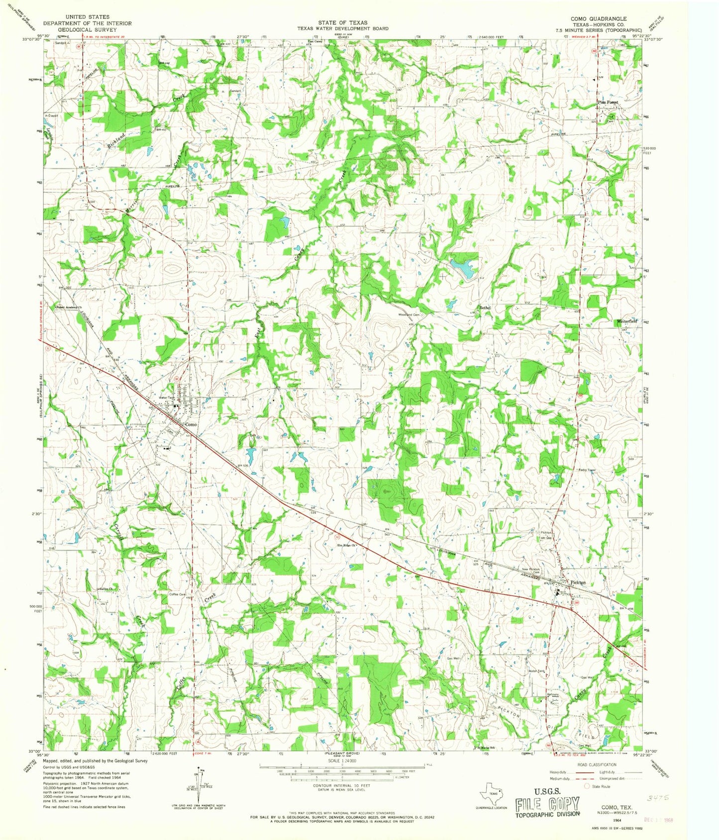
Classic USGS Como Texas 7.5'x7.5' Topo Map
Couldn't load pickup availability
Historical USGS topographic quad map of Como in the state of Texas. Map scale may vary for some years, but is generally around 1:24,000. Print size is approximately 24" x 27"
This quadrangle is in the following counties: Hopkins.
The map contains contour lines, roads, rivers, towns, and lakes. Printed on high-quality waterproof paper with UV fade-resistant inks, and shipped rolled.
Contains the following named places: Bethel, Coffee Cemetery, Como, Como City Hall, Como Post Office, Como Volunteer Fire Department, East Caney Church, Elm Ridge Church, Flying B Airport, Forest Academy Church, Galilee Church, Gamblin Lake, Gamblin Lake Dam, Morris Creek, New Pickton Cemetery, Pickton, Pickton - Pine Forest Volunteer Fire Department - First Responders, Pickton Post Office, Pickton-Pine Forest Division, Pine Forest, Saint Marks School, Texas No Name Number 38 Dam, Town of Como, Woodland Cemetery, ZIP Code: 75431