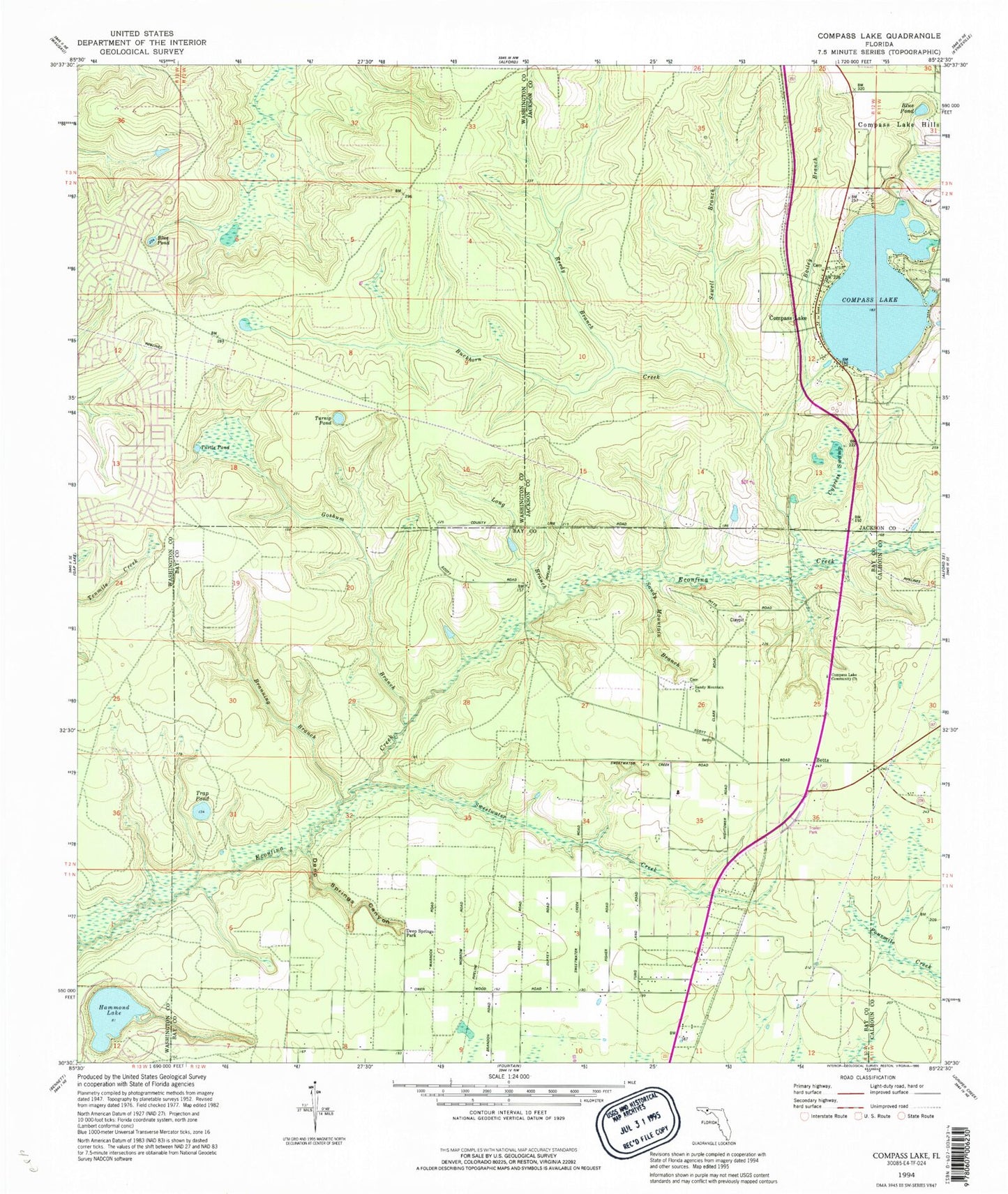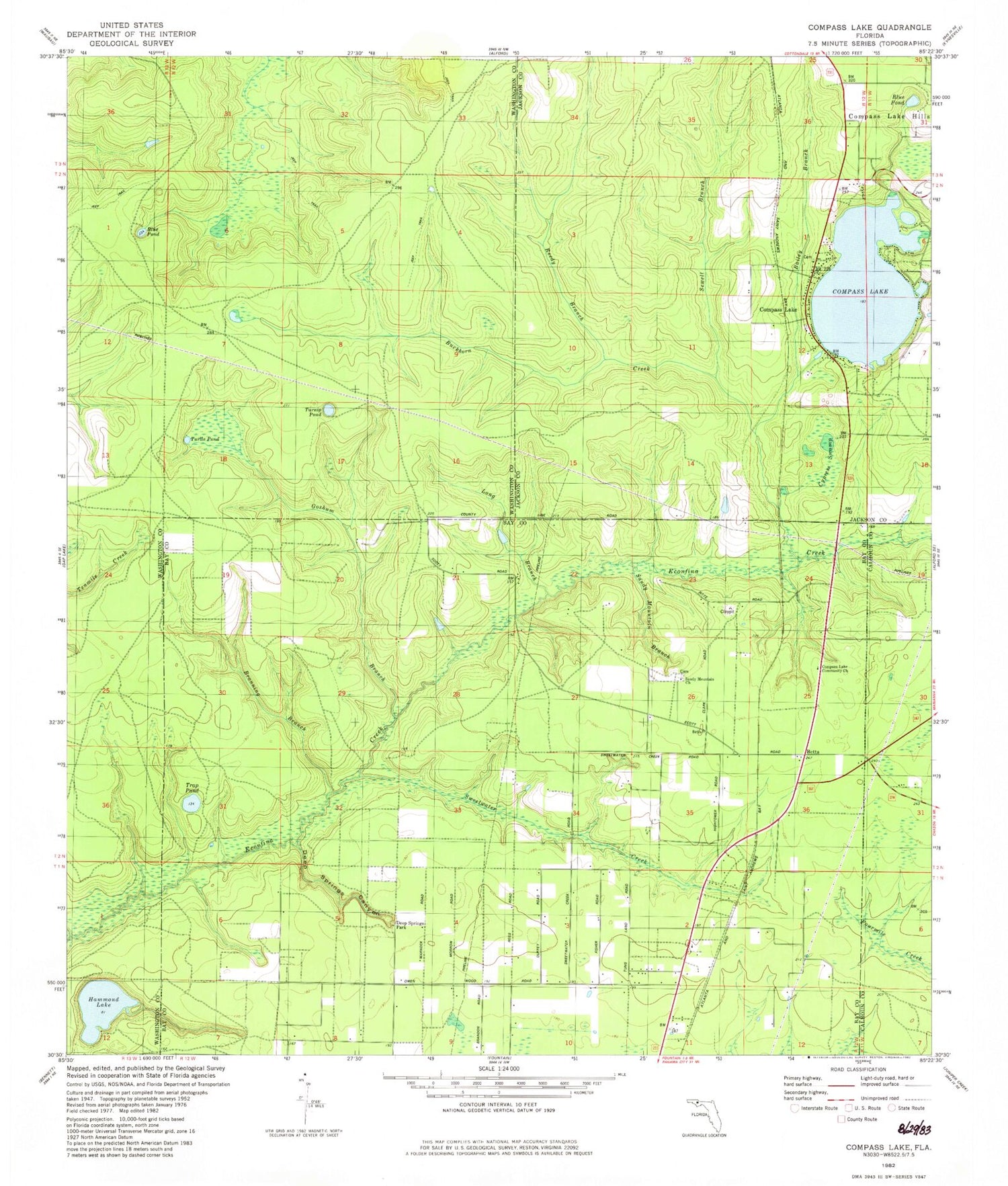
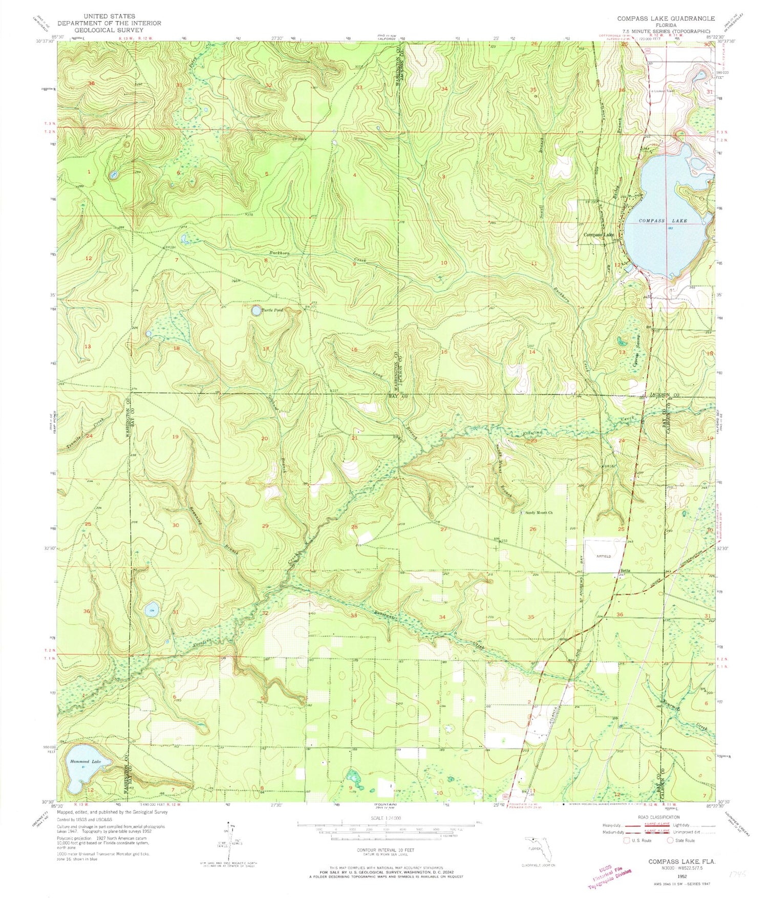
MyTopo
Classic USGS Compass Lake Florida 7.5'x7.5' Topo Map
Couldn't load pickup availability
Historical USGS topographic quad map of Compass Lake in the state of Florida. Map scale may vary for some years, but is generally around 1:24,000. Print size is approximately 24" x 27"
This quadrangle is in the following counties: Bay, Calhoun, Jackson, Washington.
The map contains contour lines, roads, rivers, towns, and lakes. Printed on high-quality waterproof paper with UV fade-resistant inks, and shipped rolled.
Contains the following named places: Bailey Branch, Betts, Branning Branch, Buckhorn Creek, Compass Lake, Compass Lake Fire Tower, Country Oaks Volunteer Fire Department, Cypress Swamp, Econfina Bridge, Goshum Branch, Hammond Lake, Long Branch, Maran Airport, Sandy Mount Church, Sandy Mountain Branch, Sewell Branch, Sweetwater Creek, Tenmile Creek, Turnip Pond, Walker Bayou, WFSY-FM (Panama City), WTBB-FM (Bonifay), ZIP Code: 32438