MyTopo
Classic USGS Concho Lake Arizona 7.5'x7.5' Topo Map
Couldn't load pickup availability
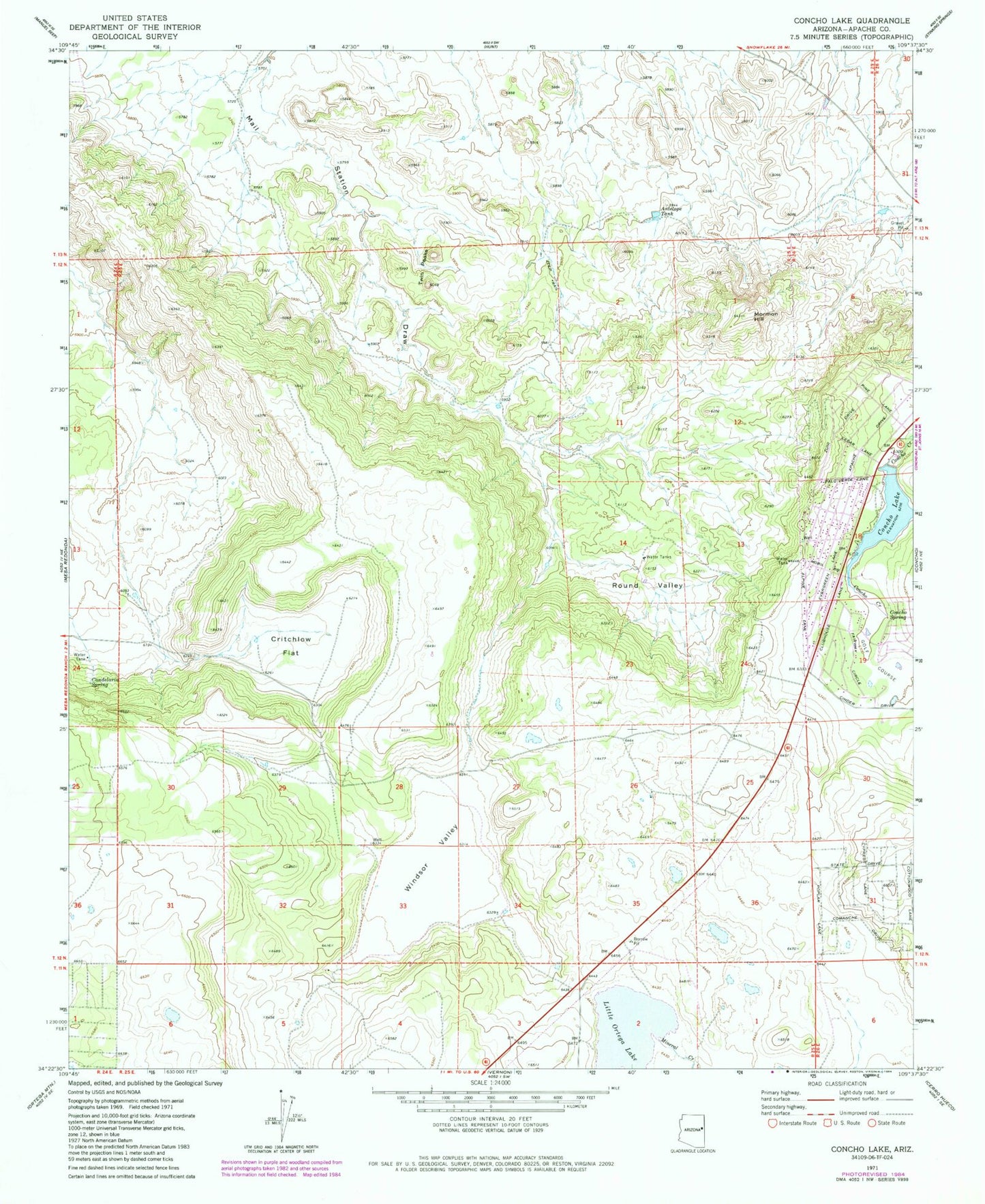
Historical USGS topographic quad map of Concho Lake in the state of Arizona. Map scale may vary for some years, but is generally around 1:24,000. Print size is approximately 24" x 27"
This quadrangle is in the following counties: Apache.
The map contains contour lines, roads, rivers, towns, and lakes. Printed on high-quality waterproof paper with UV fade-resistant inks, and shipped rolled.
Contains the following named places: Antelope Tank, Candelaria Spring, Concho Elementary School, Concho Lake, Concho Post Office, Concho Spring, Concho Valley Country Club Golf Course, Concho Volunteer Fire Department, Critchlow Flat, Little Ortega Lake, Mineral Creek, Mormon Hill, Round Valley, Twin Peaks, Windsor Valley