
MyTopo
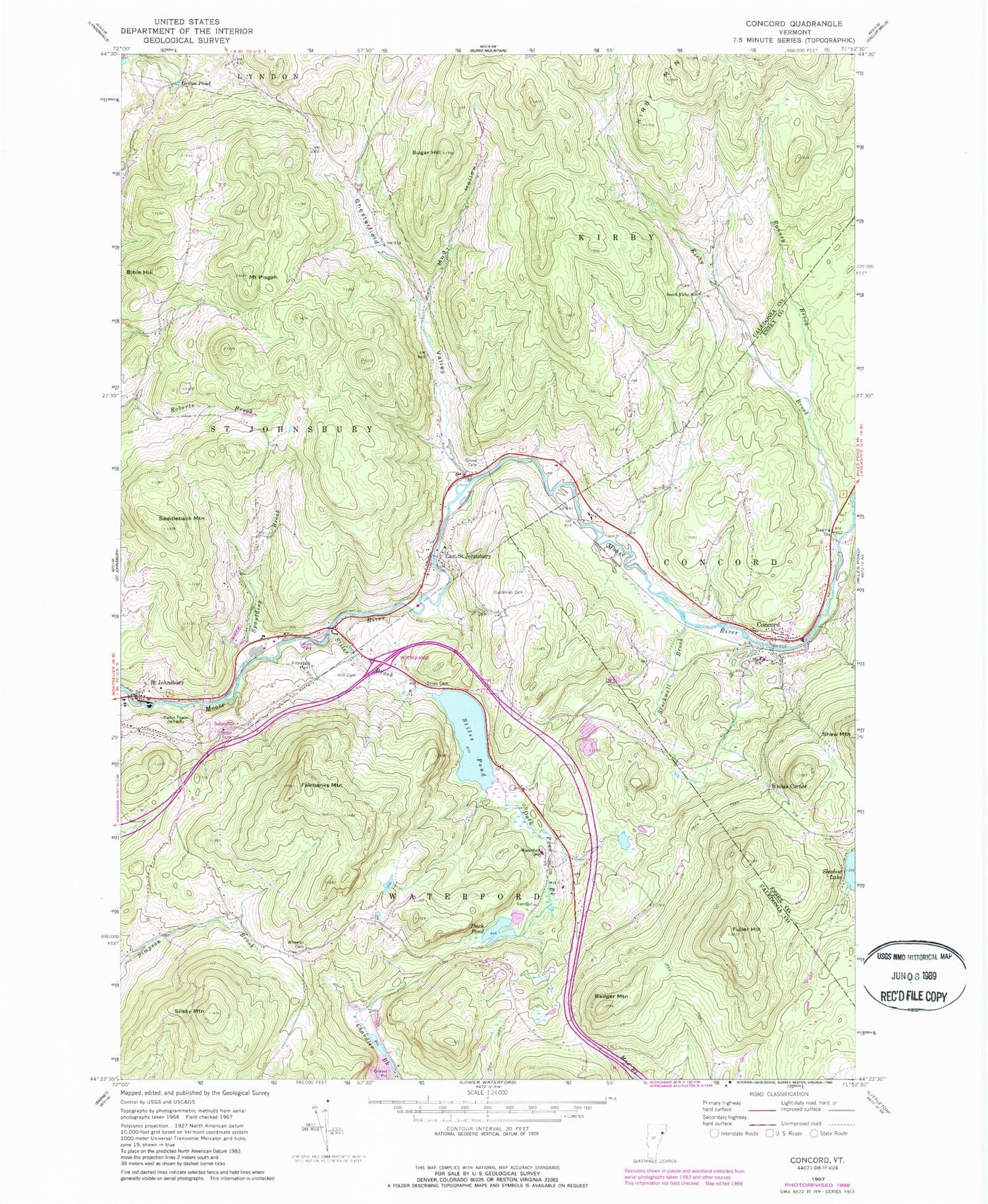
Classic USGS Concord Vermont 7.5'x7.5' Topo Map
Couldn't load pickup availability
Historical USGS topographic quad map of Concord in the state of Vermont. Typical map scale is 1:24,000, but may vary for certain years, if available. Print size: 24" x 27"
This quadrangle is in the following counties: Caledonia, Essex.
The map contains contour lines, roads, rivers, towns, and lakes. Printed on high-quality waterproof paper with UV fade-resistant inks, and shipped rolled.
Contains the following named places: Badger Mountain, Bible Hill, Chesterfield Valley, Concord, Cushman Cemetery, Duck Pond, Duck Pond Brook, East Saint Johnsbury, Fuller Hill, Grays Pond, Grove Cemetery, Hill Cemetery, Kirby Brook, Mud Hollow, Mount Pisgah, Ranney Brook, Saddleback Mountain, Silsby Mountain, South Kirby School, Spaulding Brook, Stiles Brook, Stiles Cemetery, Stiles Pond, Stockwell Brook, Sugar Hill, Waterford Elementary School, Powers Wheeler Cemetery, Whites Corner, WSTJ-AM (Saint Johnsbury), WNKV-FM (Saint Johnsbury), Town of Waterford, Stiles Pond Dam, Caste School (historical), Concord East Side Cemetery, Concord High School / Graded School, Concord West Side Cemetery, Rustic Haven Campground, Adams - Babcock Cemetery, East Saint Johnsbury Post Office, Graves School (historical), Hastings School (historical), Kirby Mountain Quarries, Maple Grove Museum, Moose River Campground, Remick School (historical), Saint Johnsbury Municipal Forest, South Kirby, South Kirby Cemetery, Third Congregational Church, Waterford Volunteer Fire Department, Concord Fire and Rescue, Essex - Caledonia Supervisory Union, Concord Census Designated Place, Concord Post Office


