MyTopo
Classic USGS Congaree South Carolina 7.5'x7.5' Topo Map
Couldn't load pickup availability
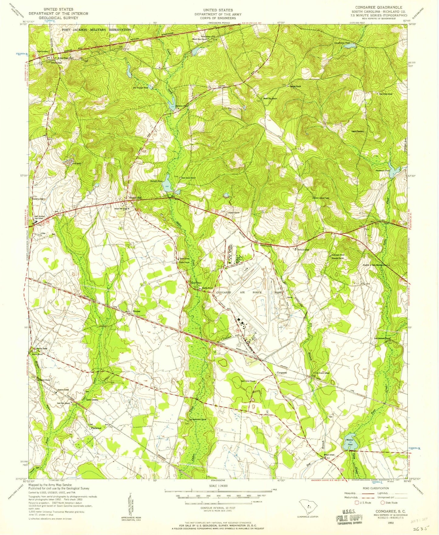
Historical USGS topographic quad map of Congaree in the state of South Carolina. Map scale may vary for some years, but is generally around 1:24,000. Print size is approximately 24" x 27"
This quadrangle is in the following counties: Richland.
The map contains contour lines, roads, rivers, towns, and lakes. Printed on high-quality waterproof paper with UV fade-resistant inks, and shipped rolled.
Contains the following named places: Bellwood School, Beulah Church, Boyds Pond, Boyds Pond D-0592 Dam, Breyard Church, Browns Chapel, Browns Chapel School, Bruner, Caponia Church, Caughmans Pond, Columbia - Richland Fire Department Congaree Run, Columbia - Richland Fire Department Hopkins, Columbia - Richland Fire Department Lower Richland, Congaree, Crossroads School, Daughter of Messiah Church, Deer Ridge Farms, Dry Branch School, Eastover Church, Eastover Lookout Tower, Fairview Church, Friendship Church, Friendship School, Good Shepherd Church, Green Lake Estates, Gwinn Field, Gwinns Pond, Gwinns Pond D-0588 Dam, Haithcock Pond, Haithcock Pond D-0591 Dam, Harmon Estates, Harmons Pond, Harmons Pond D-0585 Dam, Hopkins Census Designated Place, Hopkins Presbyterian Church, Hopkins School, Horrel Hill, Horrell Hill Division, Horrell Hill Elementary School, Horsepen Branch, Jacob Mission School, Jerusalem Church, Jordans Pond, Jordans Pond D-0590 Dam, Lebanon Church, Leesburg Church, Logues Cemetery, Lower Richland High School, Lower Richland Vocational Center, Mandel Park Pond D-0584 Dam, McEntire Air Guard Station, McEntire Joint National Guard Base, Morrells Pond, Morrells Pond D-0586 Dam, Mount Elon Church, Mount Olive Church, Nazarene Church, Peelers Pond D-0589 Dam, Pinewood, Pinewood School, Reeves School, Reveres Pond, Reveres Pond D-0583 Dam, Saint James Church, Saint Johns Church, Saint Matthews Church, San Marco Estates, Siloam Church, Siloam School, Softwinds Farm, South Carolina Noname 40043 D-0587 Dam, State of South Carolina, Swandale, Toms Creek School, Union School, Weston Lake Dam - Fort Jackson, Weston School, Westons Pond, Westons Pond D-0593 Dam, Youngs Pond, Zion Church, ZIP Code: 29061