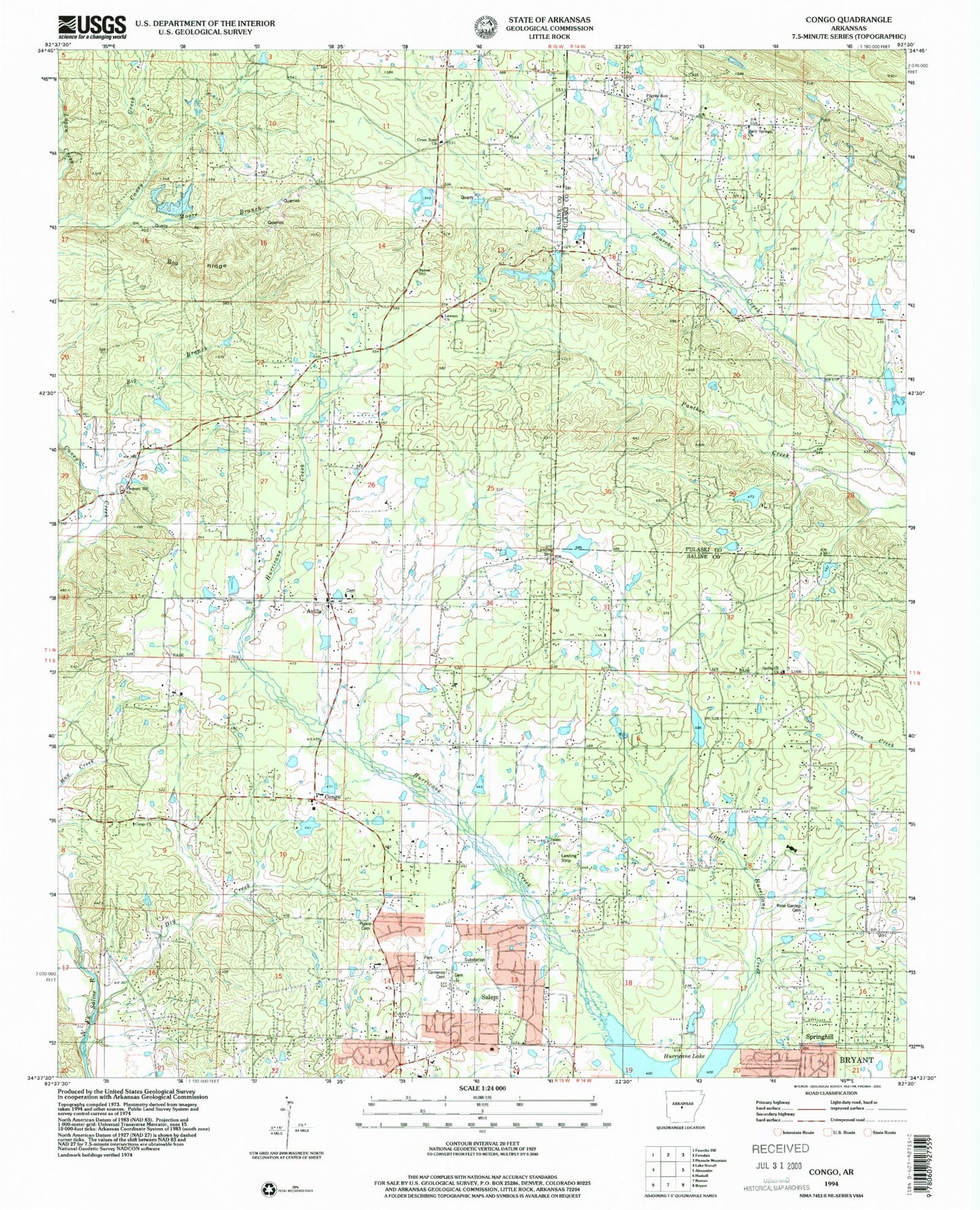
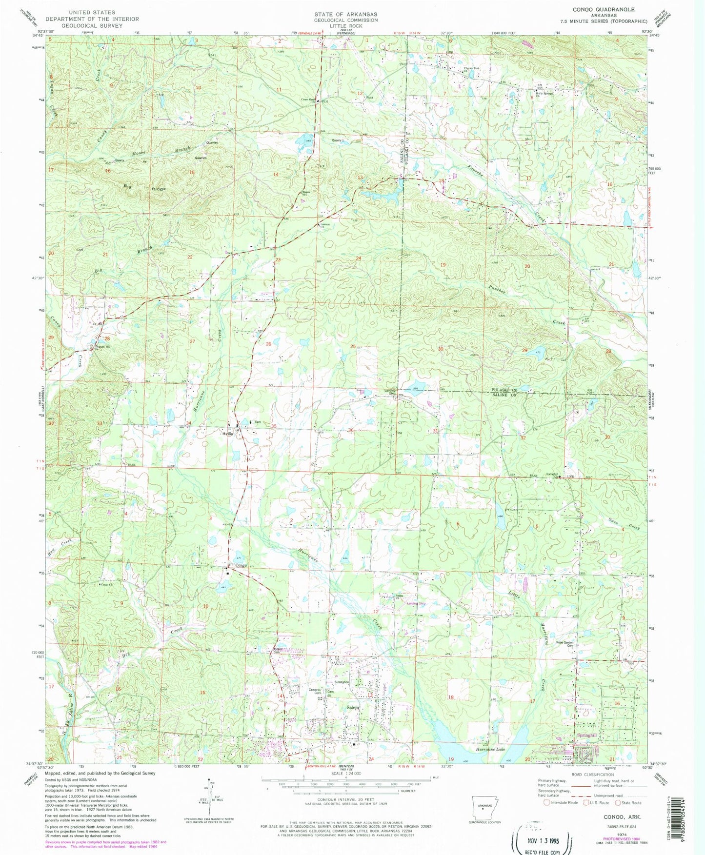
MyTopo
Classic USGS Congo Arkansas 7.5'x7.5' Topo Map
Couldn't load pickup availability
Historical USGS topographic quad map of Congo in the state of Arkansas. Map scale may vary for some years, but is generally around 1:24,000. Print size is approximately 24" x 27"
This quadrangle is in the following counties: Pulaski, Saline.
The map contains contour lines, roads, rivers, towns, and lakes. Printed on high-quality waterproof paper with UV fade-resistant inks, and shipped rolled.
Contains the following named places: 4-H Camp Lake, 4-H Camp Lake Dam, 72002, 72210, Avilla, Avilla Census Designated Place, Avilla School, Beauchamp Branch, Bethel Middle School, Big Branch, Big Ridge, Cameron Cemetery, Congo, Congo Lake Dam, Congo Road Baptist Church, Congo School, Cross Road Church, Crystal Lake, Crystal Lake Dam, Crystal Ridge Airport, Dry Creek, Fletcher Lake, Fletcher Lake Dam, Glover Lake, Glover Lake Dam, Gray Hill School, Hamma Branch, Helmich Lake, Helmich Lake Dam, Hester Lake, Hester Lake Dam, Holly Springs, Holly Springs Church, Holly Springs School, Inman Lake Number Two, Inman Lake Number Two Dam, Lake Norrell Area Fire Protection District, Lawson Church, Little Hurricane Creek, Maertins Lake, Moore Branch, Pilgrim Rest Church, Pine Crest Lake, Pine Crest Lake Dam, Pipkin Cemetery, Pleasant Hill Methodist Church, Pleasant Hill School, Rose Garden Cemetery, Salem, Salem Baptist Church, Salem Census Designated Place, Salem Church, Salem Fire Department Station 1, Salem Fire Department Station 2, Springhill, Springhill Church, Springhill Elementary School, Stephens Heliport, Tatumville, Township of Beaver, Township of Salem, West Pulaski Fire Department Station 1