MyTopo
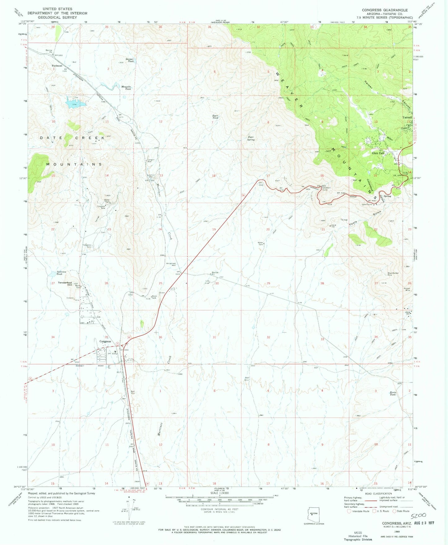
Classic USGS Congress Arizona 7.5'x7.5' Topo Map
Couldn't load pickup availability
Historical USGS topographic quad map of Congress in the state of Arizona. Map scale may vary for some years, but is generally around 1:24,000. Print size is approximately 24" x 27"
This quadrangle is in the following counties: Yavapai.
The map contains contour lines, roads, rivers, towns, and lakes. Printed on high-quality waterproof paper with UV fade-resistant inks, and shipped rolled.
Contains the following named places: Arrowhead Well, Billingsley Number Four Dam, Billingsley Number Three Dam, Billingsley Number Two Dam, Billingsley Reservoir Number Four, Billingsley Reservoir Number Three, Billingsley Reservoir Number Two, Blue Bucket Mine, Congress, Congress Cemetery, Congress Census Designated Place, Congress Elementary School, Congress Fire Station, Congress Junction, Congress Mine, Congress Post Office, Congress Public Library, Congress Railroad Station, Cottonwood Canyon, Earis Tank, Elephant Curve, First Baptist Church, Fools Gulch, Glen Ilah, KTIM-FM (Wickenburg), Longort Well, Lowman Well, Mesquite Tank, Piedmont, Piedmont Railroad Station, Planet Saturn Mine, Rincon Mine, Sawyer Tank, Senate Mine, Sullivan Tank, Tenderfoot Hill, Tenderfoot Hill Park, View Points, Weaver Mountains, Yarnell Census Designated Place, Ziger Spring, Ziger Tank