MyTopo
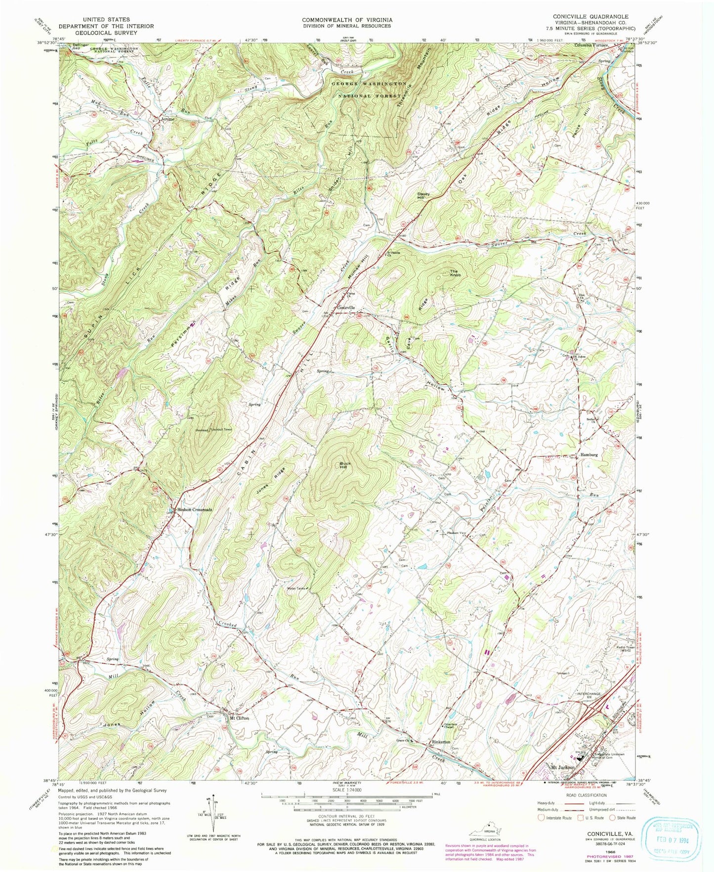
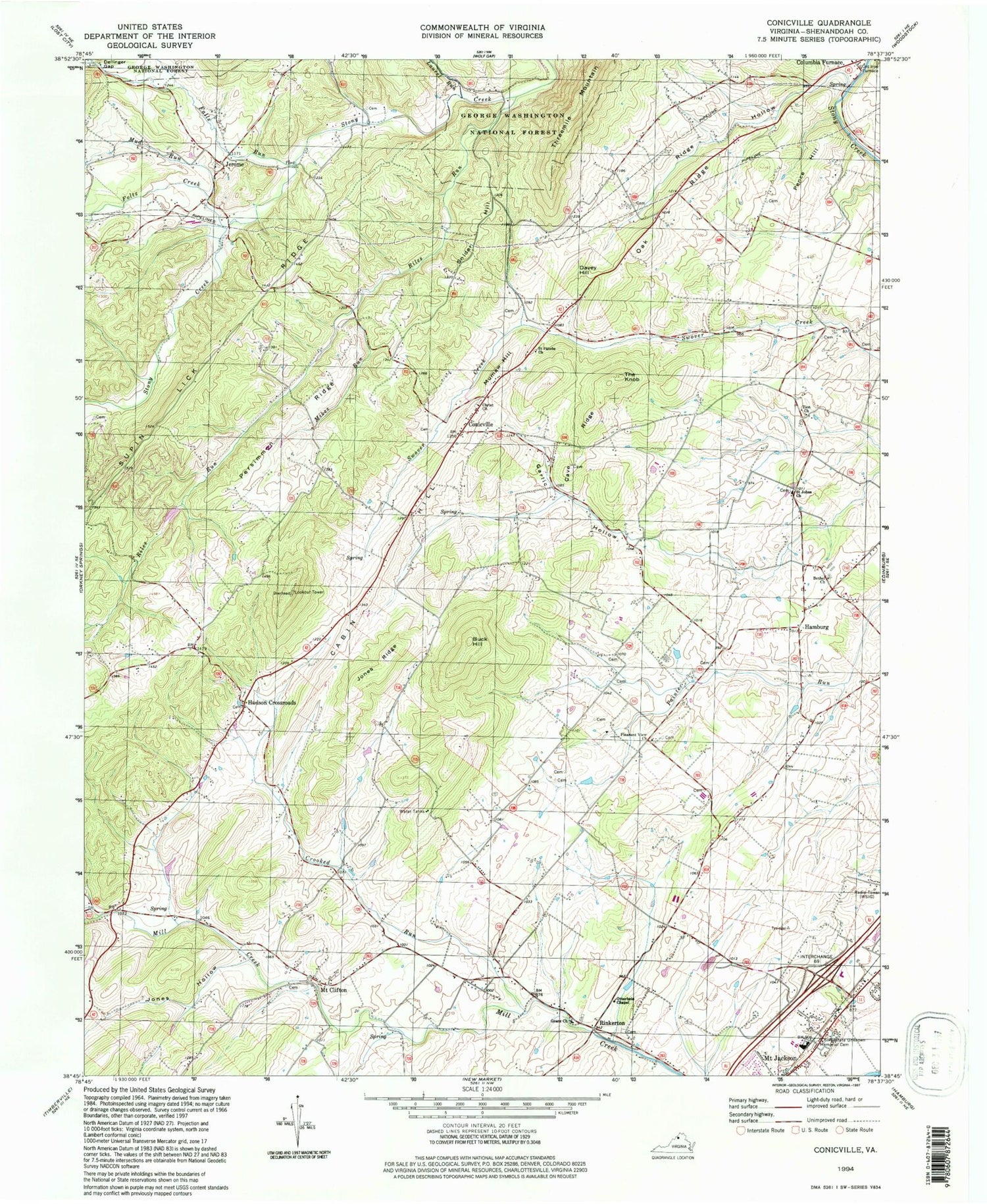
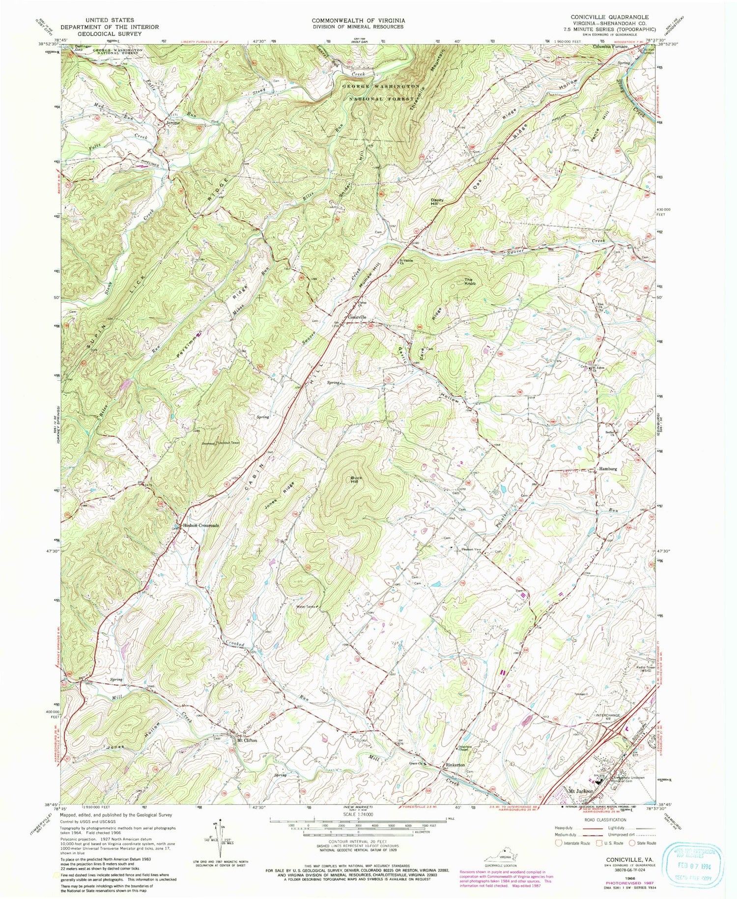
Classic USGS Conicville Virginia 7.5'x7.5' Topo Map
Couldn't load pickup availability
Historical USGS topographic quad map of Conicville in the state of Virginia. Map scale may vary for some years, but is generally around 1:24,000. Print size is approximately 24" x 27"
This quadrangle is in the following counties: Shenandoah.
The map contains contour lines, roads, rivers, towns, and lakes. Printed on high-quality waterproof paper with UV fade-resistant inks, and shipped rolled.
Contains the following named places: Bethel Church, Bethel Lutheran Cemetery, Buck Hill, Cabin Hill, Cave Ridge, Christ Church, Christ Reformed Church Cemetery, Conicville, Crooked Run, Crossroads Baptist Bible Church, Davey Hill, Dellinger Gap, District 2, Falls Run, Foltz Creek, Garlic Hollow, Grace Cemetery, Grace Church, Hamburg, Hudson Crossroads, Jerome, Jones Hollow, Jones Ridge, Laurel Run, Mikes Run, Mount Clifton, Mount Clifton Cemetery, Mount Clifton Census Designated Place, Mount Jackson Post Office, Mud Run, Mumaw Hill, Oak Ridge, Old Iron Furnace, Otterbein Chapel, Our Soldiers Cemetery, Pence Hill, Persimmon Ridge, Pleasant View Church, Ridge Hollow, Riles Run, Rinkerton, Saint Jacobs Church, Saint Johns Church, Saint Pauls Lutheran Church, Saint Pauls Lutheran Church Cemetery, Shenandoah County Fire and Rescue Station 13 - Conicville Volunteer Fire Department, Snider Hill, Straight Run, The Knob, Zion Church, ZIP Codes: 22824, 22842