MyTopo
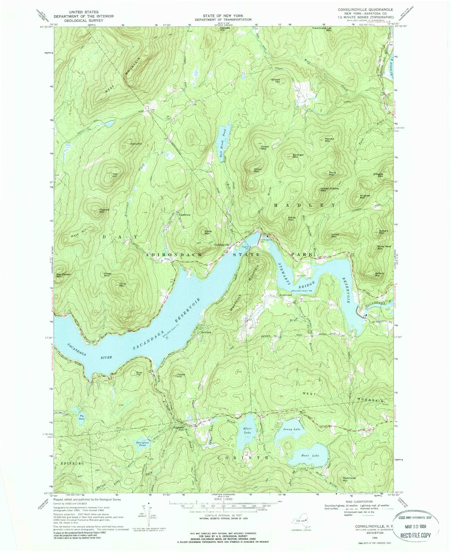
Classic USGS Conklingville New York 7.5'x7.5' Topo Map
Couldn't load pickup availability
Historical USGS topographic quad map of Conklingville in the state of New York. Typical map scale is 1:24,000, but may vary for certain years, if available. Print size: 24" x 27"
This quadrangle is in the following counties: Saratoga, Warren.
The map contains contour lines, roads, rivers, towns, and lakes. Printed on high-quality waterproof paper with UV fade-resistant inks, and shipped rolled.
Contains the following named places: West Mountain, Allentown Creek, Bell Brook, Bell Brook Pond, Birds Nest Mountain, Black Pond Creek, Breen Brook, Clute Mountain, Conklingville, Conklingville Dam, Cooks Hill, Corn Hill, Daly Creek, Davignon Pond, Day Center Mountain, Dillon Mountain, Dwyer Mountain, Efner Lake, Efner Lake Brook, Flat Hill, Fly Pond, Gilbert Hill, Gray Hill, Hammond Lot Mountain, Hughes Mountain, Hunt Brook, Hunt Lake, Indian Cobble Mountain, Jeffers Mountain, Jenny Lake, Joel Brook, Jones Mountain, Kings Mountain, Lynnwood, Mace Hill, Man Shanty Brook, Menzie Mountain, Mink Brook, Nick Creek, O'Keefe Mountain, Overlook, Palmer Lake Creek, Parker Brook, Peaked Hill, Pond Mountain, Redmond Hill, Springer Mountain, Stewarts Bridge Reservoir, Swears Mountain, Waite Mountain, Eggleston Falls, White Mountain, Woodcock Mountain, Allentown, Town of Hadley, Conklingville Cemetery, Conklingville Cemetery, Community Church of Conklingville, Lynwood Baptist Church