MyTopo
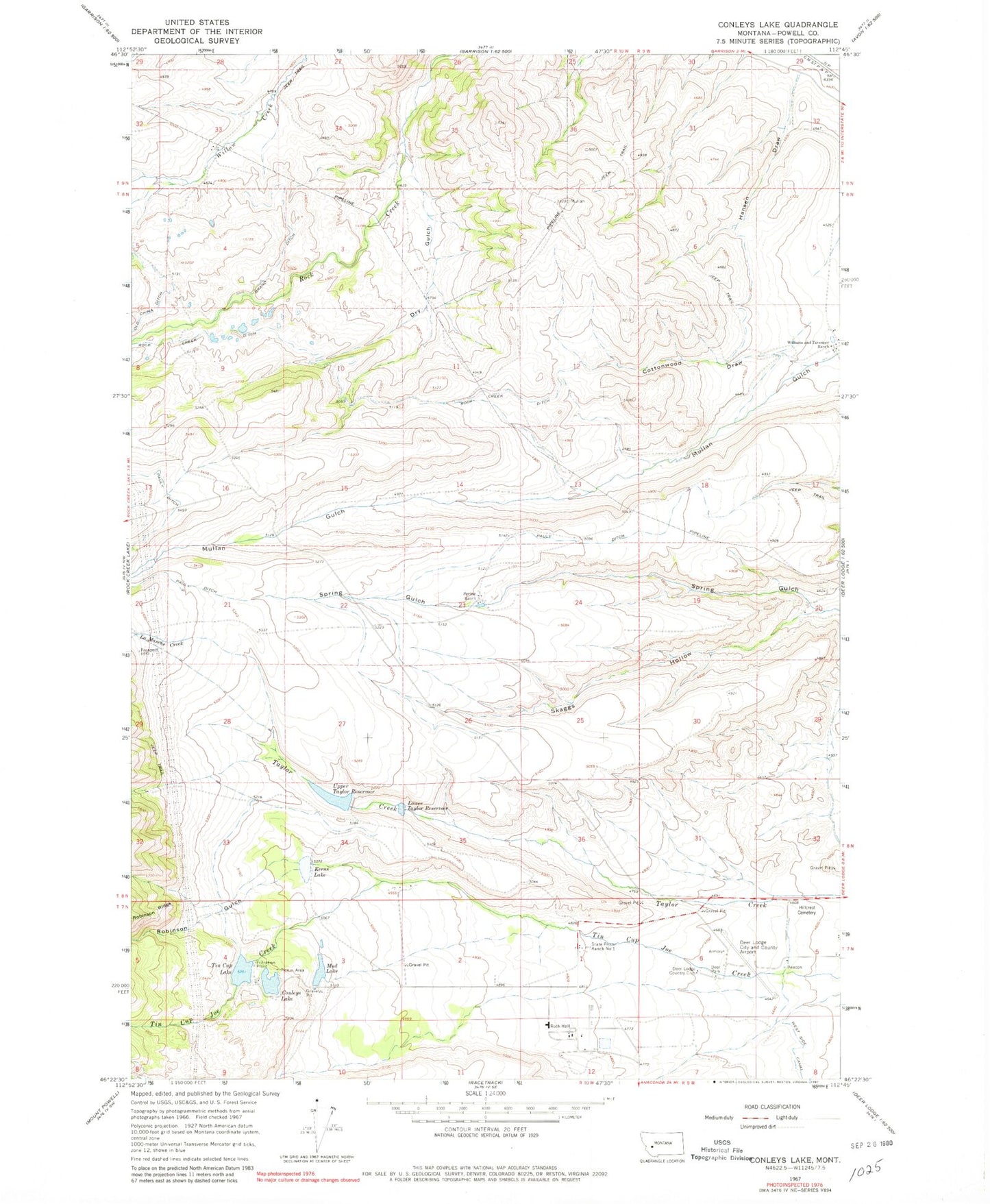
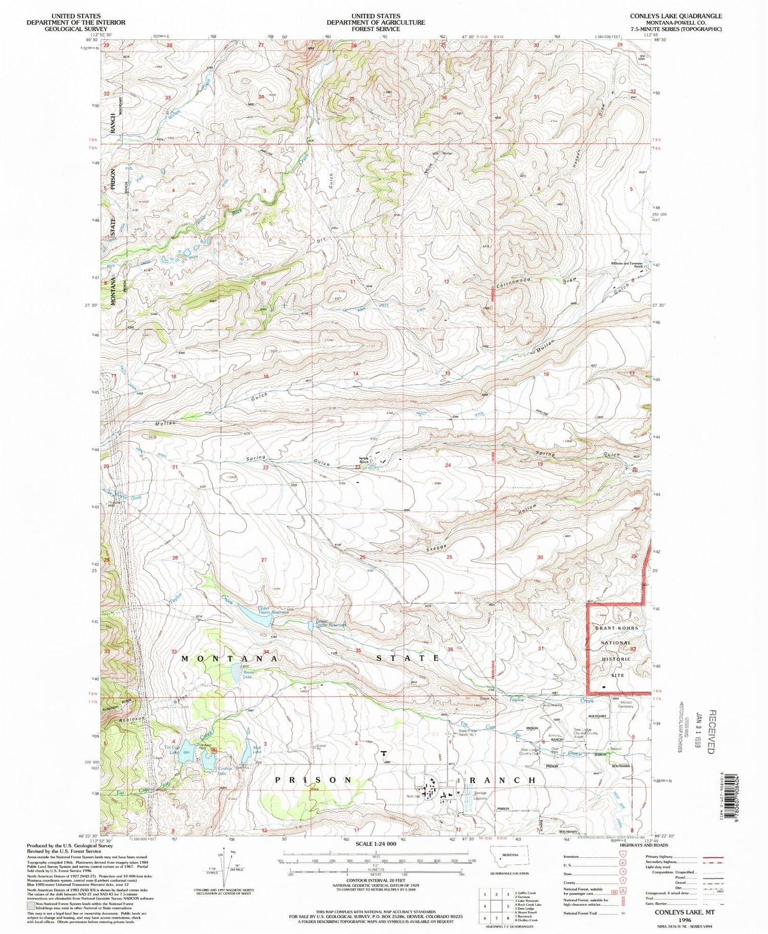
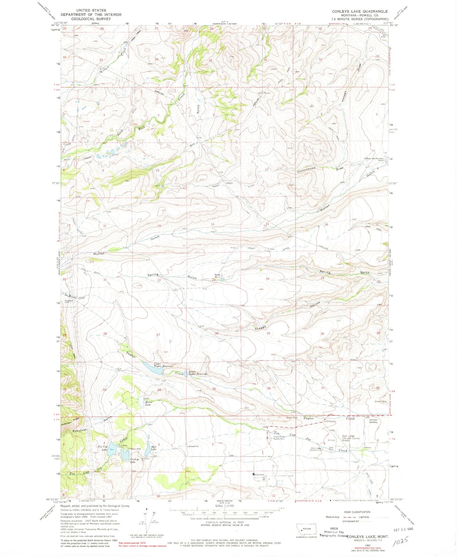
Classic USGS Conleys Lake Montana 7.5'x7.5' Topo Map
Couldn't load pickup availability
Historical USGS topographic quad map of Conleys Lake in the state of Montana. Map scale may vary for some years, but is generally around 1:24,000. Print size is approximately 24" x 27"
This quadrangle is in the following counties: Powell.
The map contains contour lines, roads, rivers, towns, and lakes. Printed on high-quality waterproof paper with UV fade-resistant inks, and shipped rolled.
Contains the following named places: 07N09W06DBBC01 Well, 07N09W06DBCB01 Well, 07N10W02CADD01 Well, 07N10W03ABBD01 Well, 07N10W03DD__01 Well, 08N09W20CAAB01 Well, 08N09W32DCDA01 Well, 08N10W23DBAD01 Well, 09N09W32BACA01 Well, Brand Ditch, Conleys Lake, Conleys Lake Dam, Cottonwood Draw, Deer Lodge Golf Club, Deer Lodge-City-County Airport, Deer Park, Dry Gulch, Hansen Draw, Hillcrest Cemetery, Kerns Lake, Kerns Lake Dam, La Marche Creek, Lower Taylor Reservoir, Montana State Prison, Montana State Prison Fire Department, Mud Lake, Mud Lake Dam, Pauly Ditch, Robinson Gulch, Rock Creek Ditch, Rock Creek Lake Dam, Roth Hall, Skaggs Hollow, Spring Ranch, State Prison Ranch Number 1, Tin Cup Lake, Tin Cup Lake Dam, Upper Taylor Dam, Upper Taylor Reservoir, Williams and Tavenner Ranch