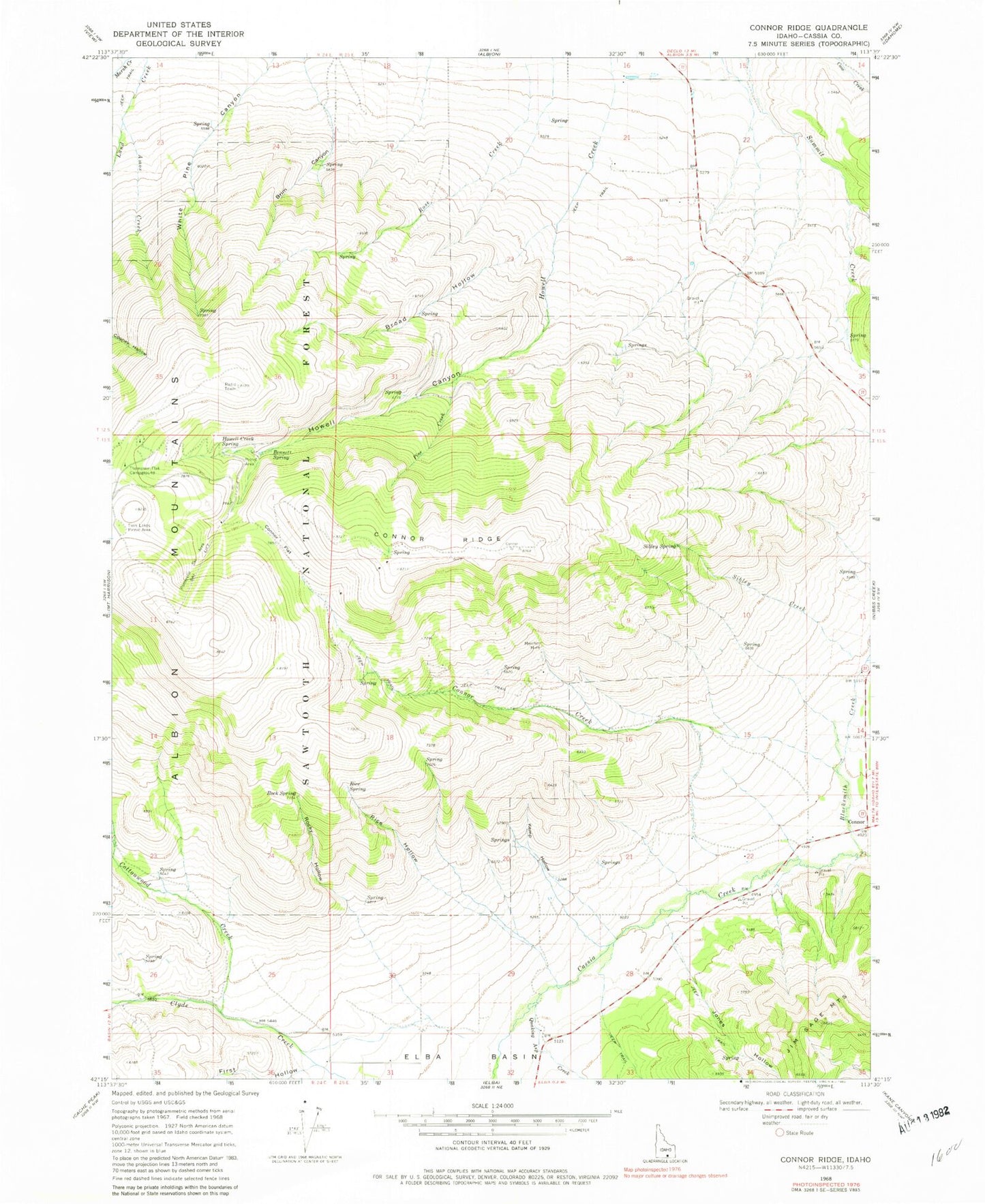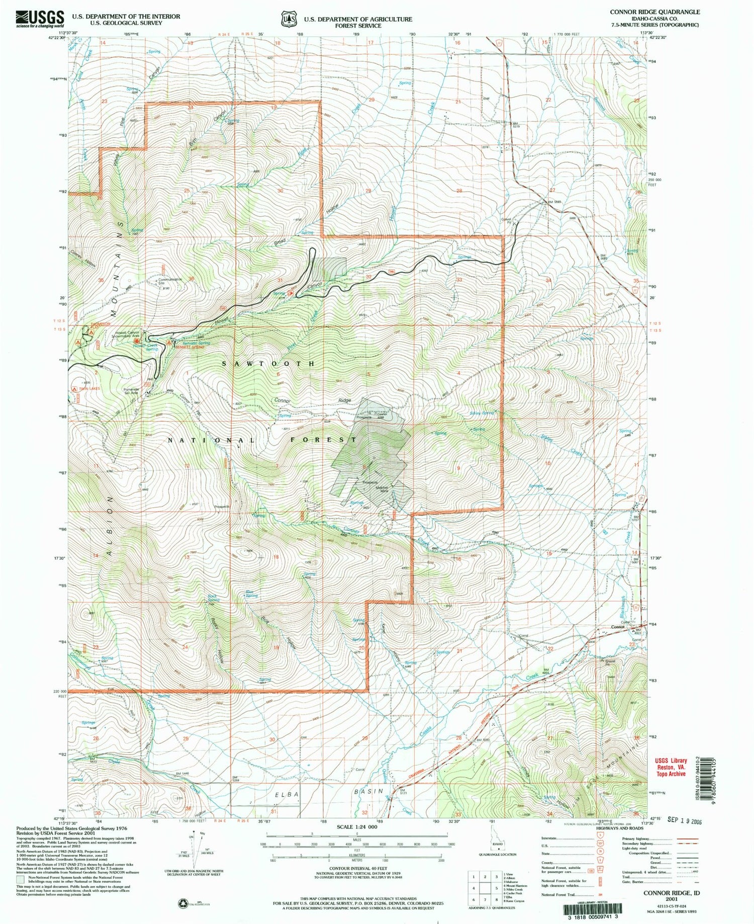
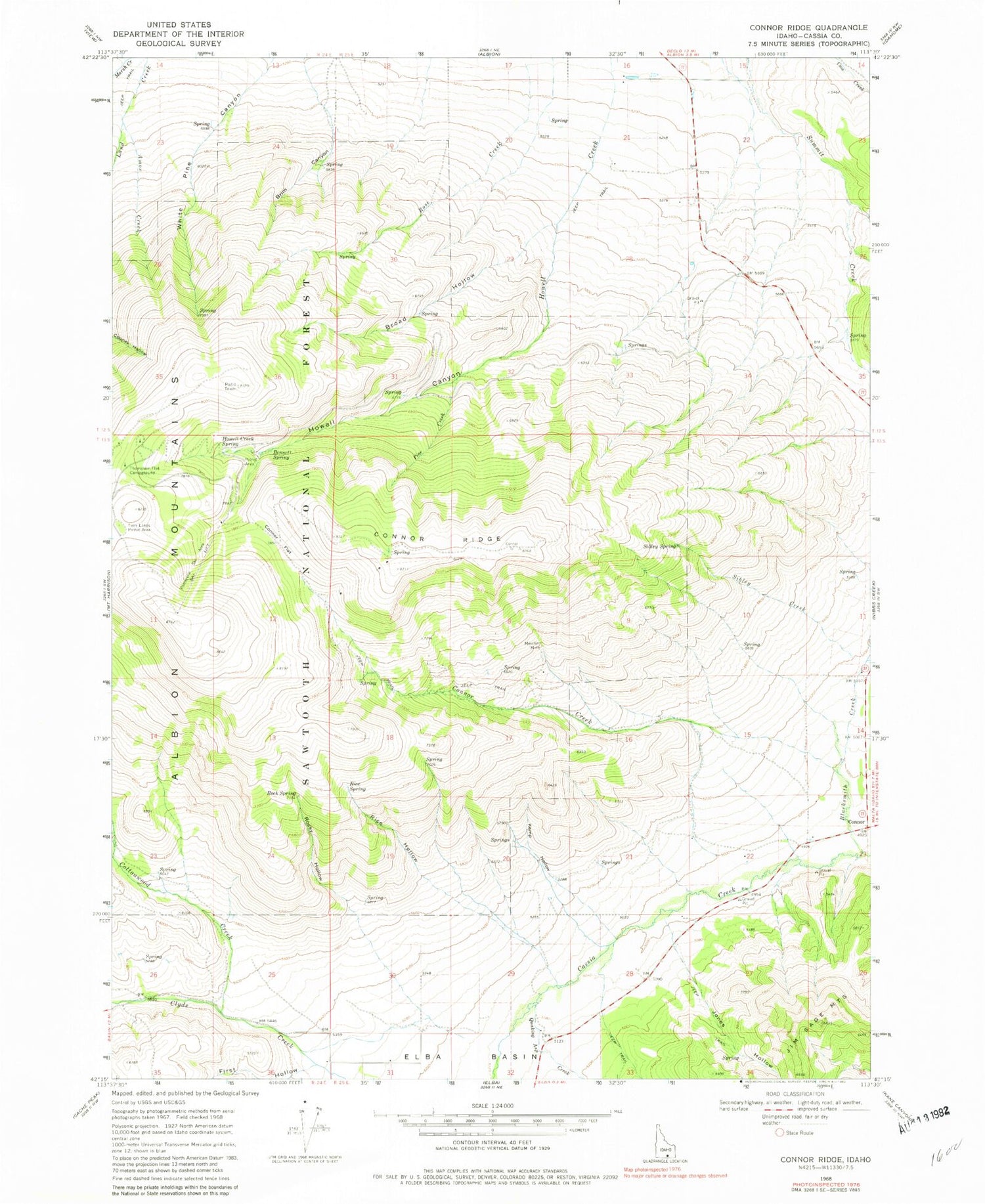
MyTopo
Classic USGS Connor Ridge Idaho 7.5'x7.5' Topo Map
Couldn't load pickup availability
Historical USGS topographic quad map of Connor Ridge in the state of Idaho. Map scale may vary for some years, but is generally around 1:24,000. Print size is approximately 24" x 27"
This quadrangle is in the following counties: Cassia.
The map contains contour lines, roads, rivers, towns, and lakes. Printed on high-quality waterproof paper with UV fade-resistant inks, and shipped rolled.
Contains the following named places: Amos Creek, Bennett Spring, Blacksmith Creek, Brim Canyon, Broad Hollow, Cassia County, Connor, Connor Creek, Connor Flat, Connor Ridge, Cottonwood Creek, Elba Basin, First Hollow, Howell Canyon, Howell Creek Spring, Jones Hollow, KCIR-FM (Twin Falls), Kemp Hollow, KNAQ-FM (Rupert), KZDX-FM (Burley), Melcher Mine, Pine Creek, Pomerelle Ski Area, Quaking Asp Creek, Rice Hollow, Rice Spring, Rock Spring, Rocky Hollow, Rose Creek, Sibley Creek, Sibley Spring, Thompson Flat Campground, Twin Lakes Picnic Area