MyTopo
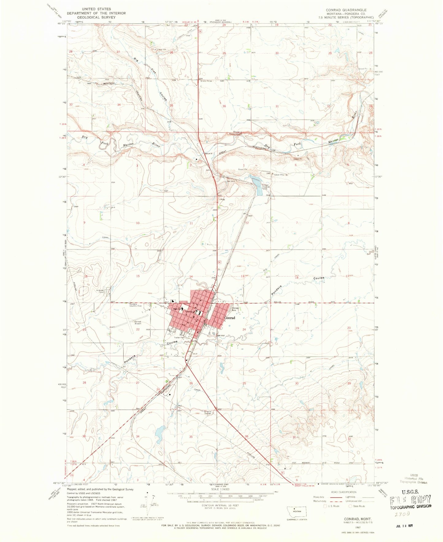
Classic USGS Conrad Montana 7.5'x7.5' Topo Map
Couldn't load pickup availability
Historical USGS topographic quad map of Conrad in the state of Montana. Map scale may vary for some years, but is generally around 1:24,000. Print size is approximately 24" x 27"
This quadrangle is in the following counties: Pondera.
The map contains contour lines, roads, rivers, towns, and lakes. Printed on high-quality waterproof paper with UV fade-resistant inks, and shipped rolled.
Contains the following named places: Abel Park, Abundant Life Christian Center, Anniston, Bankas Shell Museum, Big Flat Coulee, Blackfoot, Burke, Christian Reformed Church, City of Conrad, Columbia Grain International Incorporated Elevator, Conrad, Conrad Airport, Conrad Assembly of God Church, Conrad Baptist Church, Conrad Christian School, Conrad City Park, Conrad High School, Conrad Mission Church, Conrad Police Department, Conrad Post Office, Conrad Public Library, Conrad Southern Baptist Mission, Conrad Volunteer Fire Department, First Christian Church of Conrad, First Presbyterian Church, First Reformed Church, G Canal, General Mills Incorporated Elevator, Hillside Cemetery, Kiwanis Park, Legion Park, Lighthouse Tabernacle Church, Meadowlark Elementary School, Mental Health Center, Oliver Coulee, P Canal, P-6 Canal, PMC Hamilton Clinic, Pondera County Courthouse, Pondera County Rural Fire District Station 2, Pondera County Sheriff's Office, Pondera Golf Club, Pondera Medical Center - Hospital, Pondera Medical Center Long Term Care, Pondera Trailer Park, Pondera Valley Lutheran Church, Pondera Village Shopping Center, Prairie View School, Railroad Coulee, Saint Marys Hospital, Saint Michaels Catholic Church, School Section Coulee, Sim Oliver Coulee, Spartan Manor Trailer Park, Speer Trailer Park, Spring Creek, Sunrise Trailer Court, The Church of Jesus Christ of Latter Day Saints, Torens Trailer Park, Uncle Sam Coulee, Utterback Middle School, Valier Junction, Walstom Dam, Welch Coulee, Whoop-up Rodeo Ground, Whoop-Up Trail Historical Marker, ZIP Code: 59425