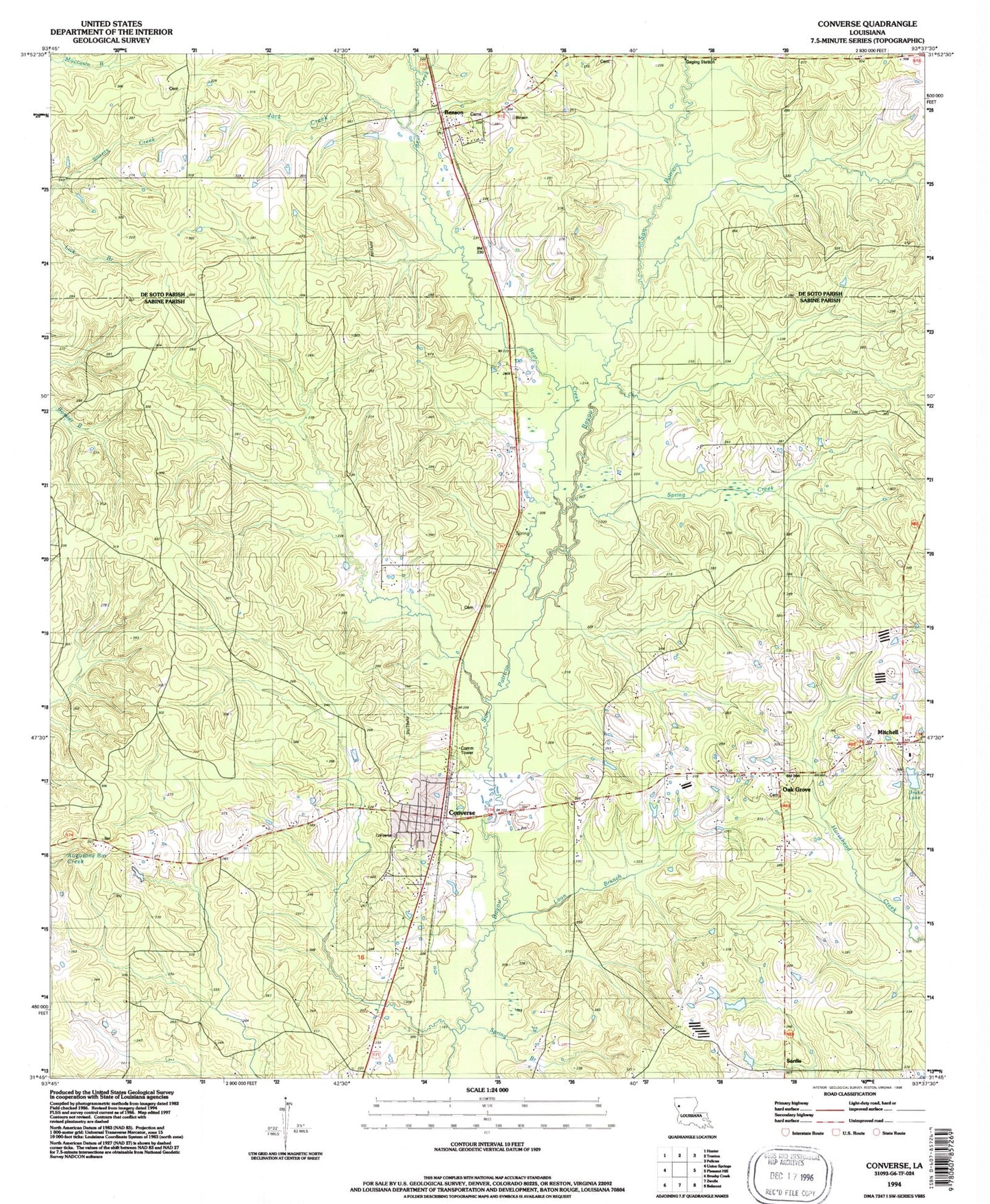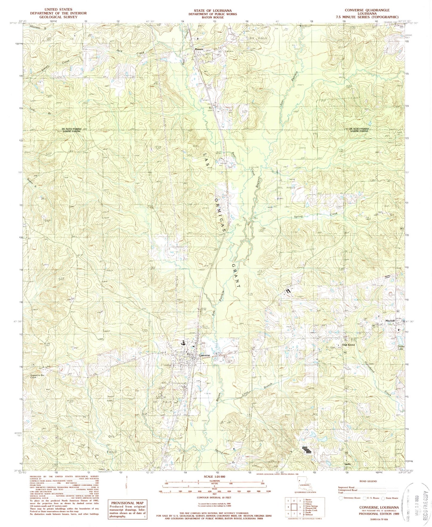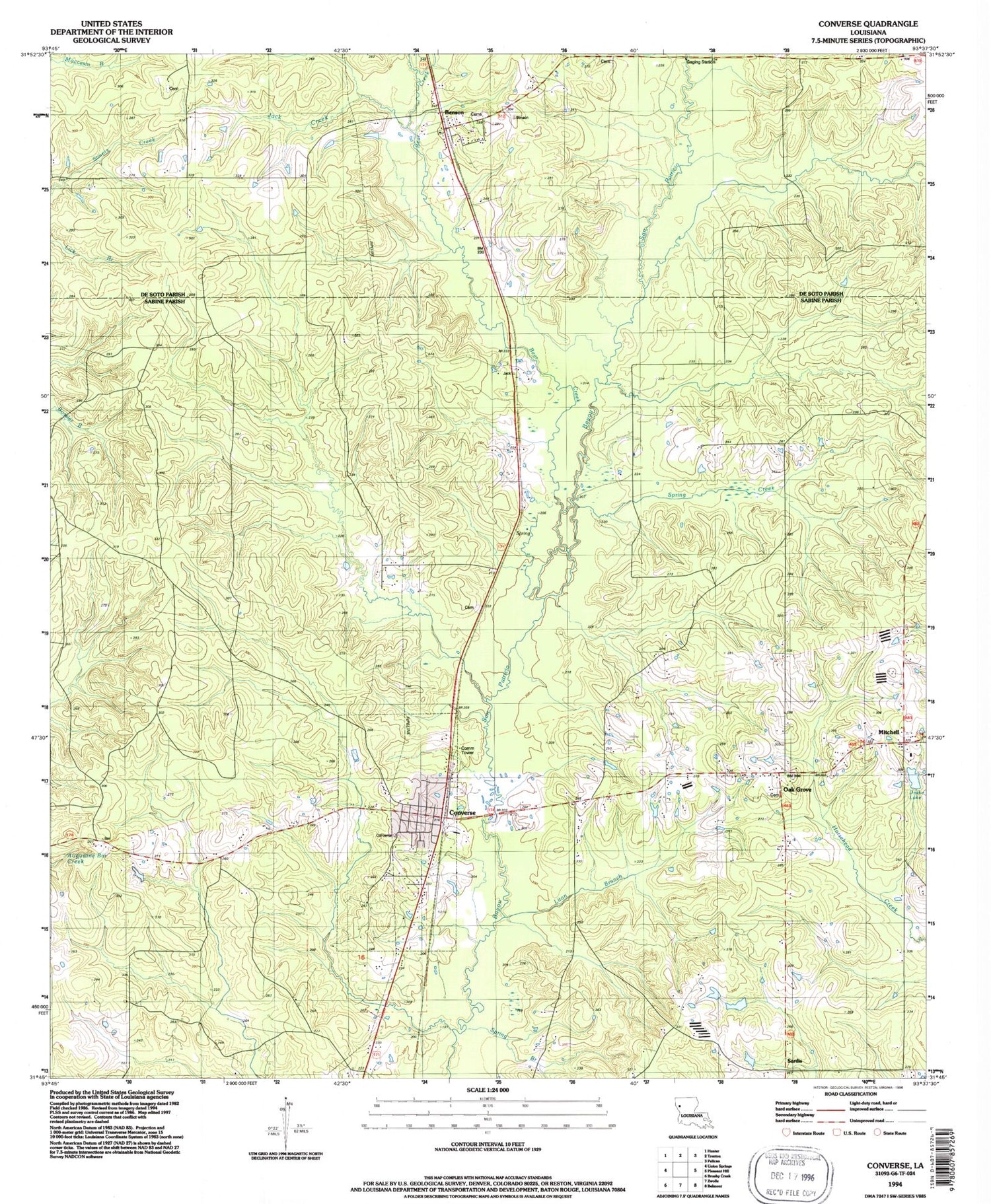

MyTopo
Classic USGS Converse Louisiana 7.5'x7.5' Topo Map
Couldn't load pickup availability
Historical USGS topographic quad map of Converse in the state of Louisiana. Map scale may vary for some years, but is generally around 1:24,000. Print size is approximately 24" x 27"
This quadrangle is in the following counties: De Soto, Sabine.
The map contains contour lines, roads, rivers, towns, and lakes. Printed on high-quality waterproof paper with UV fade-resistant inks, and shipped rolled.
Contains the following named places: Bear Creek, Benson, Benson Oil and Gas Field, Choctaw Bayou, Converse, Converse High School, Converse Oil and Gas Field, Converse Post Office, Drake Lake, Estes Bayou, Jack Creek, Las Ormigas Grant, Liton Branch, Mitchell, Mitchell School, North Sabine Fire Protection District Converse Station, Oak Grove, Oak Grove High School, Old Union Church, Pleasant Hill Oil and Gas Field, Saint Peter Church of God in Christ, Sardis, Sebastian Cemetery, Spring Branch, Spring Creek, Spring Creek School, United Church, Village of Converse, Ward Six, Ward Ten, ZIP Code: 71419