MyTopo
Classic USGS Convoy Ohio 7.5'x7.5' Topo Map
Couldn't load pickup availability
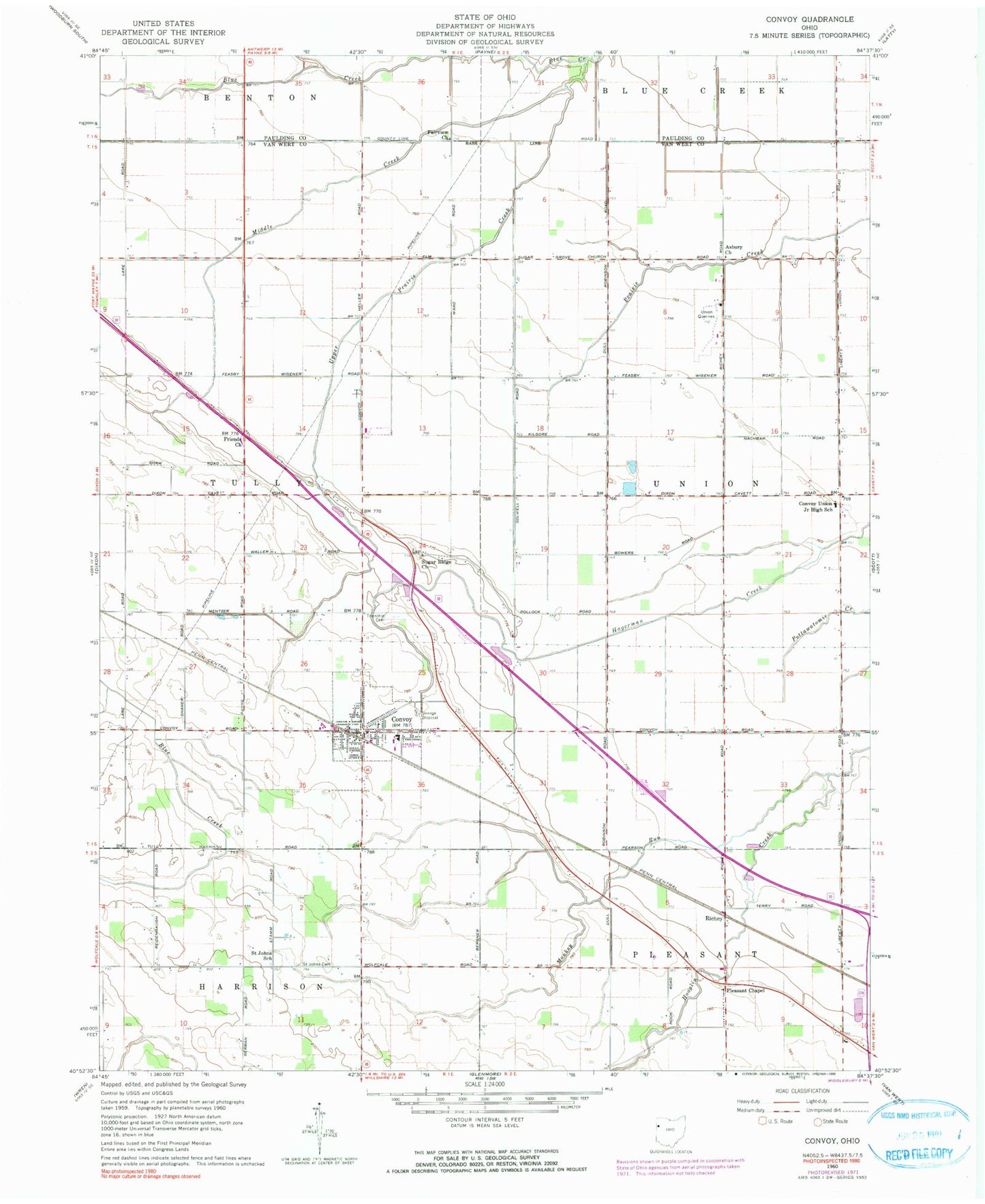
Historical USGS topographic quad map of Convoy in the state of Ohio. Map scale may vary for some years, but is generally around 1:24,000. Print size is approximately 24" x 27"
This quadrangle is in the following counties: Paulding, Van Wert.
The map contains contour lines, roads, rivers, towns, and lakes. Printed on high-quality waterproof paper with UV fade-resistant inks, and shipped rolled.
Contains the following named places: Arts Dairy, Asbury Church, Brumback Library Convoy Branch, Burley Farms, Convoy, Convoy Fire Station and Emergency Medical Services Department, Convoy Post Office, Convoy Union Junior High School, Crestview High School, Crestview North Elementary School, Davis School, Dix Cemetery, Dix School, Edgewood Park, Fairview Church, Friends Church, Gunsett School, IOOF Cemetery, Macabob Farms, Marcarl Farms, McClure School, Middle Creek, Monkey Run, Pleasant Chapel, Redeemer Lutheran Cemetery, Reidenbach School, Richey, Robinson School, Saint Johns Cemetery, Saint Johns School, School Number 1, School Number 2, School Number 3, School Number 4, School Number 5, School Number 9, Scott Quarry, Shook School, Speelman Farm, Storm Ditch, Sugar Grove Church, Sugar Ridge Cemetery, Sugar Ridge Church, Swick School, Thompson Farm, Township of Tully, Township of Union, Upper Prairie Creek, Village of Convoy, Web Ditch, West Fork Ditch, ZIP Code: 45832