MyTopo
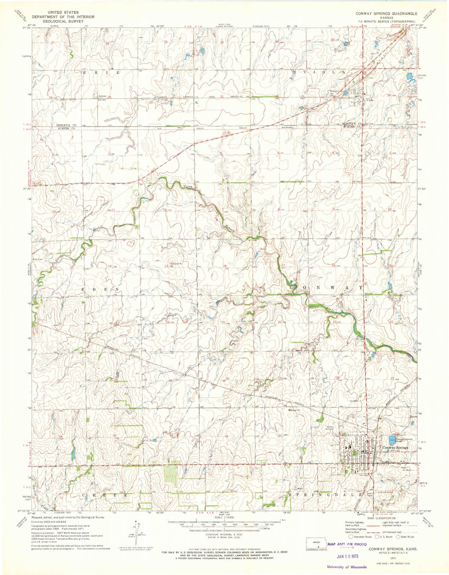
Classic USGS Conway Springs Kansas 7.5'x7.5' Topo Map
Couldn't load pickup availability
Historical USGS topographic quad map of Conway Springs in the state of Kansas. Map scale may vary for some years, but is generally around 1:24,000. Print size is approximately 24" x 27"
This quadrangle is in the following counties: Sedgwick, Sumner.
The map contains contour lines, roads, rivers, towns, and lakes. Printed on high-quality waterproof paper with UV fade-resistant inks, and shipped rolled.
Contains the following named places: Anness, City of Conway Springs, City of Viola, Conway Springs, Conway Springs City Hall, Conway Springs Fire Department, Conway Springs High School, Conway Springs Middle School, Conway Springs Museum, Conway Springs Police Department, Conway Springs Post Office, Conway Springs United Methodist Church, Conway Springs Volunteer Emergency Medical Services, Conway Springs Wastewater Treatment Plant, Conway Springs Water Tower, First Baptist Church, Kalamazoo, Kyle Trueblood Elementary School, North Branch State Creek, Saint Joseph Catholic Church, Saint Joseph Catholic School, Saint Josephs Cemetery, South Branch Slate Creek, Sunset, Township of Conway, Viola, Viola Baptist Church, Viola Cemetery, Viola Fire Station 65, Viola Post Office, Viola Presbyterian Church, Viola Township Library, Viola Wastewater Treatment Facility, Wamsley Field, ZIP Code: 67031