MyTopo
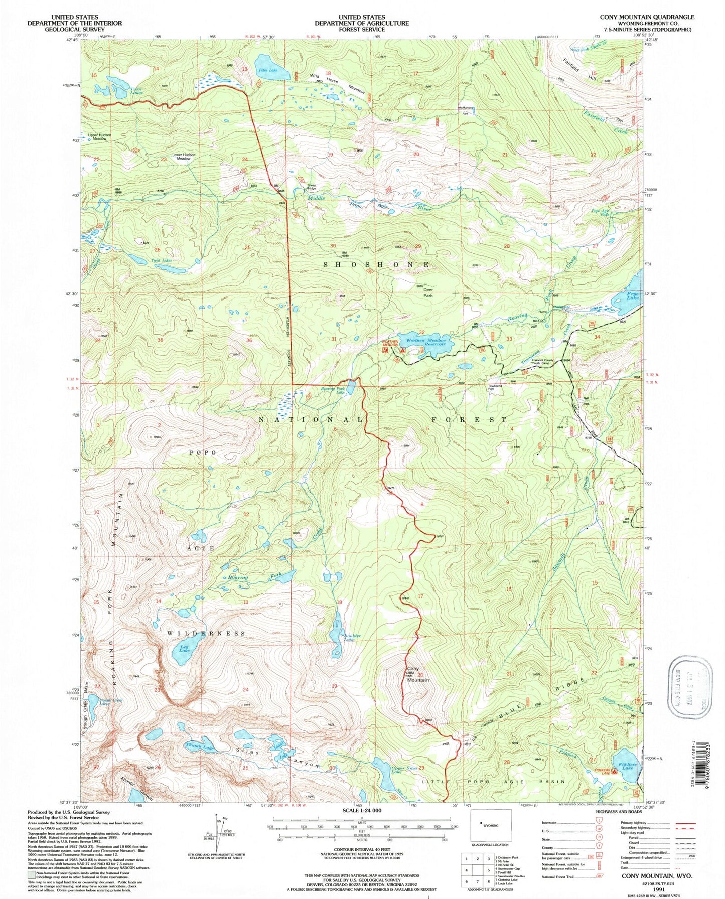
USGS Classic Cony Mountain Wyoming 7.5'x7.5' Topo Map
Couldn't load pickup availability
Historical USGS topographic quad map of Cony Mountain in the state of Wyoming. Scale: 1:24000. Print size: 24" x 27"
This quadrangle is in the following counties: Fremont.
The map contains contour lines, roads, rivers, towns, lakes, and grids including latitude / longitude and UTM / MGRS. Printed on high-quality waterproof paper with UV fade-resistant inks.
Contains the following named places: Cony Mountain, Enterprise Supply Ditch, Fiddlers Lake, Fiddlers Lake Campground, Fremont County Youth Camp, Leg Lake, Lower Hudson Meadow, McMahone Park, Neff Park, Petes Lake, Popo Agie Falls, Roaring Fork Creek, Roaring Fork Lake, Sheep Bridge, Silas Canyon, Townsend Park, Twin Lakes, Upper Silas Lake, Wild Horse Meadow, Blue Ridge, Frye Lake, Middle Fork Trail, Petes Lake Trail, Stough Creek, Boulder Lake, Island Lake, Deer Park, Twin Lakes, Thumb Lake, Worthen Meadow Reservoir, Worten Meadow Dam, Cold Spring Trail