MyTopo
Classic USGS Cook Creek Oregon 7.5'x7.5' Topo Map
Couldn't load pickup availability
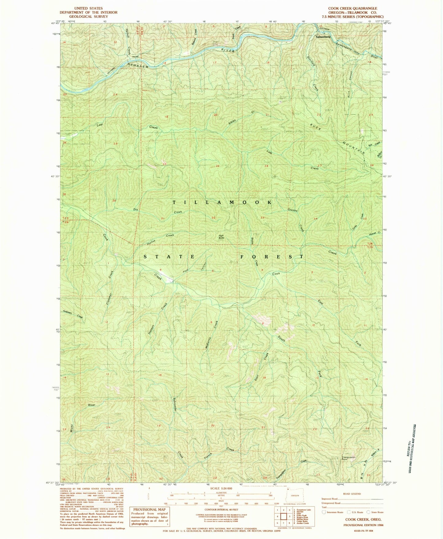
Historical USGS topographic quad map of Cook Creek in the state of Oregon. Map scale may vary for some years, but is generally around 1:24,000. Print size is approximately 24" x 27"
This quadrangle is in the following counties: Tillamook.
The map contains contour lines, roads, rivers, towns, and lakes. Printed on high-quality waterproof paper with UV fade-resistant inks, and shipped rolled.
Contains the following named places: Bastard Creek, Buick, Bulck Canyon, Clammer Creek, Dry Creek, East Fork Cook Creek, French Creek, Granite Creek, Haak Logging Company, Hanson Creek, Harliss Creek, Hatchery Creek, Helloff, Helloff Creek, Helloff Post Office, High Butte, Hoevet Creek, Maples, McAboy, McKenny Creek, Nehalem Division, Nehalem River, Platt Canyon, Rector, Rector Post Office, Salmonberry, Salmonberry Post Office, Salmonberry River, Sibley Creek, Snark, Snark Creek, South Fork Cook Creek, Starr Creek, Strahm Creek, Triangulation Point, Wakefield, Water Tank, Wheeler Lumber Company