MyTopo
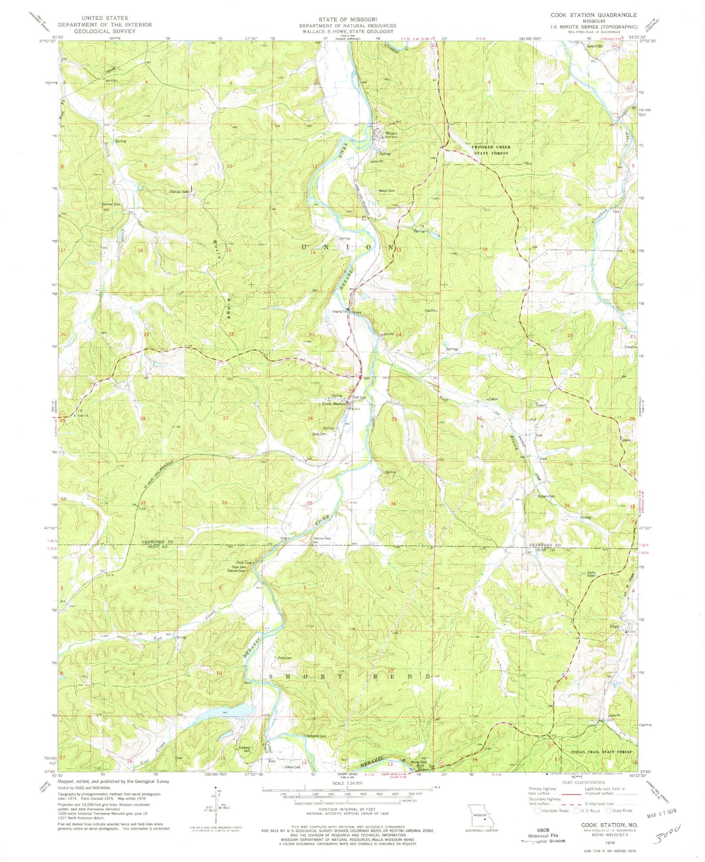
Classic USGS Cook Station Missouri 7.5'x7.5' Topo Map
Couldn't load pickup availability
Historical USGS topographic quad map of Cook Station in the state of Missouri. Map scale may vary for some years, but is generally around 1:24,000. Print size is approximately 24" x 27"
This quadrangle is in the following counties: Crawford, Dent.
The map contains contour lines, roads, rivers, towns, and lakes. Printed on high-quality waterproof paper with UV fade-resistant inks, and shipped rolled.
Contains the following named places: Anderson and Clark Iron Mine, Anderson Spring, Arthur Iron Bank, Benton School, Bonito Iron Mine, Burly Ridge, C C Cook Iron Bank, Canaan Cumberland Presbyterian Church, Canaan Hollow, Carr Church, Carr School, Cattail Creek, Cook Cemetery, Cook Station, Cook Station School, Cooks Station Baptist Church, Cooksey, Cooksey Cemetery, Cotner Cemetery, Craig Hill, Craig Iron Bank, Crooked Creek Conservation Area, Daniels School, Delcour Cemetery, Goltra, Goltra Ford, Gorman Cemetery, Hart Development Lake Section 10 Dam, Hart Development Lake Section 15 Dam, Highway School, Jones Iron Mine, Kallambah Branch, Keysville School, Lenox Spring, Lost Creek, Lost Mountain, McGary Iron Mine, Mint Spring, N.G. Clark Number Two Iron Bank, Number 113 Reservoir, Number 114 Reservoir, Pease Iron MIne, Pinto Cemetery, Ploch Lake, Ploch Lake Dam, Roberts Cemetery, Rock Spring, Rock Spring Hollow, S.L. and L.R. Iron Bank, Sligo, Sligo Cemetery, Spring Branch, Taff Branch, Taff Cemetery, Taft Creek, Township of Union, Vaughn Iron Bank, Wesco, Wesco Cemetery, Wesco Post Office, West Fork Benton Creek, Yankee Branch, ZIP Codes: 65449, 65586