MyTopo
Classic USGS Cooks Mesa Arizona 7.5'x7.5' Topo Map
Couldn't load pickup availability
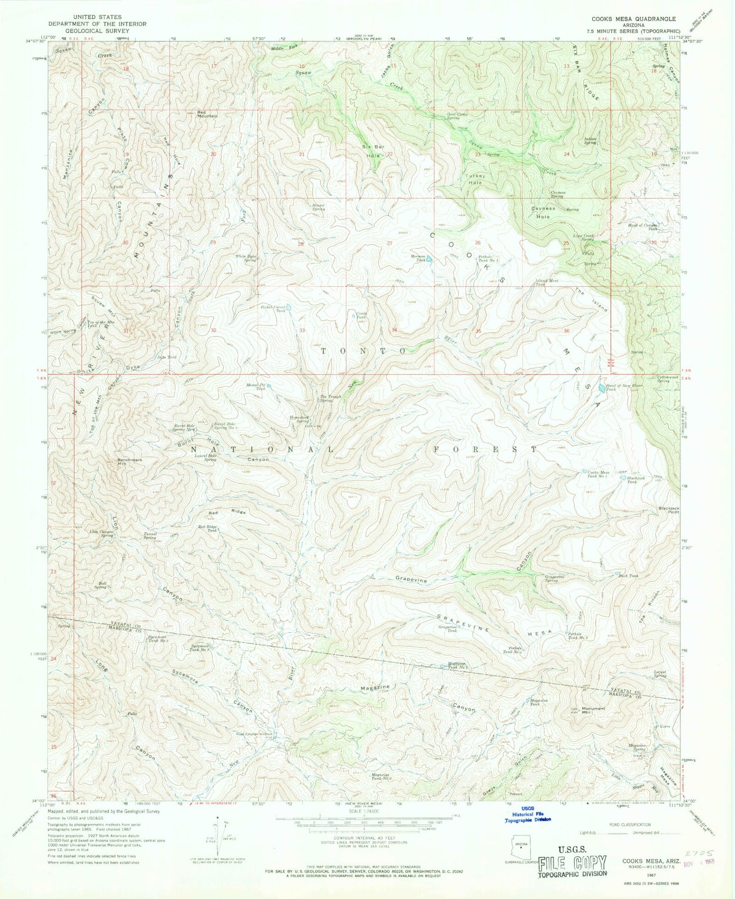
Historical USGS topographic quad map of Cooks Mesa in the state of Arizona. Map scale may vary for some years, but is generally around 1:24,000. Print size is approximately 24" x 27"
This quadrangle is in the following counties: Maricopa, Yavapai.
The map contains contour lines, roads, rivers, towns, and lakes. Printed on high-quality waterproof paper with UV fade-resistant inks, and shipped rolled.
Contains the following named places: Benchmark Mountain, Blackjack Point, Blackjack Tank, Buck Tank, Bull Spring, Burnt Hole Canyon, Burnt Hole Spring Number One, Burnt Hole Spring Number Two, Cavness Hole, Cavness Spring, Circle Tank, Cooks Mesa, Cooks Mesa Tank, Cooks Ranch, Cottonwood Spring, Dyke Canyon, Dyke Tank, Goat Camp Spring, Grapevine Canyon, Grapevine Mesa, Grapevine Spring, Grapevine Tank, Hackberry Spring, Head of Canyon Tank, Head of New River Tank, Homestead Spring, Indian Spring, Island Mesa Tank, Jacks Gulch, Laurel Hole Spring, Lime Creek Spring, Lion Canyon, Lion Canyon Spring, Locust Spring, Long Canyon, Magazine Canyon, Magazine Mesa, Magazine Spring, Magazine Tank, Magazine Tank Number One, Magazine Tank Number Two, Manzanita Canyon, Manzanita Spring, Mescal Pit Tank, Middle Fork Squaw Creek, Monument Mountain, Mormon Tank, Picket Corral Tank, Pinto Cow Canyon, Pothole Tank Number Four, Pothole Tank Number One, Pothole Tank Number Three, Red Hole, Red Mountain, Red Ridge, Red Ridge Tank, Road Junction Windmill, Rosalie Mine Trail Number Eight, Round Spring, Six Bar Hole, South Fork Canyon, South Fork Squaw Creek, Squaw Mountain, Sycamore Canyon, Sycamore Tank Number One, Sycamore Tank Number Two, The Island, The Rincon, Tin Trough Spring, Top of the Mountain Canyon, Top of the Mountain Tank, Tunnel Spring, Turkey Hole, Upper Ranch, White Dyke Canyon, White Dyke Spring