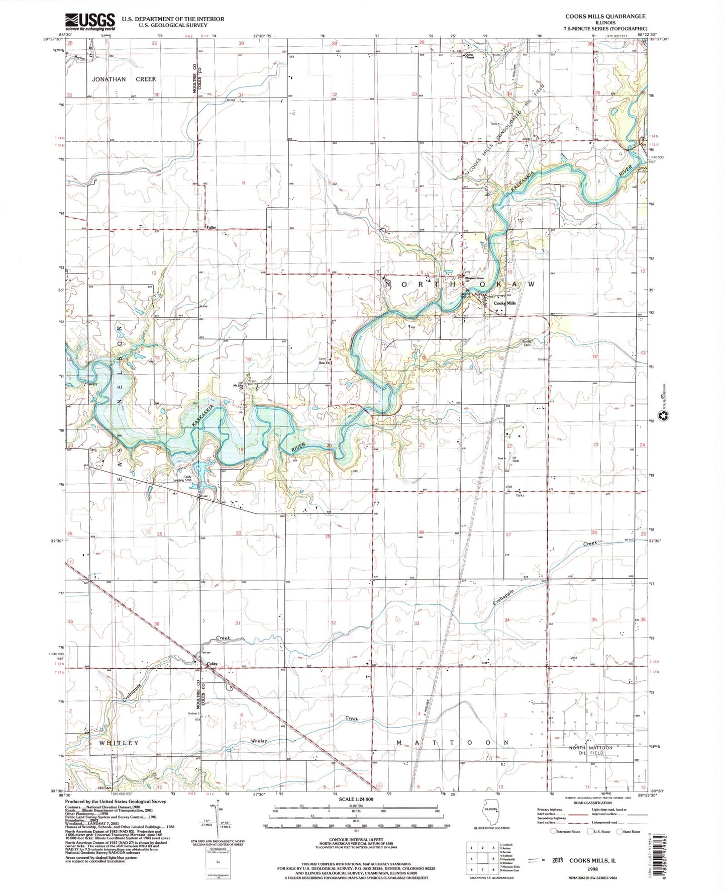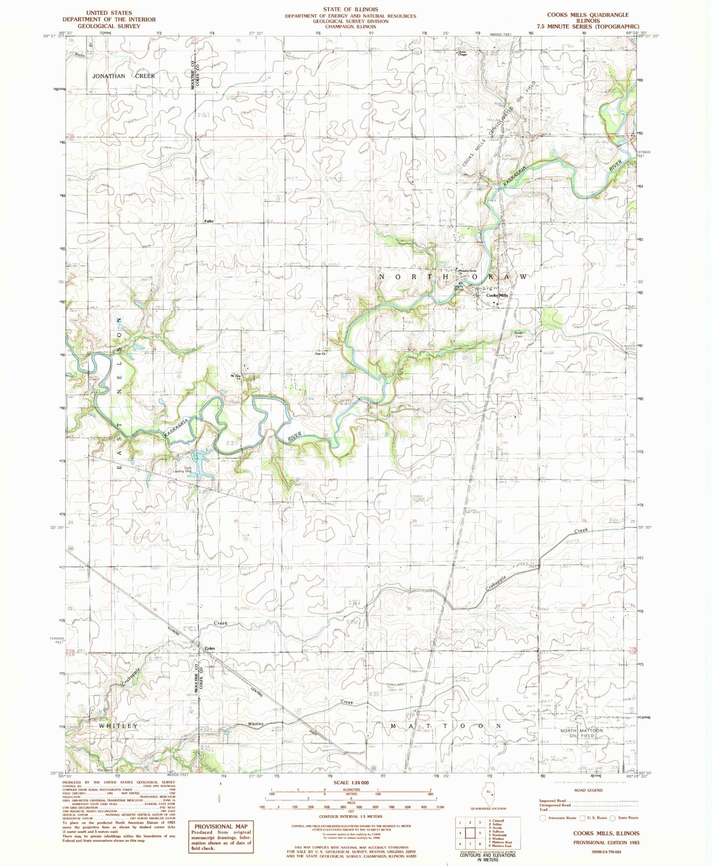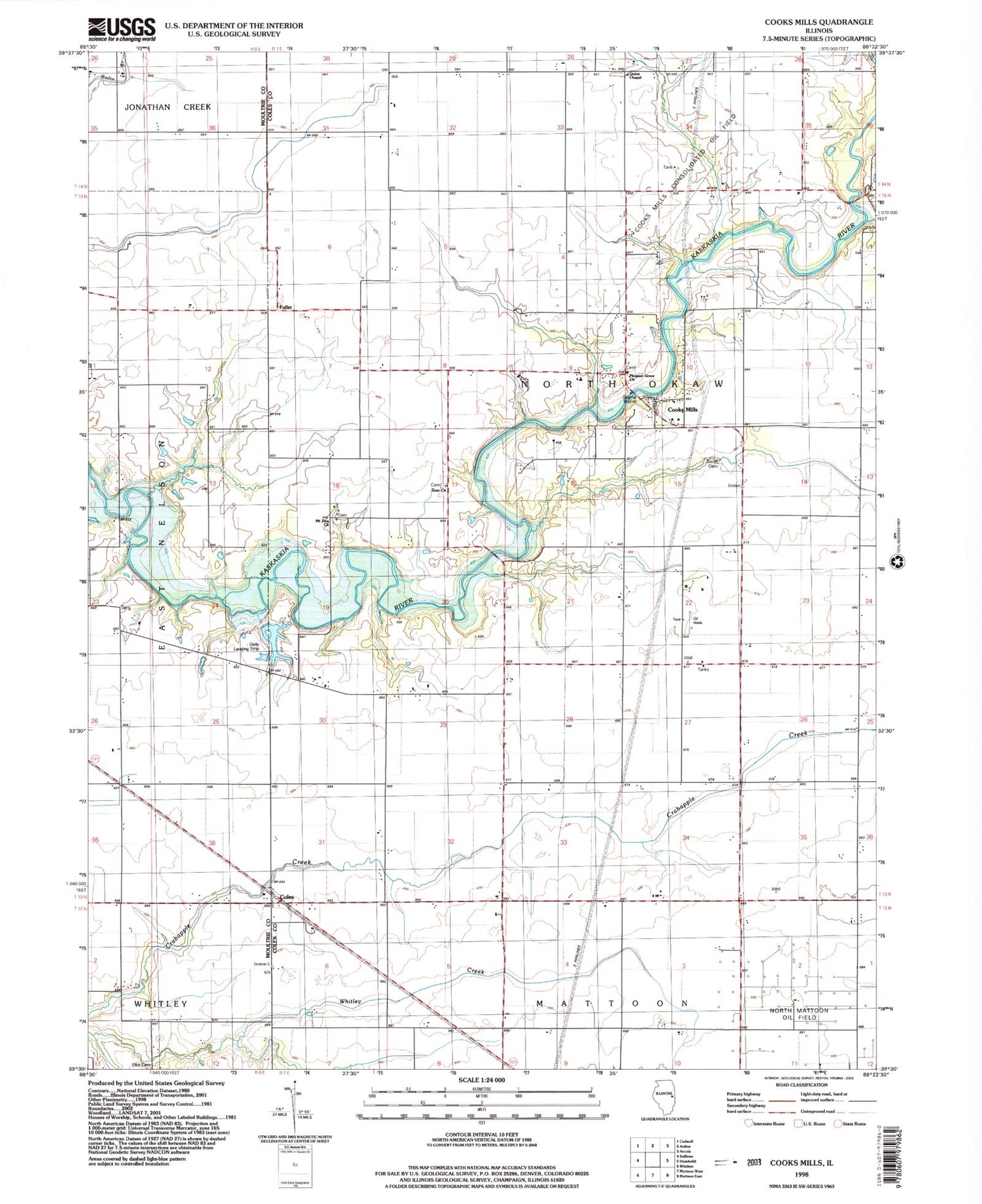

MyTopo
Classic USGS Cooks Mills Illinois 7.5'x7.5' Topo Map
Couldn't load pickup availability
Historical USGS topographic quad map of Cooks Mills in the state of Illinois. Map scale may vary for some years, but is generally around 1:24,000. Print size is approximately 24" x 27"
This quadrangle is in the following counties: Coles, Moultrie.
The map contains contour lines, roads, rivers, towns, and lakes. Printed on high-quality waterproof paper with UV fade-resistant inks, and shipped rolled.
Contains the following named places: Ames School, Braden School, Business Knoll School, Coles, Cooks Mills, Cooks Mills Fire Protection District, Crabapple School, Daily RLA Airport, Flat Branch, Fuller, Fuller Point School, Henton School, Hobert School, Hoskins School, Hougland School, Julian School, Little Red School, Mount Zion Cemetery, Mount Zion Church, North Mattoon Oil Field, Pleasant Grove Baptist Church, Pleasant Grove Cemetery, Quinn Chapel, Senteney School, Smith Cemetery, Smith School, Township of North Okaw, Wade School, Zoar Cemetery, Zoar Church