MyTopo
Classic USGS Cooksburg Pennsylvania 7.5'x7.5' Topo Map
Couldn't load pickup availability
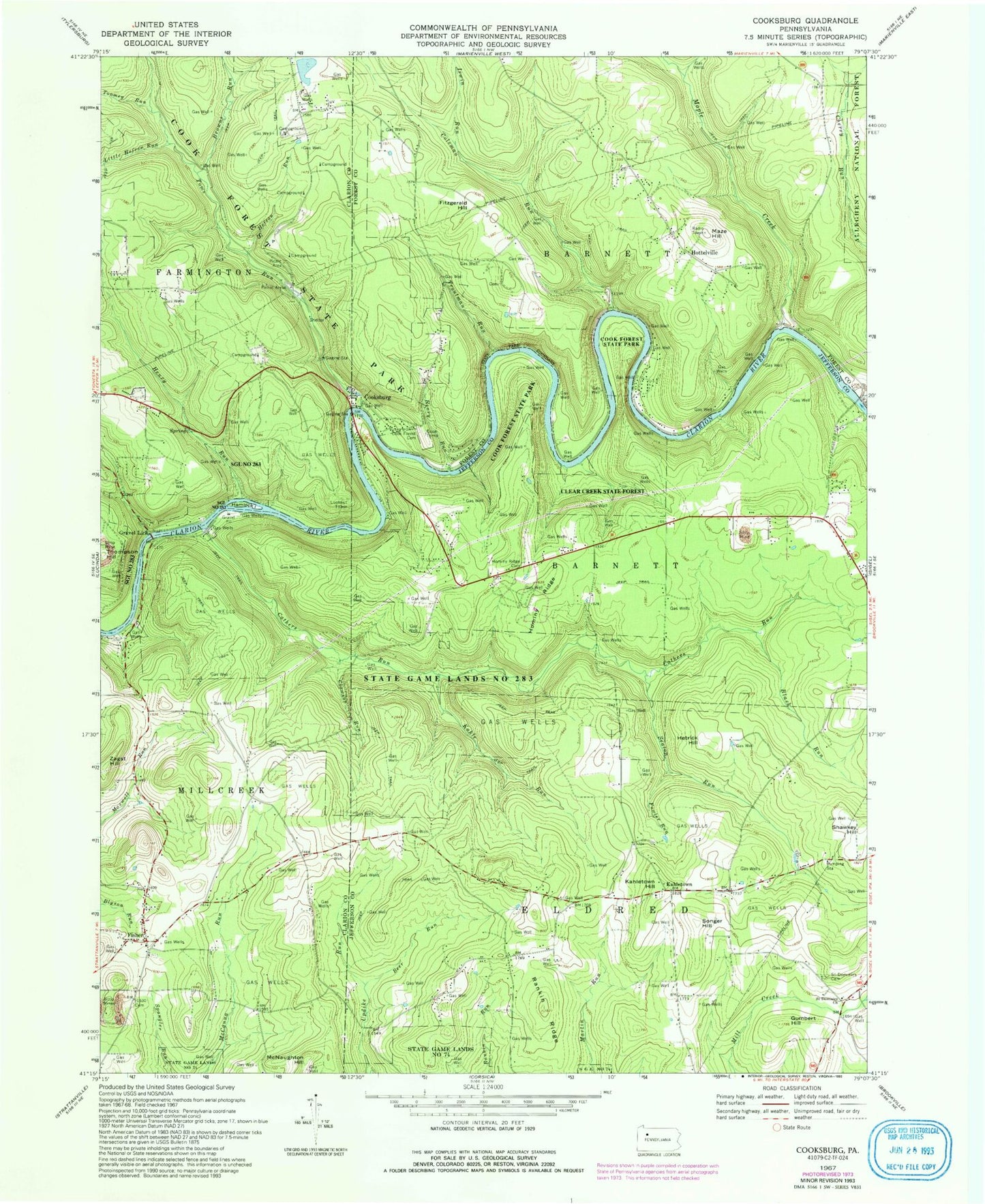
Historical USGS topographic quad map of Cooksburg in the state of Pennsylvania. Typical map scale is 1:24,000, but may vary for certain years, if available. Print size: 24" x 27"
This quadrangle is in the following counties: Clarion, Forest, Jefferson.
The map contains contour lines, roads, rivers, towns, and lakes. Printed on high-quality waterproof paper with UV fade-resistant inks, and shipped rolled.
Contains the following named places: Beer Run, Browns Run, Clawson Run, Coleman Run, Cooksburg Cemetery, Cook Tomb, Cooksburg, Fisher, Fitzgerald Hill, Fowler Run, Gumbert Hill, Hefren Run, Hemlock Island, Henry Run, Henry Run, Hetrick Hill, Hominy Ridge, Hominy Ridge Cemetery, Hottelville, Irwin Run, Kahle Run, Kahletown Hill, Little Hefren Run, Maple Creek, Maze Hill, Rankin Ridge, Saint Dominics Cemetery, Saint Dominics Church, Shawkey Hill, Songer Hill, Thompson Hill, Toms Run, Toomey Run, Troutman Run, Zagst Hill, Fitzgerald School, Woolford School (historical), Ella, Pine Grove School, Crawford Pumping Station, Stone School, Henry School (historical), Slocum Spring, Hominy Ridge, Turkey Ridge, Gravel Lick, Kahletown, State Game Lands Number 283, Black Run, Seaton Run, Cathers Run, Cherry Run, Cook Forest State Park, Printer Run, Cook Forest Tower, Township of Barnett, Township of Barnett, Township of Eldred, C & W Milliron Flying Field, Millcreek Township Volunteer Fire Department Station 590, Cooksburg Post Office, Fisher Post Office, Daniels Cemetery, Fisher Presbyterian Cemetery, Haight - Wing Family Cemetery, Fisher Methodist Cemetery, Kahletown Cemetery