MyTopo
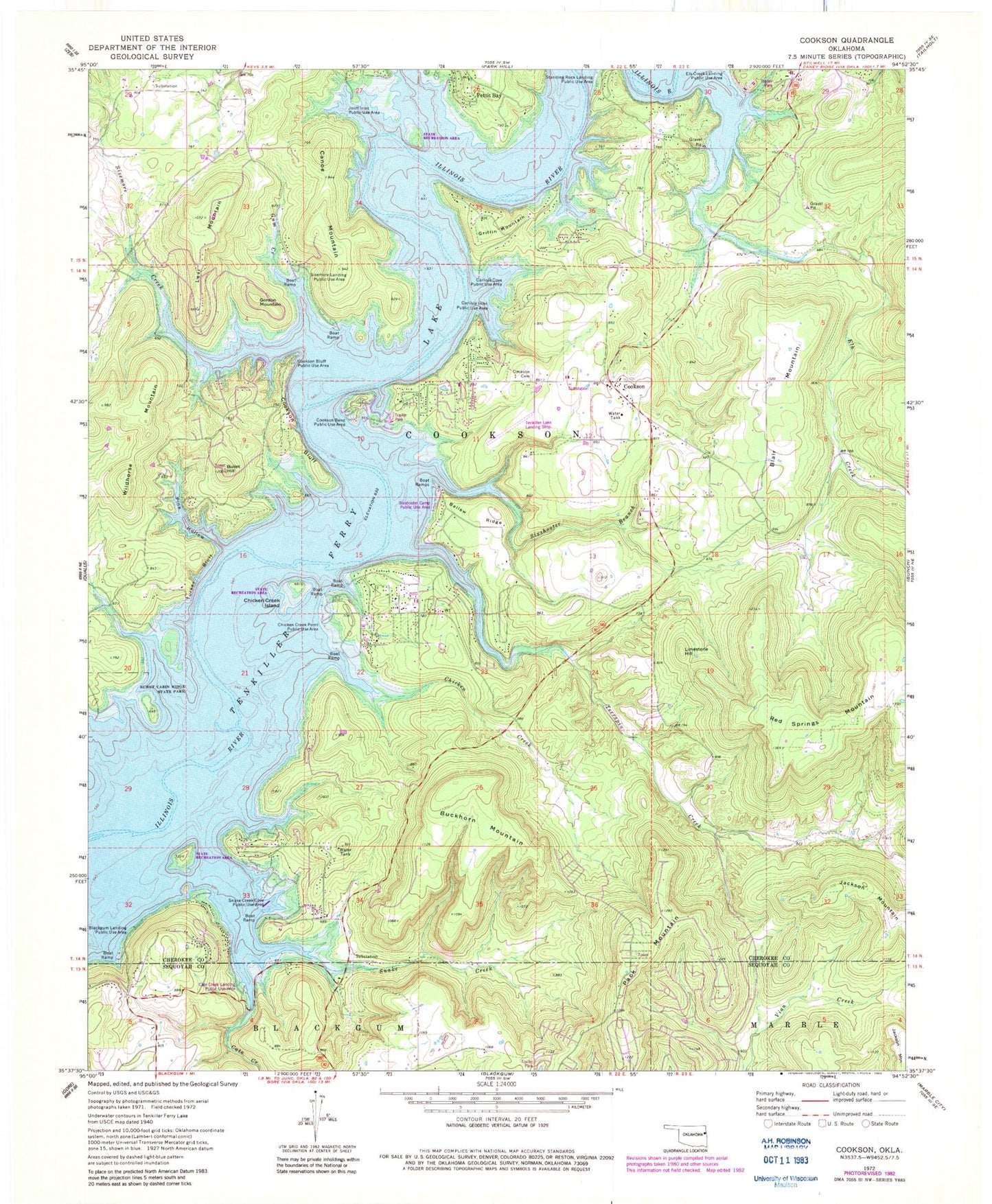
Classic USGS Cookson Oklahoma 7.5'x7.5' Topo Map
Couldn't load pickup availability
Historical USGS topographic quad map of Cookson in the state of Oklahoma. Typical map scale is 1:24,000, but may vary for certain years, if available. Print size: 24" x 27"
This quadrangle is in the following counties: Cherokee, Sequoyah.
The map contains contour lines, roads, rivers, towns, and lakes. Printed on high-quality waterproof paper with UV fade-resistant inks, and shipped rolled.
Contains the following named places: Ballew Ridge, Ballew Ridge Public Use Area, Blackgum Landing Public Use Area, Buckhorn Mountain, Bullet Hill, Canoe Mountain, Carlisle Cove Public Use Area, Carlisle Inlet Public Use Area, Cato Creek, Chicken Creek, Chicken Creek Island, Chicken Creek Point Public Use Area, Cookson Bend Public Use Area, Cookson Bluff, Cookson Bluff Public Use Area, Cookson - Proctor Cemetery, Elk Creek, Gordon Mountain, Griffin Mountain, Gum Creek, Joliff Inlet Public Use Area, Levi Mountain, Limestone Hill, Pack Mountain, Pine Hollow, Sisemore Creek, Sisemore Landing Public Use Area, Sixshooter Branch, Snake Creek, Snake Creek Cove Public Use Area, Standing Rock Landing Public Use Area, Tenkiller Ferry Lake, Terrapin Creek, Turkey Bluff, Wildhorse Mountain, Cookson, Tenkiller Lake Airpark, Cato Creek Landing Public Use Area, Sixshooter Camp Public Use Area, Cookson Post Office, Township of Cookson, Cookson Volunteer Fire Department, Blackgum Mountain Volunteer Fire Department Station 1 Headquarters, Chicken Creek Fire Department, Keys Fire Department Station 2, Snake Creek Wilderness Airport, Cookson Census Designated Place