
MyTopo
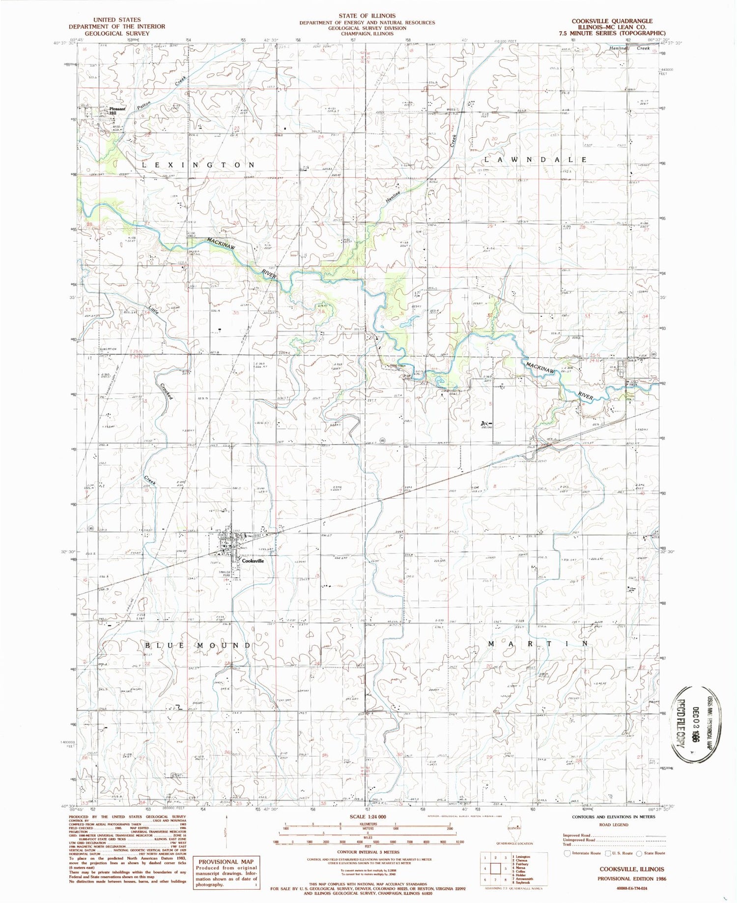
Classic USGS Cooksville Illinois 7.5'x7.5' Topo Map
Couldn't load pickup availability
Historical USGS topographic quad map of Cooksville in the state of Illinois. Map scale may vary for some years, but is generally around 1:24,000. Print size is approximately 24" x 27"
This quadrangle is in the following counties: McLean.
The map contains contour lines, roads, rivers, towns, and lakes. Printed on high-quality waterproof paper with UV fade-resistant inks, and shipped rolled.
Contains the following named places: Blue Mound Cemetery, Cooksville, Cooksville Fire Department, Cooksville Post Office, Evergreen Cemetery, Henline Creek, Pleasant Hill, Schertz Aerial Service - Cooksville Airport, Township of Blue Mound, Township of Lawndale, Township of Lexington, Township of Martin, Village of Cooksville, Wiley Cemetery, ZIP Codes: 61728, 61730


