MyTopo
Classic USGS Coolidge Dam Arizona 7.5'x7.5' Topo Map
Couldn't load pickup availability
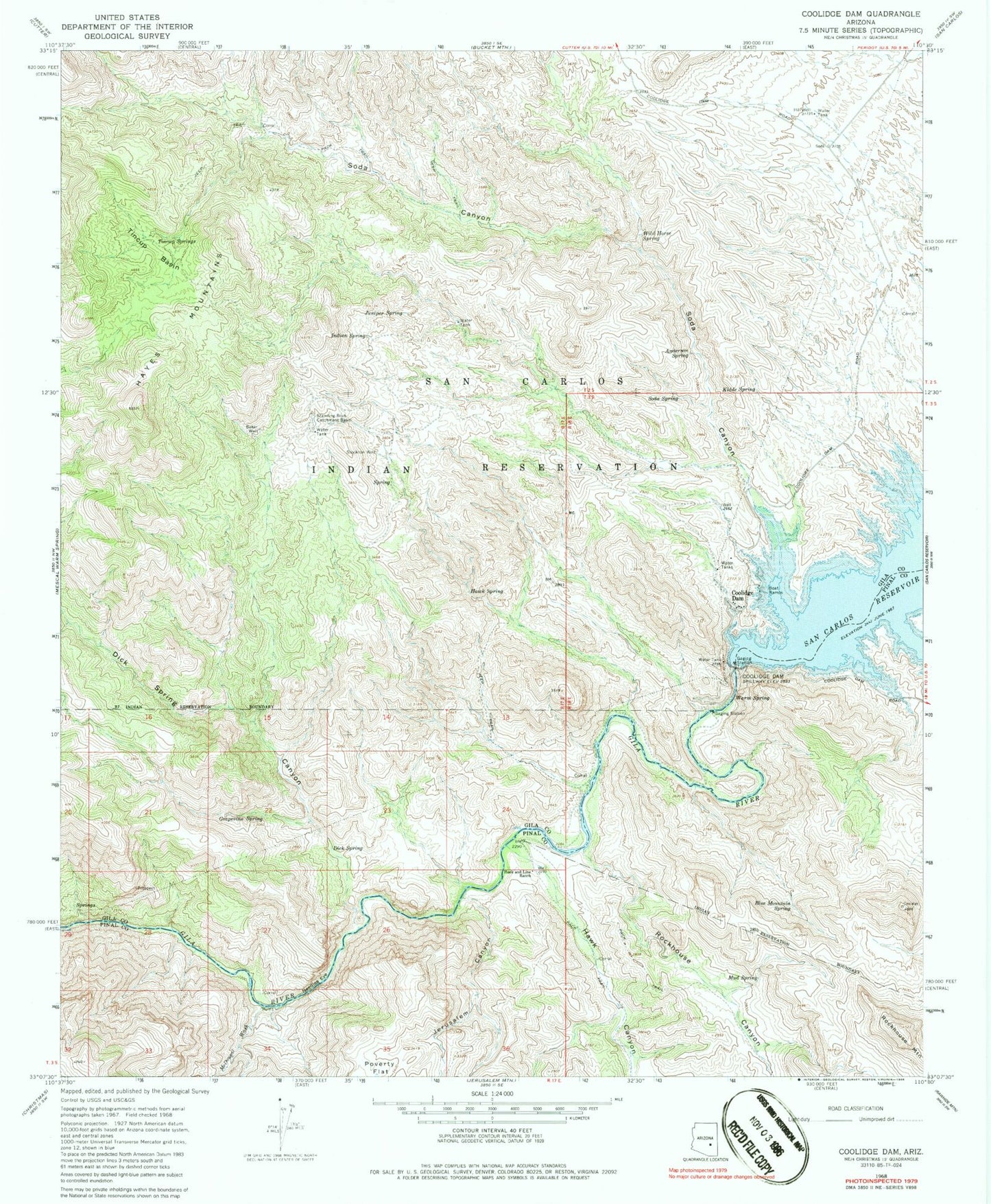
Historical USGS topographic quad map of Coolidge Dam in the state of Arizona. Map scale may vary for some years, but is generally around 1:24,000. Print size is approximately 24" x 27"
This quadrangle is in the following counties: Gila, Pinal.
The map contains contour lines, roads, rivers, towns, and lakes. Printed on high-quality waterproof paper with UV fade-resistant inks, and shipped rolled.
Contains the following named places: Anderson Spring, Baker Well, Blue Mountain Spring, Coolidge Dam, Dick Spring, Dick Spring Canyon, Dick Spring Creek, Grapevine Spring, Hawk Canyon, Hawk Spring, Hayes Mountains, Hill Well, Hook and Line Ranch, Indian Spring, Jerusalem Canyon, Juniper Spring, Kidde Spring, McDougal Wash, Mud Spring, Needles Eye, Needle's Eye Wilderness, Poverty Flat, Rockhouse Canyon, Rockhouse Mountain, Soda Canyon, Soda Spring, Standing Rock Catchment Basin, Stockton Well, Tincup Basin, Tincup Springs, Warm Spring, Wild Horse Spring